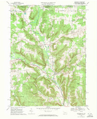
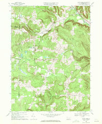
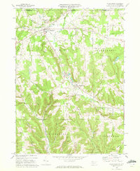
1960s Maps of Warren County, Pennsylvania
Explore 18 historic maps of Warren County from the 1960s. These maps offer a rare glimpse into what life looked like during the 1960s — showing old roads, neighborhoods, homes, and landmarks that have changed or disappeared over time.
Whether you're researching your family's past, planning a metal detecting trip, or studying how Warren County's landscape evolved across the 1960s, these high-resolution maps are a powerful tool for exploring the history of this region.
- Focus on a specific era: All maps on this page are from the 1960s, giving you a focused view of this time period.
- See what’s changed: Compare century-old streets, trails, and buildings to today's modern landscape using overlays and satellite layers.
- Research with precision: Use these maps for genealogy, historical research, land use analysis, or educational projects.
- View, download, or print: Maps are fully viewable online in high resolution, and can be downloaded or printed for your own records.
Start exploring Warren County's history through authentic maps from the 1960s. This is your window into the past.
Warren County, PA maps
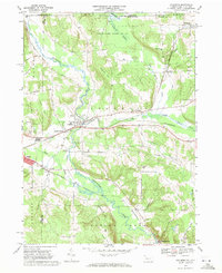
(18)- 1966 Map of Russell City, 1967 Print
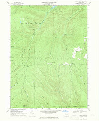
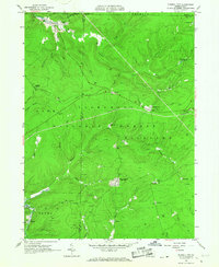 1966 Russell City1967 Print · USGSElk and Forest Counties in the mid-1960s were centers of active timber and energy production within the Allegheny National Forest. Genealogists and researchers can trace the rail-and-resource economy through sites like Russell City, Sheffield Junction, and the numerous gas wells dotting the hills.4 unique versions available
 - 1966 Map of West Hickory, 1967 Print
 1966 West Hickory1967 Print · USGSThe Allegheny River valley in the mid-1960s shows a landscape of active oil production and deep timberlands. Researchers can locate numerous oil wells across Preacher Hill and trace the historic Little Hickory Furnace and State Fish Hatchery.5 unique versions available
 - 1966 Map of Cobham, 1967 Print
 1966 Cobham1967 Print · USGSThe Allegheny River valley in Warren County was a mix of conservation land and resource extraction in the mid-sixties. Genealogists and historians can locate family-named landmarks like Bimber Corners, the Economite Cem, and the Plank Road Sch.3 unique versions available
 - 1966 Map of Lynch, 1968 Print
 1966 Lynch1968 Print · USGSForest County's deep woods and industrial drainages are captured here in the mid-sixties as oil extraction and forestry shaped the landscape. Genealogists and historians can trace old settlements like Pigeon, Lynch, and Byromtown alongside the Old Railroad Grade.3 unique versions available
 - 1966 Map of Tidioute, 1968 Print
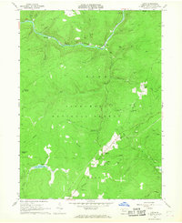
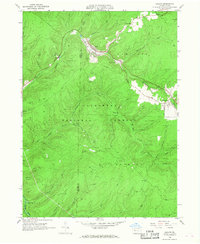
 1966 Tidioute1968 Print · USGSThe riverfront borough of Tidioute and the surrounding timberlands of the Allegheny National Forest are captured here in the mid-1960s. Genealogists and researchers can locate old family burial grounds like Morrison Hill Cem and remote settlements such as Fagundus.4 unique versions available
 - 1966 Map of Cornplanter Bridge, 1968 Print
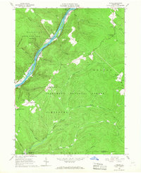
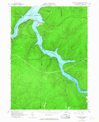 1966 Cornplanter Bridge1968 Print · USGSThe Allegheny River valley and its major tributaries appear here just as the reservoir was becoming a central feature of the landscape in the mid-1960s. Researchers can trace the infrastructure of the newly created Allegheny Reservoir, the crossing at Cornplanter Bridge, and numerous Oil Wells scattered across the forest.3 unique versions available
 - 1966 Map of Cornplanter Run, 1968 Print
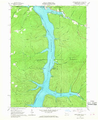 1966 Cornplanter Run1968 Print · USGSThe Pennsylvania-New York borderlands appear here in the mid-sixties, just as the new reservoir reshaped the valley. Researchers can find old petroleum sites in the Oil Field and trace legacy sites like the Riverview-Corydon Cem and Camp Olmsted.4 unique versions available
 - 1966 Map of Ludlow, 1968 Print
 1966 Ludlow1968 Print · USGSMcKean County's timberlands and gas fields are captured in the mid-sixties, showing the intersection of industrial work and forest conservation. Researchers can locate the small community of Ludlow, the Hoffman Farm Camp, and the winding Old Railroad Grade.4 unique versions available
 - 1966 Map of Sheffield, 1969 Print
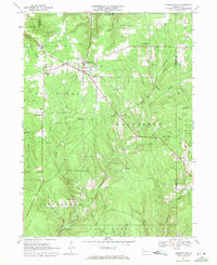
 1966 Sheffield1969 Print · USGSWarren and Forest Counties were active hubs of the oil and gas industry in the 1960s, with deep-woods settlements connected by the river and rail. Local historians can trace the footprint of early communities like Henrys Mills and Saybrook alongside landmarks such as St Pauls Ch and the Deer Lick Reservoir.2 unique versions available
 - 1966 Map of Cherry Grove, 1970 Print
 1966 Cherry Grove1970 Print · USGSThe Pennsylvania highlands in the mid-1960s reveal a landscape of forestry, oil extraction, and early recreation. Researchers can trace the Old Railroad Grade and Dunham Siding, or locate the Cherry Grove Cem and Oil Wells scattered across the plateau.4 unique versions available
 - 1967 Map of Pleasantville, 1971 Print
 1967 Pleasantville1971 Print · USGSThe Pennsylvania oil region remains active in the late 1960s, showing a landscape defined by thousands of wells and rugged creek valleys. Researchers can trace historic crossroads and cemeteries like Pithole City, Jerusalem Corners Cem, and Shamburg.3 unique versions available
 - 1968 Map of Grand Valley, 1971 Print
 1968 Grand Valley1971 Print · USGSThe oil-rich highlands of Warren and Crawford counties are documented here in the late sixties. Researchers can trace the petroleum-driven economy through numerous Oil Wells and the OIL FIELD, while locating family sites at Maultby Cem and Excelsior Ch.3 unique versions available
 - 1968 Map of Pittsfield, 1971 Print
 1968 Pittsfield1971 Print · USGSWestern Warren County in the late sixties shows a landscape of deep valleys and vital rail connections along Brokenstraw Creek. Researchers can trace the heritage of small settlements like Torpedo and Garland or locate family sites near Whitestown Cem.3 unique versions available
 - 1968 Map of Columbus, 1971 Print
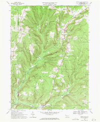
 1968 Columbus1971 Print · USGSWarren County at the end of the 1960s shows a landscape defined by the winding Brokenstraw Creek and a dense network of competing railroads. Researchers can trace historic family properties near Westlawn Cem or follow the rail lines through Columbus and Spring Creek.4 unique versions available
 - 1968 Map of Lottsville, 1971 Print
 1968 Lottsville1971 Print · USGSWarren County’s northern borderlands in the late sixties remain a landscape of creek-side villages and family-named landmarks. Genealogists and local historians can trace burial sites at Bear Lake Cem or Brooks Hill Cem and follow the old Erie-Lackawanna rail line.3 unique versions available
 - 1968 Map of Spring Creek, 1971 Print
 1968 Spring Creek1971 Print · USGSNorthwestern Pennsylvania's rural landscape is captured here in the late sixties, showing the transition from rail-side villages to upland oil fields. Genealogists and historians can locate Spring Creek Sch, the Trimm Cem, and several Oil Wells near Sanford.3 unique versions available
 - 1968 Map of Sugar Grove, 1972 Print
 1968 Sugar Grove1972 Print · USGSThe Pennsylvania and New York border comes alive in the late sixties, showing a landscape of small farming valleys and early energy development. Genealogists and local historians can trace family roots through landmarks like Peoples Ch, Wesleyan Cem, and the old Stillwater Road.3 unique versions available
 - 1969 Map of Youngsville, 1971 Print
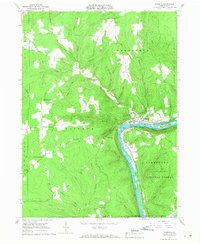
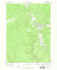
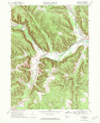
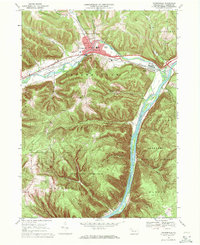 1969 Youngsville1971 Print · USGSYoungsville and the Allegheny River valley appear here in the late sixties, showing a landscape defined by industry and conservation. Local historians can trace the Penn Central rail lines and locate the County Home and Hospital or the historic St Lukes Ch.4 unique versions available
End of results
Showing maps 1-18 of 18
Top cities of Warren County
- Warren historical maps
- Sheffield Township historical maps
- Youngsville historical maps
- Pittsfield Township historical maps
- Spring Creek Township historical maps
- Tidioute historical maps
See more
Frequently asked questions
- What are the different types of historical maps available for Warren County?
- What is the oldest map of Warren County?
- Where can I purchase historical maps of Warren County for my home or office?
- Where can I download high-res historical maps of Warren County?
- Are there historical topographic maps available for Warren County?
- Is there historical aerial imagery available for Warren County?
- Where are historical maps of Warren County sourced from?