Old Maps of Warren County, Pennsylvania
Explore 159 old maps of Warren County, spanning from 1906 to today. These high-resolution historic maps reveal how streets, neighborhoods, landmarks, and natural features evolved over time — perfect for genealogy, metal detecting, research, and local history exploration.
What you can do with these maps:
- See how Warren County changed over time: Compare historical maps to modern-day views to trace roads, homesites, rail lines & more.
- View detailed metadata: Each map includes creators, publishers, year, scale, and archive source.
- Overlay maps with satellite & LiDAR: Visualize the past alongside modern tools to explore terrain & human change.
- Trusted historical sources: Maps sourced from the USGS, Library of Congress, and other archives.
- Access maps your way: View online, download high-res files, or order prints for personal or research use.
Start exploring old maps of Warren County to uncover forgotten places, hidden landmarks, and the deep history beneath your feet.
Warren County, PA maps
(159)- 1906 Map of Warren
 1906 Warren1906 Print · USGSWarren and its surrounding river valleys are captured here at the height of the early rail era. Genealogists can trace family names across dozens of rural landmarks, from the State Insane Asylum to scattered outposts like Lander and Old Clarendon.3 unique versions available
 - 1907 Map of Warren
 1907 Warren1907 Print · USGSWarren and its riverfront neighborhoods thrived at the dawn of the century as a hub for the Pennsylvania RR. Local historians can trace the footprint of the State Insane Asylum and find rural schools such as Dutch Hill School and Knupp School.
 - 1908 Map of Warren
 1908 Warren1908 Print · USGSThe river-and-rail economy of Warren County is documented here at the turn of the century. Genealogists can trace family-named landmarks and rural hubs like Lander, Oakland Cem, and the State Insane Asylum.3 unique versions available
 - 1926 Map of Youngsville, 1961 Print
 1926 Youngsville1961 Print · USGSWarren County at the dawn of the motorized age shows a landscape of small valley towns and isolated hill farms. Local researchers can trace old schoolhouse locations like White Sch and family-named landmarks such as Pikes Rocks and Cole Hill Fire Tower.
 - 1927 Map of Tidioute
 1927 Tidioute1927 Print · USGSThe Allegheny River valley was a bustling corridor of rail and river industry in the late twenties. Genealogists can trace family footprints across dozens of local schoolhouses like Triumph Sch and rural hubs such as Endeavor or East Hickory.4 unique versions available
 - 1927 Map of Titusville, 1958 Print
 1927 Titusville1958 Print · USGSThe oil region of northwestern Pennsylvania is captured here in the late 1920s, centered on the industrial and rail hub of Titusville. Genealogists and researchers can locate the historic Drake Oil Well, dozens of country schools like Fink Ridge Sch, and the local Harrison Cem.3 unique versions available
 - 1929 Map of Corry
 1929 Corry1929 Print · USGSThe industrial hub of Corry and the rural expanses of Erie and Crawford counties are captured here just before the Great Depression. Genealogists can trace family roots through numerous remote schools and churches, from Harbor Hall Ch to the tiny settlement of Hatchtown.2 unique versions available
 - 1929 Map of Youngsville
 1929 Youngsville1929 Print · USGSWarren County at the close of the twenties shows a landscape of busy rail junctions and upland farm communities. You can trace early family sites through dozens of named schoolhouses like Yankebush Sch, find the Cole Hill Fire Tower, or follow the Erie RR through Bear Lake.5 unique versions available
 - 1930 Map of Tidioute
 1930 Tidioute1930 Print · USGSThe Allegheny River valley and the Pennsylvania Railroad corridor are shown in detail during the late 1920s. Genealogists and historians can trace defunct school sites like Triumph Sch and remote settlements such as Fagundus or Trunkeyville.4 unique versions available
 - 1932 Map of Corry
 1932 Corry1932 Print · USGSThe industrial crossroads at the junction of the Pennsylvania and Erie Railroads come to life in the early 1930s. Trace old family roots and rural schoolhouses like Picidilli Sch and Daytown Sch near Spartansburg and Corry.3 unique versions available
 - 1933 Map of Titusville
 1933 Titusville1933 Print · USGSNorthwestern Pennsylvania in the early thirties reveals a landscape defined by the oil industry and rural township life. Genealogists and historians can trace family-named crossroads like Rendalls Corners or locate the historic Drake Oil Well and Asbury Chapel.3 unique versions available
 - 1934 Map of Kane
 1934 Kane1934 Print · USGSThe timber and oil lands of McKean and Elk counties are captured here in the mid-1930s as a network of railroads and pipelines. Researchers can trace family roots in settlements like De Young PO, locate CCC Camp No 7, or find the Greendale Sch.3 unique versions available
 - 1935 Map of Sheffield
 1935 Sheffield1935 Print · USGSThe Allegheny National Forest region in the mid-1930s reveals a landscape of deep timber runs, winding rail lines, and isolated New Deal work camps. Researchers can trace family roots at Cherry Grove Cem or locate forgotten crossroads like Deadmans Corners and Seldom Seen Corners.2 unique versions available
 - 1936 Map of Kinzua
 1936 Kinzua1936 Print · USGSThe Allegheny River valley remains in its natural state in the mid-1930s, long before the creation of the Allegheny Reservoir. Genealogists and historians can locate vanished riverfront settlements like Corydon and Kinzua, as well as the original boundaries of the Cornplanter Indian Reservation.
 - 1939 Map of Kane
 1939 Kane1939 Print · USGSThe northern Pennsylvania plateau in the late 1930s is a landscape of timber-towns and industrial rail sidings. Genealogists and researchers can trace the old Baltimore and Ohio line through Kane, James City, and the rural Russell City De Young P O.3 unique versions available
 - 1941 Map of Sheffield
 1941 Sheffield1941 Print · USGSForest and Warren Counties are seen here during the early 1940s, a period when local logging and oil activities shaped the landscape. Researchers can trace the Tionesta Valley RR and find remote outposts like Pigeon PO or Seldom Seen Cors.2 unique versions available
 - 1941 Map of Kinzua
 1941 Kinzua1941 Print · USGSThe Allegheny River valley and the Cornplanter Indian Reservation are shown here in the years before mid-century dam projects forever changed the landscape. Researchers can trace the river-level Pennsylvania Railroad, the Kinzua Coal Mine, and now-submerged settlements like Kinzua and Corydon.3 unique versions available
 - 1943 Map of Youngsville
 1943 Youngsville1943 Print · USGSThe valleys and ridges of Warren County appear in detail during the early 1940s, highlighting the rail-to-river economy along the Allegheny River. Genealogists can trace family roots through numerous hill schools and rural churches like Davy Hill Ch and Vankirkbush Sch.
 - 1947 Map of Cherry Grove, 1972 Print
 1947 Cherry Grove1972 Print · USGSPotter County's high forest plateaus are captured here as they appeared in the late forties and early seventies. Researchers can trace the old Coudersport and Port Allegany Railroad and locate the Cherry Springs Fire Tower.
 - 1949 Map of Kinzua, 1954 Print
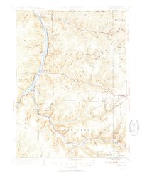 1949 Kinzua1954 Print · USGSThe Allegheny River valley remains the heart of this region in the late 1940s, just before major changes altered the landscape. Researchers can trace riverside life in Kinzua and Corydon or locate the historic Cornplanter Indian Reservation.4 unique versions available
 - 1954 Map of Russell, 1956 Print
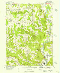 1954 Russell1956 Print · USGSWarren County in the mid-1950s shows a landscape of institutional farms and rural crossroads along the Conewango Creek. Trace the New York Central Railroad corridor through Russell and Akeley, or locate ancestral sites like Marshtown Cem and Putnamville.4 unique versions available
 - 1954 Map of Scandia, 1956 Print
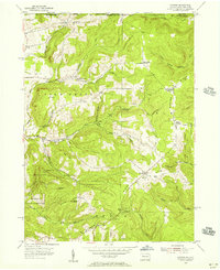 1954 Scandia1956 Print · USGSThe Pennsylvania and New York borderlands come alive in this midcentury survey of the hills north of Warren. Local historians can trace the foundations of Scandia, find family plots at Seven Dolors Cem, and locate the sprawling grounds of the Warren State Hospital.3 unique versions available
 - 1954 Map of Clarendon, 1956 Print
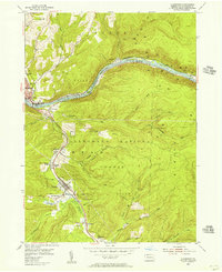 1954 Clarendon1956 Print · USGSMid-century Warren County is shown here as a center for the regional energy economy, dominated by the Oil Field. Family historians can trace the residents of Clarendon, Tiona, and Weldbank, or locate sites like Snyder Cem and Lincoln Sch.5 unique versions available
 - 1954 Map of Warren, 1956 Print
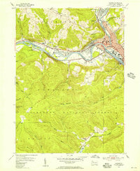 1954 Warren1956 Print · USGSWarren and its river valleys are seen here in the mid-fifties, when the rail and oil industries shaped the local economy. Researchers can trace historic cemeteries like Oakland Cem and industry sites like the Oil Refinery and Buchers Mills.6 unique versions available
 - 1957 Map of Warren, 1964 Print
 1957 Warren1964 Print · USGSThe northern Pennsylvania oil and timber country comes into focus in the mid-fifties, showing the region before modern highway expansions. Trace the industrial rail networks of the Pennsylvania RR and the early Allegheny River Reservoir near Warren and Oil City.4 unique versions available
Showing maps 1-25 of 159
Top cities of Warren County
- Warren historical maps
- Sheffield Township historical maps
- Youngsville historical maps
- Pittsfield Township historical maps
- Spring Creek Township historical maps
- Tidioute historical maps
See more
Frequently asked questions
- What are the different types of historical maps available for Warren County?
- What is the oldest map of Warren County?
- Where can I purchase historical maps of Warren County for my home or office?
- Where can I download high-res historical maps of Warren County?
- Are there historical topographic maps available for Warren County?
- Is there historical aerial imagery available for Warren County?
- Where are historical maps of Warren County sourced from?