2000s (21st Century) Maps of Warren County, Pennsylvania
Explore 22 historic maps of Warren County from the 2000s (21st Century). These maps offer a rare glimpse into what life looked like during the 2000s — showing old roads, neighborhoods, homes, and landmarks that have changed or disappeared over time.
Whether you're researching your family's past, planning a metal detecting trip, or studying how Warren County's landscape evolved across the 2000s, these high-resolution maps are a powerful tool for exploring the history of this region.
- Focus on a specific era: All maps on this page are from the 2000s, giving you a focused view of this time period.
- See what’s changed: Compare century-old streets, trails, and buildings to today's modern landscape using overlays and satellite layers.
- Research with precision: Use these maps for genealogy, historical research, land use analysis, or educational projects.
- View, download, or print: Maps are fully viewable online in high resolution, and can be downloaded or printed for your own records.
Start exploring Warren County's history through authentic maps from the 2000s. This is your window into the past.
Warren County, PA maps
(22)- 2023 Map of Ludlow, 2023 Print
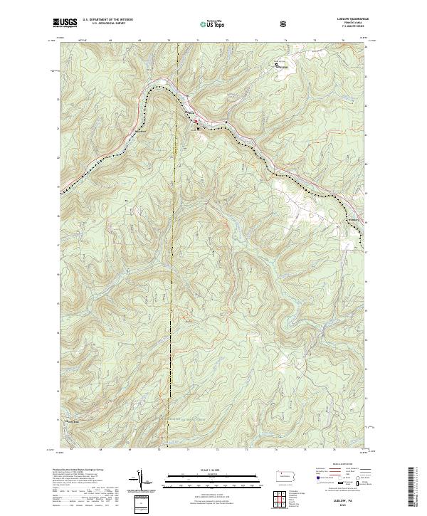 2023 Ludlow2023 Print · USGSThe timbered highlands of McKean County are captured here in the twenty-first century, showing the small settlements and mountain runs within the Allegheny National Forest. Researchers can trace the winding East Branch Tionesta Creek or locate local burials at Monah Cem and Gibbs Hill Cem.
 - 2023 Map of West Hickory, 2023 Print
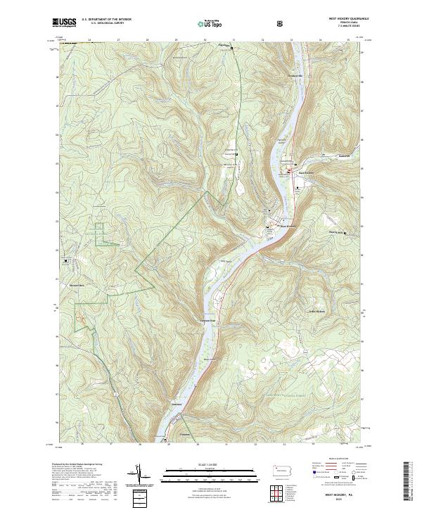 2023 West Hickory2023 Print · USGSThe Allegheny River corridor in Forest County is captured here in modern detail, from its protected wilderness islands to the valley hamlets. Researchers can trace family history at the Methodist Church East Hickory Cem or locate the site of Fagundus.
 - 2023 Map of Tidioute, 2023 Print
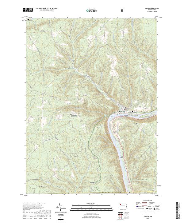 2023 Tidioute2023 Print · USGSThe Allegheny River valley comes alive in this modern survey of Warren County. Genealogists can locate family sites at Tidioute Cem, Gorman Cem, or the small settlement of Fagundus.
 - 2023 Map of Youngsville, 2023 Print
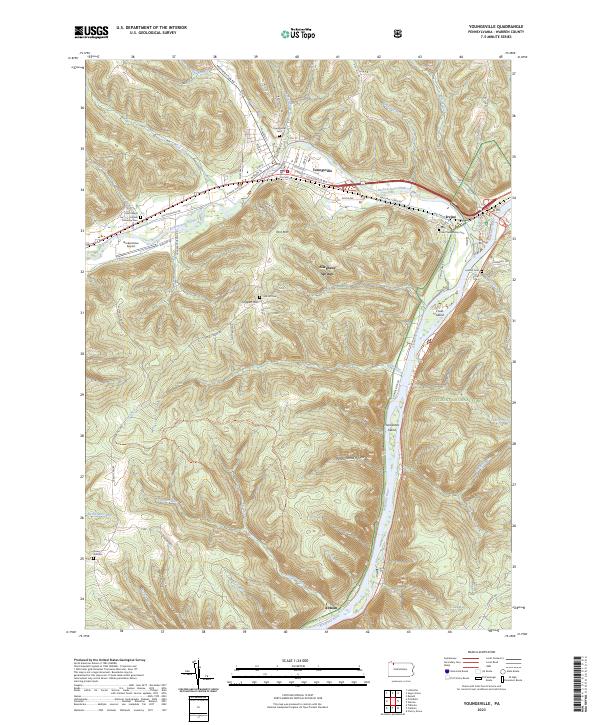 2023 Youngsville2023 Print · USGSThe confluence of the Allegheny River and Brokenstraw Creek defines this contemporary view of Warren County. Genealogists can locate several family and community burial grounds, including Davey Hill Cem, Lenhart Cem, and the Irvine Presbyterian Cem.
 - 2023 Map of Pittsfield, 2023 Print
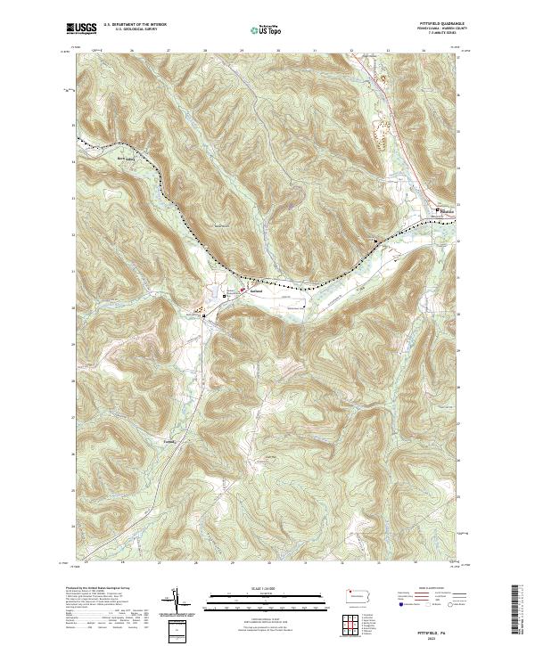 2023 Pittsfield2023 Print · USGSWarren County’s creek valleys and upland ridges are shown in high detail in this modern survey of the area surrounding the Pittsfield confluence. Researchers can locate several historical burial sites including Whitestown Cem and trace rural settlements like Garland and Torpedo.
 - 2023 Map of Sheffield, 2023 Print
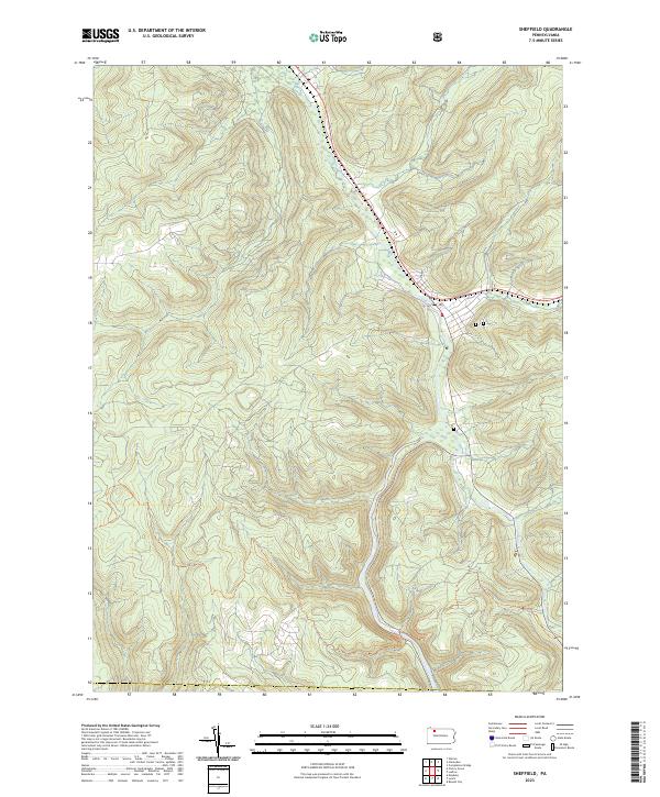 2023 Sheffield2023 Print · USGSCovers Warren County, including Sheffield Township, Cherry Grove Township, and other nearby areas
 - 2023 Map of Spring Creek, 2023 Print
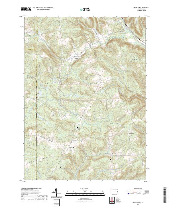 2023 Spring Creek2023 Print · USGSThe rolling hills of Warren County appear here in a recent survey of its rural landscapes and family farmsteads. Genealogists can trace family lines through the Gilson Family Farm Burial Plot, Trimm Cem, and old settlements like Sanford.
 - 2023 Map of Russell, 2023 Print
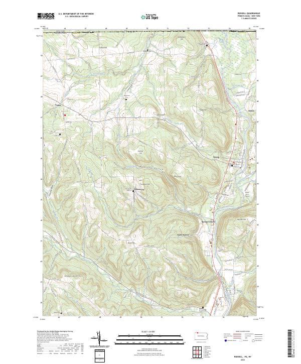 2023 Russell2023 Print · USGSWarren County at the New York border showcases a landscape of ridge-top farms and creek-side hamlets. Researchers can trace family history through several rural burial grounds like Marshtown Cem or explore the settlement patterns of Russell and Akeley along the Conewango Creek.
 - 2023 Map of Cherry Grove, 2023 Print
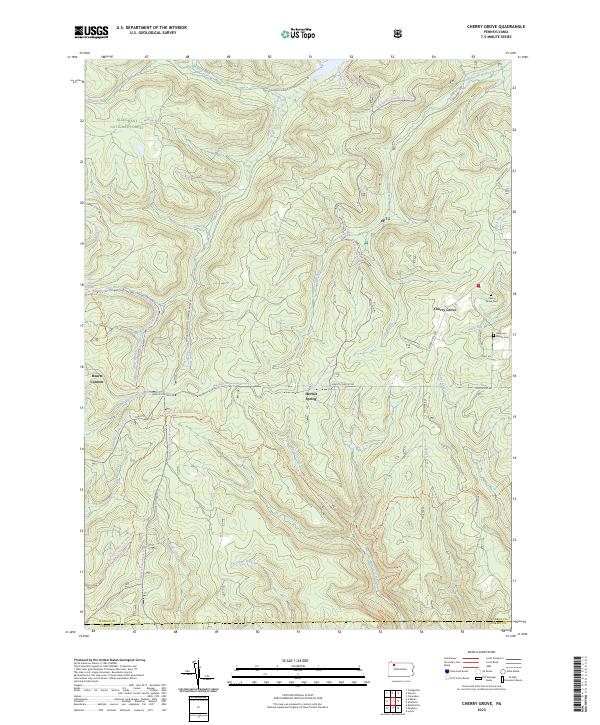 2023 Cherry Grove2023 Print · USGSThe high plateau of the Pennsylvania wilds appears here during the early twenty-first century, showing the intersection of managed forest and wilderness. Genealogists and hikers can locate the Sorenson Family Cem, the North Country National Scenic Trl, and the remote Hermit Spring.
 - 2023 Map of Columbus, 2023 Print
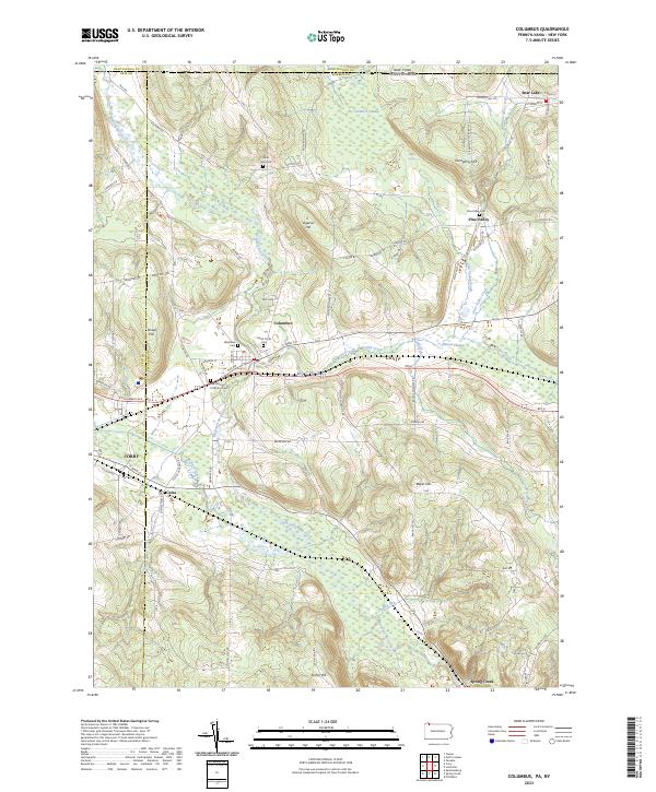 2023 Columbus2023 Print · USGSThe rural valleys of Warren County appear here during the early twenty-first century, centered on the historic crossroads of Columbus. Genealogists can locate family sites at Saint John Cem or trace the old paths of Plank Rd and Brokenstraw Creek.
 - 2023 Map of Cobham, 2023 Print
 2023 Cobham2023 Print · USGSThe Allegheny River valley comes into focus in this recent survey of the forested highlands between Warren and Forest counties. Researchers can trace the river islands and riverfront settlements of Cobham and Magee or locate the Limestone Cemetery near the wilderness boundary.
 - 2023 Map of Clarendon, 2023 Print
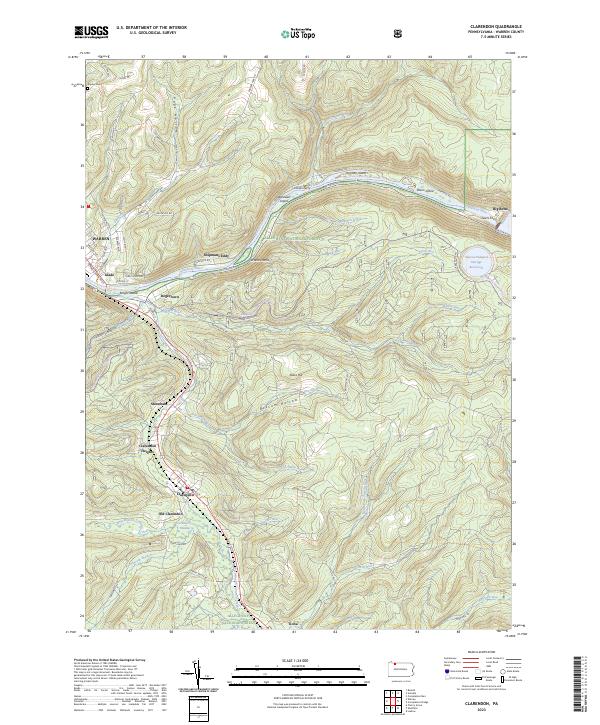 2023 Clarendon2023 Print · USGSThe northern Pennsylvania highlands and the Allegheny River valley are shown here as they appear today within the Allegheny National Forest. Researchers can trace the legacy of timber and industry through settlements like Old Clarendon, Stoneham, and Tiona, or locate family sites at Snyder Cem and Shipmans Eddy.
 - 2023 Map of Lottsville, 2023 Print
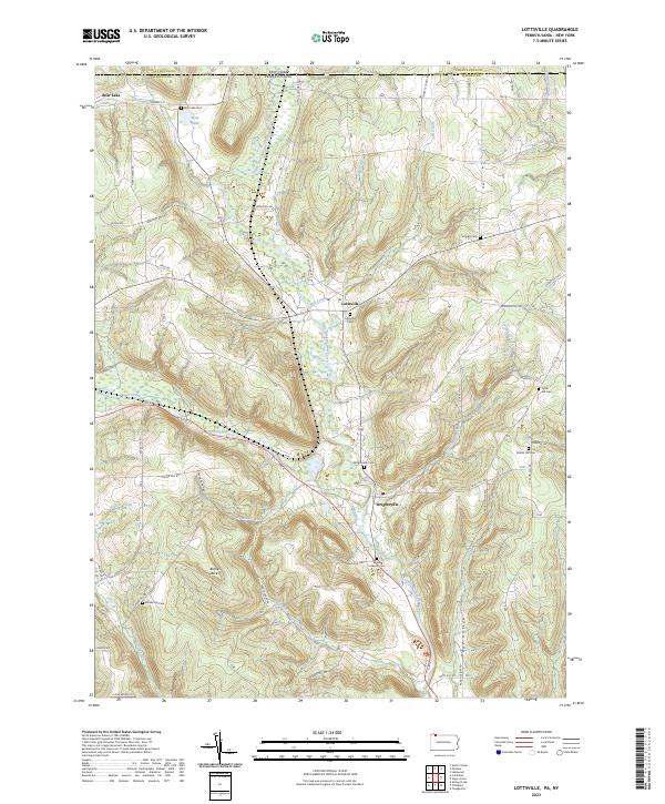 2023 Lottsville2023 Print · USGSNorthwestern Pennsylvania at the New York border remains defined by its rural creek valleys and historic family settlements. Genealogists can trace local lineages through several burial sites like Tuttle Hill Cem and Bear Lake Cem near the banks of Little Brokenstraw Creek.
 - 2023 Map of Grand Valley, 2023 Print
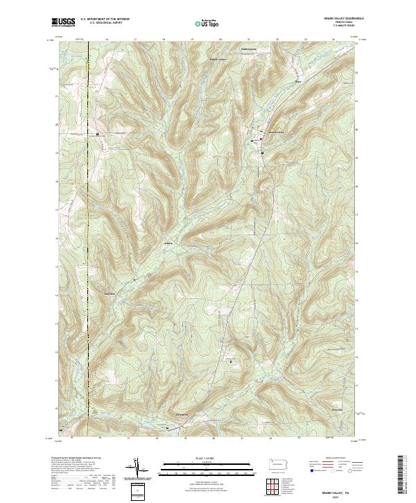 2023 Grand Valley2023 Print · USGSWarren County's rural landscape is captured here in the modern era, showing the enduring footprint of its historic hamlets and valley roads. Genealogists can trace family names through local sites like Vroman Excelsior Cem and the community at Enterprise.
 - 2023 Map of Lynch, 2023 Print
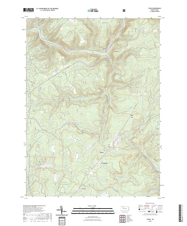 2023 Lynch2023 Print · USGSThe Pennsylvania woods of the Allegheny National Forest are shown here in 2023, featuring deep creek valleys and remote settlements. Local historians can trace old transit routes like the Old Railroad Grade and find family sites near Byromtown or the Frost Cem.
 - 2023 Map of Warren, 2023 Print
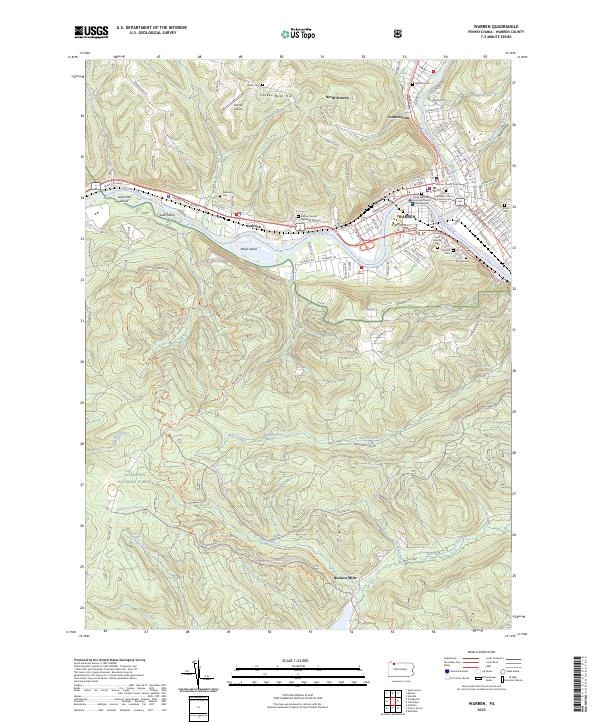 2023 Warren2023 Print · USGSWarren and the Allegheny River valley appear in high detail during this era. Genealogists and researchers can trace civic history at the Warren County Courthouse or locate family plots in Oakland Cem and Saint Josephs Cem.
 - 2023 Map of Sugar Grove, 2023 Print
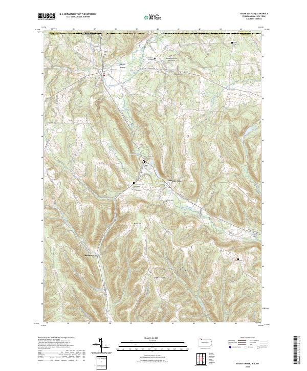 2023 Sugar Grove2023 Print · USGSNorthern Warren County's valley settlements and family-named ridges are shown in high detail as they appeared in the 2020s. Genealogists can trace burial sites from the Robert Miles Gravesite to the Jackson Run Cem.
 - 2023 Map of Russell City, 2023 Print
 2023 Russell City2023 Print · USGSThe Allegheny National Forest is shown here at the intersection of four counties during the twenty-first century. Researchers can trace remote settlements and cemeteries such as Brookston, Pigs Ear, and the Brookston Cem amidst an extensive network of modern forest trails.
 - 2023 Map of Cornplanter Run, 2023 Print
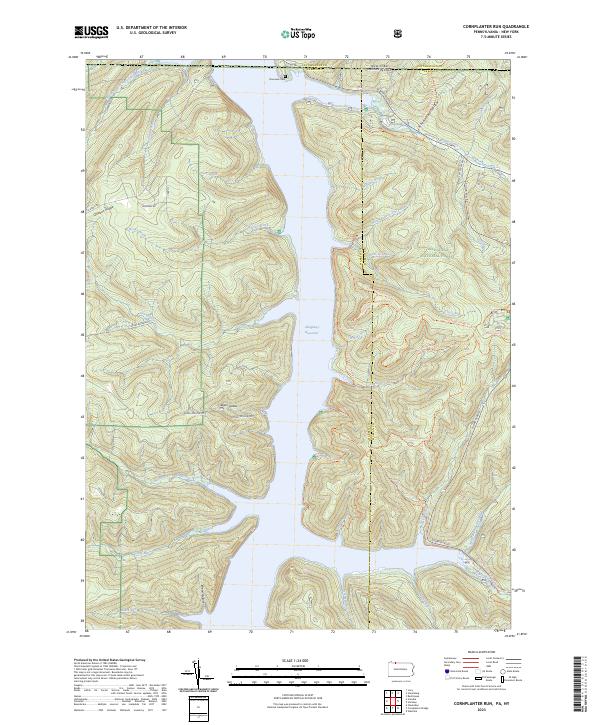 2023 Cornplanter Run2023 Print · USGSThe Allegheny National Forest meets the New York border in the 2020s, showing a landscape defined by the Allegheny Reservoir. Researchers can trace old routes like Cornplanter Road or find family landmarks at Riverview Cemetery and Roper Hollow.
 - 2023 Map of Scandia, 2023 Print
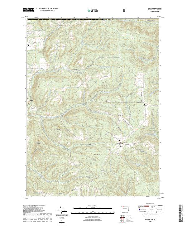 2023 Scandia2023 Print · USGSWarren County, Pennsylvania, is shown here as a landscape of deep valleys and forested ridges during the early twenty-first century. Researchers can locate numerous family-named burial grounds like Macks Corners Cem and Smith Cem alongside landmarks such as Scandia Air Park.
 - 2023 Map of Pleasantville, 2023 Print
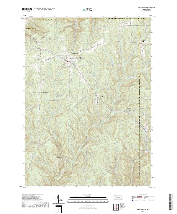 2023 Pleasantville2023 Print · USGSPleasantville and the surrounding oil country of Venango County are shown here as they appeared in the early 21st century. Researchers can trace the legacy of the Pennsylvania oil boom through sites like Pithole City, East Shamburg, and rural landmarks such as Asbury Chapel.
 - 2023 Map of Cornplanter Bridge, 2023 Print
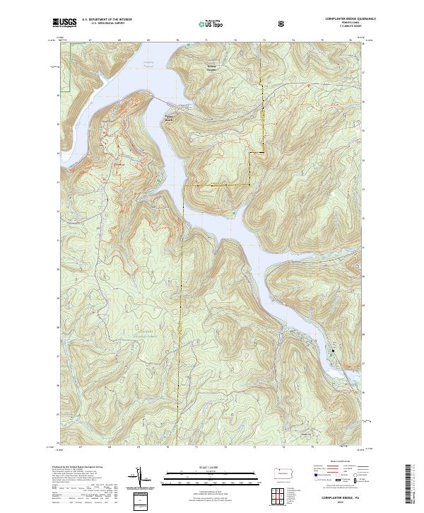 2023 Cornplanter Bridge2023 Print · USGSThe Allegheny National Forest meets the McKean County line in the early twenty-first century, centered on the massive Allegheny Reservoir. Researchers can trace old mountain roads and find local sites like Lone Pine Cem, Kinzua Heights, and Jakes Rocks.
End of results
Showing maps 1-22 of 22
Top cities of Warren County
- Warren historical maps
- Sheffield Township historical maps
- Youngsville historical maps
- Pittsfield Township historical maps
- Spring Creek Township historical maps
- Tidioute historical maps
See more
Frequently asked questions
- What are the different types of historical maps available for Warren County?
- What is the oldest map of Warren County?
- Where can I purchase historical maps of Warren County for my home or office?
- Where can I download high-res historical maps of Warren County?
- Are there historical topographic maps available for Warren County?
- Is there historical aerial imagery available for Warren County?
- Where are historical maps of Warren County sourced from?