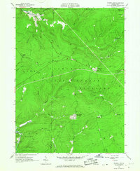
1966 Map of Russell City
USGS Topo · Published 1967About this map
Industrial extraction and remote forest settlements define this portion of the Allegheny National Forest during the mid-1960s. The landscape is a dense network of gas wells and oil fields connected by pipelines, highlighting the region's historical importance to Pennsylvania's energy production. The Baltimore and Ohio Railroad and its accompanying railroad grade provide the primary infrastructure for the area, threading through creek valleys and connecting small crossroads like Russell City and Sheffield Junction. Distinctive local names like Pigs Ear, Windy City, and Pine Camp point to the rugged character of these upland settlements. Waterways such as South Branch Tionesta Creek and East Branch Tionesta Creek carve deep into the plateau, while surveying markers like the bench at Four Corners anchor the terrain.
Find a feature on this map
54 named features on this map. Tap any name to fly to it.
Don’t see what you’re looking for? This feature index may not catch every label — zoom into the map to look around manually.
Map Details
Editions of this 1966 Russell City Map
4 editions found
Other maps of this area

1918 · Loleta
USGS Topo · 1:62,500

1934 · Kane
USGS Topo · 1:48,000

1935 · Sheffield
USGS Topo · 1:48,000

1936 · Marienville
USGS Topo · 1:48,000

1939 · Kane
USGS Topo · 1:62,500

1940 · Hallton
USGS Topo · 1:48,000

1941 · Sheffield
USGS Topo · 1:62,500

1941 · Marienville
USGS Topo · 1:62,500

1943 · Hallton
USGS Topo · 1:62,500

1957 · Warren
USGS Topo · 1:250,000
Featured Places
- Sheffield Township, PA
- Dunring, Jenks Township
- Brookston, Howe Township
- Sheffield Junction, Howe Township
- Wetmore Township, PA