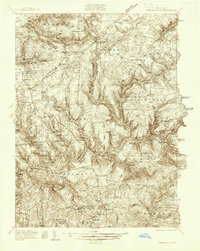
1936 Map of Marienville
USGS Topo · Published 1936About this map
Marienville serves as the primary hub of this 1930s landscape, situated at the junction of the Baltimore and Ohio RR and Highway No 68. The topography is dominated by the deep incisions of the Clarion River, which winds through the southern half of the sheet, bordered by the protected lands of Allegheny National Forest and Cook Forest State Park. This period of surveying captures a rural infrastructure defined by numerous small schoolhouses like Hottelville Sch and Shippen Sch, alongside remote outposts such as Muzette and Vowinckel. The placement of Muzette Fire Tower and Zimmerman Hill Fire Tower reflects the vital role of fire observation in these heavily wooded highlands. For genealogists, the map preserves the locations of community landmarks including St Dominic Ch and Mt Tabor Cem, providing a precise look at the settlements before later 20th-century consolidation.
Find a feature on this map
80 named features on this map. Tap any name to fly to it.
Don’t see what you’re looking for? This feature index may not catch every label — zoom into the map to look around manually.
Map Details
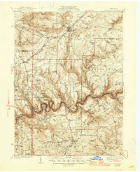
Editions of this 1936 Marienville Map
3 editions found
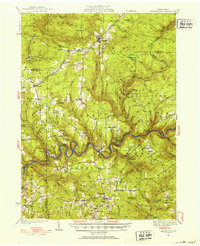
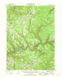
Historical Maps of Warsaw Township Through Time
Featured Locations
- Polk Township, PA
- Warsaw Township, PA
- Millcreek Township, PA
- Millstone Township, PA
- Fisher, Millcreek Township