
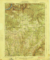
1918 Map of Loleta
USGS Topo · Published 1918About this map
The Clarion River carves a winding path through this 1918 tactical map, serving as a natural boundary for Barnett, Heath, and Millstone townships. The landscape is defined by the intersection of forest industry and early rail transport, centered on Marienville and the Baltimore & Ohio line. While many small settlements like Loleta, Clarington, and Cooksburg anchor the riverfront and creek valleys, the interior is crisscrossed by numerous named runs and creeks, such as Tionesta East Millstone and Bear Run. This survey highlights the complex county lines where Forest Co., Elk Co., Clarion Co., and Jefferson Co. meet. It captures the region before modern development, showing isolated stations like Vowinckel Sta. and the detailed network of timber-era drainage systems like Black Swamp Run.
Find a feature on this map
63 named features on this map. Tap any name to fly to it.
Don’t see what you’re looking for? This feature index may not catch every label — zoom into the map to look around manually.
Map Details
Editions of this 1918 Loleta Map
This is the sole edition of this map. No revisions or reprints were ever made.
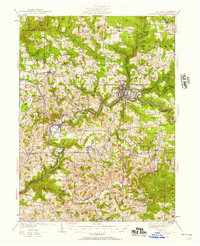
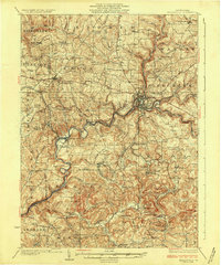
Other maps of this area

1906 · Clarion
USGS Topo · 1:62,500

1907 · Clarion
USGS Topo · 1:62,500

1922 · Tionesta
USGS Topo · 1:62,500

1922 · Du Bois
USGS Topo · 1:62,500

1924 · Du Bois
USGS Topo · 1:62,500
1924 · Tionesta
USGS Topo · 1:62,500
1924 · Brookville
USGS Topo · 1:62,500
1926 · Brookville
USGS Topo · 1:62,500

1927 · Tidioute
USGS Topo · 1:48,000

1930 · Tidioute
USGS Topo · 1:62,500
Featured Places
- Warsaw Township, PA
- Millstone Township, PA
- Polk Township, PA
- Millcreek Township, PA
- Fisher, Millcreek Township