
1907 Map of Clarion
USGS Topo · Published 1907About this map
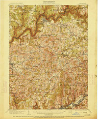
Clarion sits as the central hub of this 1907 survey, where the Pittsburg Summerville and Clarion R.R. and a Narrow Gage R.R. converge near the winding Clarion River. The landscape is a dense network of early industrial and agricultural activity, particularly in the south where coal operations like Jocelyn Mine and Acme Mines are established near Rimersburg. The map reveals the civic structure of the era through features like the County Home near Sligo and numerous rural schools and churches that served isolated farmsteads, including Five Points School and Leatherwood Church.
Find a feature on this map
129 named features on this map. Tap any name to fly to it.
Don’t see what you’re looking for? This feature index may not catch every label — zoom into the map to look around manually.
Map Details
Editions of this 1907 Clarion Map
5 editions found
Other maps of this area

1900 · Kittanning
USGS Topo · 1:62,500

1901 · Rural Valley
USGS Topo · 1:62,500

1902 · Kittanning
USGS Topo · 1:62,500

1903 · Rural Valley
USGS Topo · 1:62,500

1906 · Clarion
USGS Topo · 1:62,500

1907 · Foxburg
USGS Topo · 1:62,500

1908 · Foxburg
USGS Topo · 1:62,500

1909 · Smicksburg
USGS Topo · 1:62,500

1918 · Loleta
USGS Topo · 1:62,500

1922 · Oil City
USGS Topo · 1:48,000