
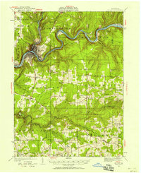
1922 Map of Oil City
USGS Topo · Published 1922About this map
The Allegheny River carves a dramatic path through the center of this Venango County region, its sharp bends like Henrys Bend and Walnut Bend dictating the placement of early settlements and rail infrastructure. As a 1922 survey, it captures the area during a period of industrial transit, shown by the Pennsylvania RR and Erie RR following the riverbanks to serve Oil City. Beyond the urban center, the landscape is dotted with rural identifiers essential for family historians, including dozens of neighborhood schools such as Mc Calmont School and Gilson School. Significant landmarks like the Pump Station and numerous sidings like Brandon Siding hint at the local utility and timber movements of the early twentieth century. Further south, the map details the upland communities of Cranberry PO and Centerville (Fertigs PO), where local roads connect scattered farmsteads and churches like Meadow Church.
Find a feature on this map
90 named features on this map. Tap any name to fly to it.
Don’t see what you’re looking for? This feature index may not catch every label — zoom into the map to look around manually.
Map Details
Editions of this 1922 Oil City Map
2 editions found
Other maps of this area

1906 · Clarion
USGS Topo · 1:62,500

1907 · Clarion
USGS Topo · 1:62,500

1907 · Foxburg
USGS Topo · 1:62,500

1908 · Foxburg
USGS Topo · 1:62,500

1909 · Franklin
USGS Topo · 1:62,500

1910 · Hilliards
USGS Topo · 1:62,500

1911 · Franklin
USGS Topo · 1:62,500

1912 · Hilliards
USGS Topo · 1:62,500

1922 · Tionesta
USGS Topo · 1:62,500

1924 · Oil City
USGS Topo · 1:62,500