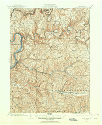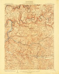
1903 Map of Rural Valley
USGS Topo · Published 1903About this map
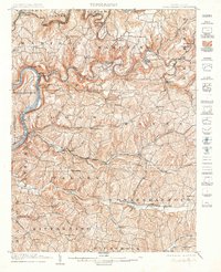
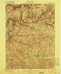
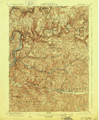
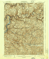
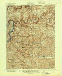
Redbank Creek and the Allegheny River define the industrial and topographic character of this Armstrong County landscape at the beginning of the twentieth century. The map illustrates a region transitioning from early iron production to a sophisticated rail-dependent economy, evidenced by the presence of Mahoning Furnace and Pine Furnace along the winding waterways. The Low Grade Division Redbank and the Pennsylvania R.R. (Buffalo and Allegheny Valley Division) trace the river valleys, serving established settlements like Templeton and Mosgrove.
Find a feature on this map
78 named features on this map. Tap any name to fly to it.
Don’t see what you’re looking for? This feature index may not catch every label — zoom into the map to look around manually.
Map Details
Editions of this 1903 Rural Valley Map
6 editions found
Historical Maps of Mahoning Through Time
8 maps found