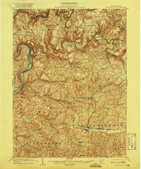
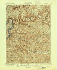
1903 Map of Rural Valley
USGS Topo · Published 1918About this map
Mahoning Creek and Redbank Creek wind through a landscape defined by early industrial activity in Armstrong and Clarion counties. This early 20th-century survey documents the transition of the region, where iron manufacturing sites like Mahoning Furnace, McCrea Furnace, and Buffalo Furnace speak to the area's rich mineral history. The Allegheny River marks the western boundary, flanked by the Pennsylvania RR, which served as a vital artery for the transport of coal and iron between river settlements such as Mosgrove and Templeton.
Find a feature on this map
72 named features on this map. Tap any name to fly to it.
Don’t see what you’re looking for? This feature index may not catch every label — zoom into the map to look around manually.
Map Details
Editions of this 1903 Rural Valley Map
6 editions found
Other maps of this area

1900 · Kittanning
USGS Topo · 1:62,500

1901 · Rural Valley
USGS Topo · 1:62,500

1902 · Kittanning
USGS Topo · 1:62,500

1902 · Indiana
USGS Topo · 1:62,500

1902 · Elders Ridge
USGS Topo · 1:62,500

1903 · Rural Valley
USGS Topo · 1:62,500

1904 · Elders Ridge
USGS Topo · 1:62,500

1906 · Clarion
USGS Topo · 1:62,500

1907 · Clarion
USGS Topo · 1:62,500

1907 · Foxburg
USGS Topo · 1:62,500