
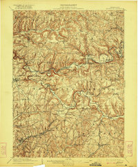
1909 Map of Smicksburg
USGS Topo · Published 1909About this map
Little Mahoning Creek and its many winding tributaries dictate the rugged development of this rural Pennsylvania landscape at the turn of the century. The map centers on the borough of Smicksburg, surrounded by a dense network of township boundaries including West Mahoning, North Mahoning, and South Mahoning. Settlement patterns follow the narrow valley floors and ridge tops, with numerous small post offices and hamlets like New Salem Pierce PO and Perryville Hamilton PO serving the agricultural community.
Find a feature on this map
88 named features on this map. Tap any name to fly to it.
Don’t see what you’re looking for? This feature index may not catch every label — zoom into the map to look around manually.
Map Details
Editions of this 1909 Smicksburg Map
2 editions found
Other maps of this area

1901 · Rural Valley
USGS Topo · 1:62,500

1902 · Indiana
USGS Topo · 1:62,500

1902 · Barnesboro
USGS Topo · 1:62,500

1902 · Elders Ridge
USGS Topo · 1:62,500

1903 · Rural Valley
USGS Topo · 1:62,500

1904 · Barnesboro
USGS Topo · 1:62,500

1904 · Elders Ridge
USGS Topo · 1:62,500

1906 · Clarion
USGS Topo · 1:62,500

1906 · Punxsutawney
USGS Topo · 1:62,500

1907 · Clarion
USGS Topo · 1:62,500