Old Maps of Carroll Township, Pennsylvania for Hiking & Exploration
Hike through history with 25 historic maps of Carroll Township. Explore old trails, ghost towns, and forgotten backroads — perfect for outdoor adventurers and local explorers.
- Rediscover forgotten places: Map out old mining camps, roads, and footpaths that no longer exist on modern maps.
- Layer with modern tools: Combine with LiDAR or satellite views to plan hikes through historical terrain.
- Made for exploration: Popular among hikers, overlanders, and local history lovers.
Use these maps to find adventure and explore the hidden past of Carroll Township.
Carroll Township, PA maps
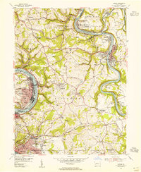
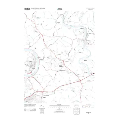
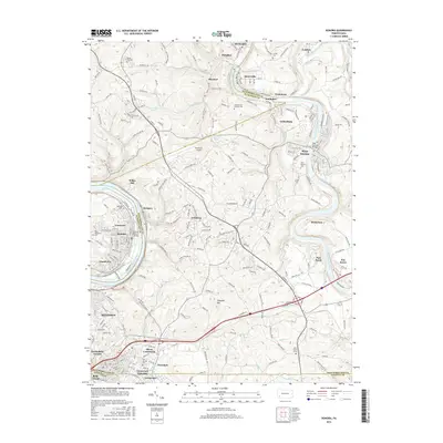
(25)- 1902 Map of Brownsville
 1902 Brownsville1902 Print · USGSThe Monongahela Valley was a powerhouse of Pennsylvania industry at the start of the twentieth century, defined by its coal mines and river-front rail lines. Researchers can trace the heritage of the National Pike and locate vanished works at Vesta Mine or Coal Bluff.
 - 1906 Map of Brownsville
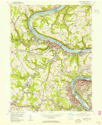
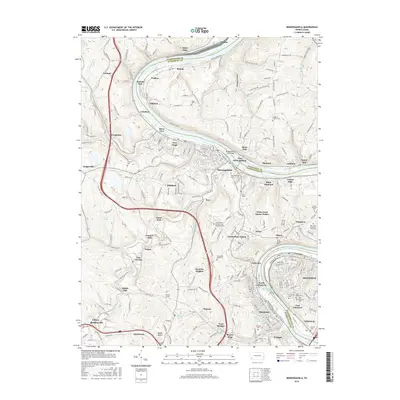
 1906 Brownsville1906 Print · USGSSouthwestern Pennsylvania’s river valleys were centers of industrial expansion when this survey was conducted. Genealogists can locate family homes and landmarks in riverfront towns like Monessen and Charleroi, or trace rural roots near Salem Church and Ginger Hill.4 unique versions available
 - 1931 Map of Brownsville, 1954 Print
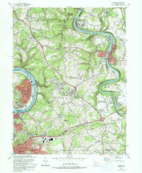
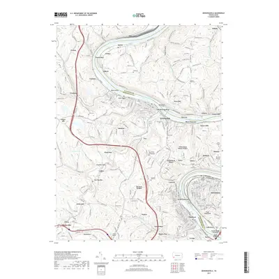
 1931 Brownsville1954 Print · USGSThe industrial Monongahela and Youghiogheny river valleys are captured here in the early thirties, showcasing a landscape of coal mines and river locks. Genealogists can trace family homes near Vesta Mine, Sutersville, and rural landmarks like Salem Church.
 - 1933 Map of Brownsville
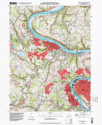
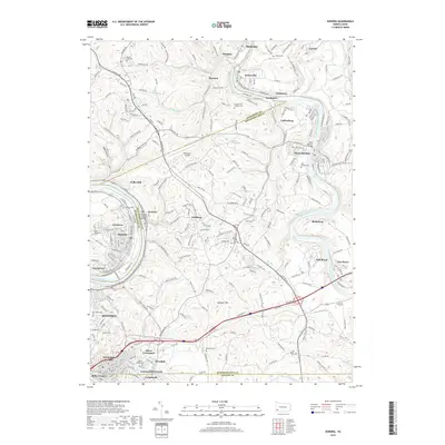
 1933 Brownsville1933 Print · USGSWestern Pennsylvania’s industrial heartland thrives along the river bends in the early thirties, where coal and rail define the landscape. Trace the expansion of river towns like Charleroi and Monessen, locate the Vesta Mine, or find rural landmarks like Mt Union Sch.2 unique versions available
 - 1940 Map of Brownsville
 1940 Brownsville1940 Print · USGSThe Monongahela and Youghiogheny river valleys were the industrial heart of Pennsylvania during this era of coal and steel. Genealogists and historians can trace the exact locations of Vesta Mine, Salem Church, and historic rural schools like Central Sch.
 - 1953 Map of Pittsburgh
 1953 Pittsburgh1953 Print · USGSWestern Pennsylvania's industrial landscape at the start of the fifties shows the steel and rail corridors between Pittsburgh and Altoona. Trace family roots in river towns like Tarentum or follow the Pennsylvania Turnpike across Laurel Hill.
 - 1954 Map of Pittsburgh
 1954 Pittsburgh1954 Print · USGSWestern Pennsylvania in the early fifties remains a powerhouse of heavy industry and vital transit corridors. Genealogists and historians can trace the rail-and-river network connecting Pittsburgh, Johnstown, and Altoona via the Pennsylvania RR and the Lincoln Highway.2 unique versions available
 - 1954 Map of Donora, 1955 Print
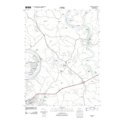
 1954 Donora1955 Print · USGSThe industrial heart of the Monongahela and Youghiogheny valleys is captured here during the mid-fifties. Researchers can trace coal operations at Ocean Mine and Coal Hollow Mine or locate family roots at Concord Pioneer Sch.4 unique versions available
 - 1954 Map of Monongahela, 1955 Print
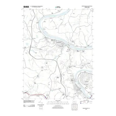
 1954 Monongahela1955 Print · USGSIndustrial life along the river valley is captured here in the mid-fifties, showing the deep integration of coal mining and rail transport. Researchers can locate family landmarks from the Black Diamond Mine to the Mentor School and Ohav Sholom Cem.4 unique versions available
 - 1958 Map of Pittsburgh
 1958 Pittsburgh1958 Print · USGSWestern Pennsylvania in the late fifties shows an industrial heartland defined by the confluence of the Allegheny River and Monongahela River. Researchers can trace the sprawling rail networks of the Pennsylvania RR and find established towns like Butler, Latrobe, and Windber.5 unique versions available
 - 1959 Map of Pittsburgh
 1959 Pittsburgh1959 Print · USGSWestern Pennsylvania in the late fifties is captured here at the height of its industrial era. Genealogists and historians can trace the riverfront growth of Pittsburgh, the rail works at Altoona, and the mountain gaps of Laurel Hill.
 - 1964 Map of Pittsburgh
 1964 Pittsburgh1964 Print · USGSWestern Pennsylvania in the late fifties and early sixties shows a landscape of powerful river industries and expanding highways. Genealogists and historians can trace the rail corridors of the Pennsylvania RR through industrial hubs like Johnstown, Altoona, and Nanty Glo.
 - 1986 Map of Pittsburgh East
 1986 Pittsburgh East1986 Print · USGSWestern Pennsylvania in the mid-eighties shows a landscape defined by industrial rivers and rising mountain ridges. Trace the dense rail networks of CONRAIL and the Pittsburgh and Lake Erie RR connecting historic centers like Monessen, Jeannette, and Connellsville.3 unique versions available
 - 1993 Map of Donora
 1993 Donora1993 Print · USGSThe industrial river valleys of the Monongahela and Youghiogheny are captured in the early nineties as they balance legacy industry with growing suburbs. Genealogists can trace family roots through sites like Douglass Cem, Apples Mill Ch, and the Concord Pioneer Sch.2 unique versions available
 - 1993 Map of Monongahela, 1999 Print
 1993 Monongahela1999 Print · USGSThe industrial Monongahela Valley is captured in the early nineties, showing a landscape shaped by river commerce and mining. Researchers can trace family roots at Taylor Cem or locate historic landmarks like Shire Oaks and Hazel Kirk.
 - 2010 Map of Donora, 2010 Print
 2010 Donora2010 Print · USGSCovers Carroll Township, including Monessen, Donora, and other nearby areas
 - 2010 Map of Monongahela, 2010 Print
 2010 Monongahela2010 Print · USGSCovers Carroll Township, including Monessen, Charleroi, and other nearby areas
 - 2013 Map of Monongahela, 2013 Print
 2013 Monongahela2013 Print · USGSCovers Carroll Township, including Monessen, Charleroi, and other nearby areas
 - 2013 Map of Donora, 2013 Print
 2013 Donora2013 Print · USGSCovers Carroll Township, including Monessen, Donora, and other nearby areas
 - 2016 Map of Donora, 2016 Print
 2016 Donora2016 Print · USGSCovers Carroll Township, including Monessen, Donora, and other nearby areas
 - 2016 Map of Monongahela, 2016 Print
 2016 Monongahela2016 Print · USGSCovers Carroll Township, including Monessen, Charleroi, and other nearby areas
 - 2019 Map of Monongahela, 2019 Print
 2019 Monongahela2019 Print · USGSCovers Carroll Township, including Monessen, Charleroi, and other nearby areas
 - 2019 Map of Donora, 2019 Print
 2019 Donora2019 Print · USGSCovers Carroll Township, including Monessen, Donora, and other nearby areas
 - 2023 Map of Donora, 2023 Print
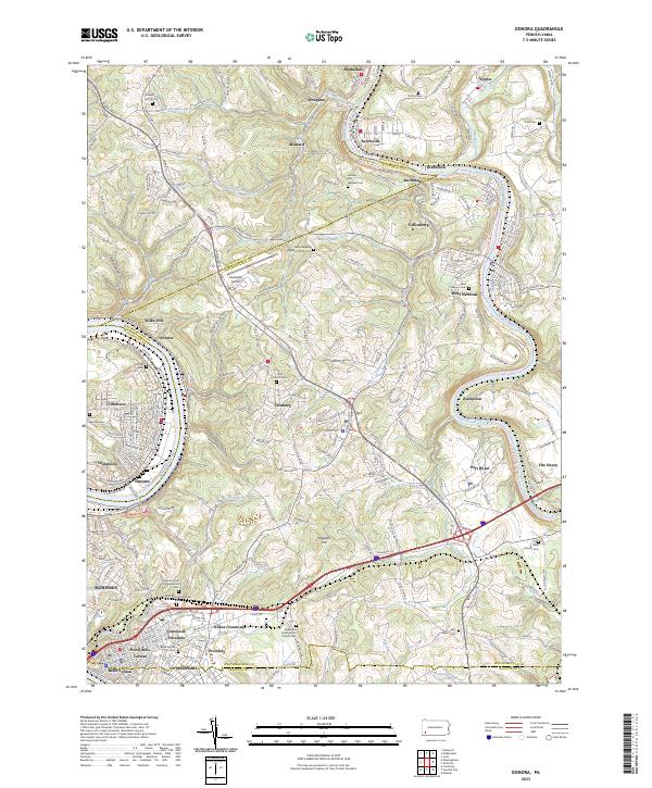 2023 Donora2023 Print · USGSThe industrial river valleys of Washington and Westmoreland counties are shown here in the early twenty-first century. Researchers can trace family sites at Round Hill Cem, the Plummer School, and many churches from Donora to West Newton.
 - 2023 Map of Monongahela, 2023 Print
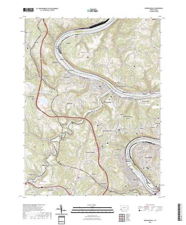 2023 Monongahela2023 Print · USGSThe Monongahela River valley shows its industrial character and deep family roots in the 2020s. Genealogists can trace decades of history through dozens of sites like the Horseshoe Bottom Presbyterian Church Cem and Sholom Cem.
End of results
Showing maps 1-25 of 25
Top cities near Carroll Township
- Pittsburgh historical maps
- Bethel Park historical maps
- Mount Lebanon historical maps
- Monroeville historical maps
- McKeesport historical maps
- Baldwin historical maps
See more
Top neighborhoods of Carroll Township
- Baidland historical maps
- Cracker Jack historical maps
- Eldora historical maps
- Fisher historical maps
- Frye historical maps
- Grandview historical maps
See more
Frequently asked questions
- What are the different types of historical maps available for Carroll Township?
- What is the oldest map of Carroll Township?
- Where can I purchase historical maps of Carroll Township for my home or office?
- Where can I download high-res historical maps of Carroll Township?
- Are there historical topographic maps available for Carroll Township?
- Is there historical aerial imagery available for Carroll Township?
- Where are historical maps of Carroll Township sourced from?