Old Maps of Chartiers Township, Pennsylvania for Metal Detecting
Plan your next treasure hunt with 23 historic maps of Chartiers Township. Find old homesites, ghost towns, trails, and gathering spots that may be lost to time — perfect for identifying promising metal detecting locations.
- Locate forgotten sites: Uncover places like long-lost settlements, abandoned rail lines, or gathering spots.
- Plan better hunts: Use map overlays combined with LiDAR or satellite views to narrow in on historically rich areas.
- Made for detectorists: Thousands of hobbyists use these maps to discover relics, coins, and hidden history.
Use these historic maps to boost your research and find new opportunities beneath the surface of Chartiers Township.
Chartiers Township, PA maps
(23)- 1901 Map of Amity, 1956 Print
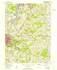
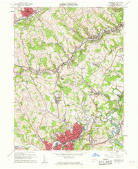
 1901 Amity1956 Print · USGSWashington County at the turn of the century shows a landscape transitioning between historic pikes and the burgeoning rail era. Researchers can trace ancestral property near Tenmile Creek or follow the route of the National Pike through Laboratory and Zediker.
 - 1904 Map of Amity
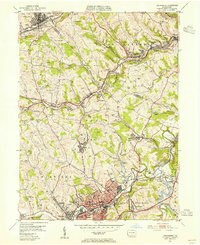
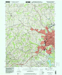
 1904 Amity1904 Print · USGSWashington County at the start of the twentieth century was a bustling nexus of rail and road, centered on the growing city of WASHINGTON. Researchers can trace early property lines and rail stops like Meadowlands, Laboratory, and the Pittsburg and Washington Turnpike.6 unique versions available
 - 1904 Map of Carnegie, 1954 Print
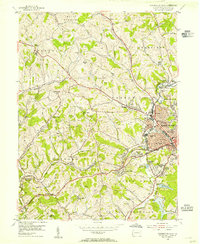
 1904 Carnegie1954 Print · USGSAllegheny County's industrial heartland is captured here at the start of the twentieth century as rail lines and mines reshaped the landscape. Researchers can trace early settlements and social hubs like Cliff Mine, the County Home, and the Union Church.
 - 1904 Map of Burgettstown, 1958 Print
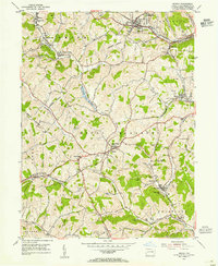
 1904 Burgettstown1958 Print · USGSWashington County and its neighbors are documented at the turn of the century as the coal and rail industries began reshaping the landscape. Researchers can trace early family sites and infrastructure from Pattersons Mill to the Francis Mine and the North Star Tyre P O.
 - 1906 Map of Burgettstown
 1906 Burgettstown1906 Print · USGSWestern Pennsylvania’s coal and rail landscape comes into focus at the dawn of the twentieth century. Researchers can trace historic family landmarks and industrial sites like Francis Mine, Pattersons Mill, and the North Star Tyre P O.5 unique versions available
 - 1906 Map of Carnegie
 1906 Carnegie1906 Print · USGSThe industrial valleys of Western Pennsylvania come alive in the early 1900s, showing the early infrastructure of the Ohio River and its tributaries. Local historians can trace family roots at Union Church or explore the early coal economy at Cliff Mine and Walkers Mills.7 unique versions available
 - 1907 Map of Claysville
 1907 Claysville1907 Print · USGSWashington County during the first decade of the 1900s shows a dense network of hill-country townships connected by the Baltimore and Ohio RR. Researchers can trace rural life through numerous named schoolhouses and local post offices like Crothers PO and Vienna Coon Island PO.5 unique versions available
 - 1908 Map of Carnegie, 1910 Print
 1908 Carnegie1910 Print · USGSSouthwest of the Pittsburgh river forks in the early 1900s, a complex web of railroads and industrial hollows began to link the rural coal and mill towns. Trace the paths of the Wabash and Side Belt lines past landmarks like Cliff Mine, Guy Mills, and Treveskyn Cuddy PO.
 - 1951 Map of Canton
 1951 Canton1951 Print · USGSThe industrial heartland of Ohio and Pennsylvania reached its mid-century peak during this era of heavy rail and river transit. Genealogists and historians can trace the development of steel towns like Aliquippa and Weirton alongside the Ohio River and major lines of the Pennsylvania RR.
 - 1953 Map of Canton
 1953 Canton1953 Print · USGSThe industrial heartland of Ohio and Pennsylvania is captured at its mid-century peak in this detailed regional survey. Genealogists and historians can trace the vast rail networks of the Pennsylvania RR and find local landmarks like Nimisila Reservoir and Tappan Reservoir.
 - 1953 Map of Washington East, 1955 Print
 1953 Washington East1955 Print · USGSThe coal and rail landscape of Washington County comes alive in the mid-fifties, showing the region as its industrial and suburban identities merged. Genealogists can locate family names at Hill Church or Immaculate Conception Cem, while historians can trace the operations of the Lindley Mine and the Pennsylvania RR.5 unique versions available
 - 1953 Map of Canonsburg, 1955 Print
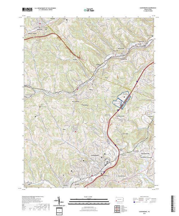
 1953 Canonsburg1955 Print · USGSCanonsburg and the surrounding coal townships are shown in detail during the early fifties, a time of heavy rail traffic and active mining. Genealogists can trace family footprints across Robinson Run Cem, St Marys Ch, and the complex rail junctions at Muse Junction.
 - 1954 Map of Washington West, 1955 Print
 1954 Washington West1955 Print · USGSWashington and its surrounding townships are shown in the mid-1950s, highlighting the area's transition from a rail-dependent industrial center to a growing suburban landscape. Researchers can trace the Arden Mines, old schools like Log Pile Sch, and the historic National Pike.3 unique versions available
 - 1954 Map of Midway, 1955 Print
 1954 Midway1955 Print · USGSWashington County during the mid-fifties reveals an landscape shaped by coal mining and established rail lines. Genealogists and local historians can trace family locations near Hickory School, the Cherry Valley Cemetery, or follow the Montour railroad through the Acheson Tunnel.4 unique versions available
 - 1957 Map of Canton, 1971 Print
 1957 Canton1971 Print · USGSThe industrial heartland of eastern Ohio and western Pennsylvania comes alive in this mid-century survey of the Ohio River Valley. Trace the heritage of rail and river commerce through Pittsburgh, the massive steel towns along the Ohio River, and major junctions on the Pennsylvania RR.3 unique versions available
 - 1960 Map of Canonsburg, 1961 Print
 1960 Canonsburg1961 Print · USGSWashington County at the start of the sixties reveals a landscape of deep coal heritage and industrial rail hubs. Genealogists and historians can trace the foundations of Canonsburg and Houston or locate rural landmarks like St Marys Cem and Ship Mine.5 unique versions available
 - 1962 Map of Canton
 1962 Canton1962 Print · USGSThe industrial heartland of Eastern Ohio and Western Pennsylvania thrives in the early sixties as steel mills and rail lines dominate the river valleys. Genealogists and historians can trace local landmarks like McKinley National Memorial, Malone College, and industrial sites such as Republic Steel Corp.2 unique versions available
 - 1986 Map of Pittsburgh West
 1986 Pittsburgh West1986 Print · USGSThe Tri-State region's coal and rail corridors are captured in the mid-eighties as industry and aviation expanded. Trace the legacy of extraction at Nelms Mine No 1, locate Short Creek PO, or follow the Chessie System tracks along the Ohio River.3 unique versions available
 - 1993 Map of Washington West, 1999 Print
 1993 Washington West1999 Print · USGSWashington and its western suburbs appear in the early nineties, revealing a landscape where industrial heritage meets suburban growth. Researchers can trace historic sites like Arden Mines, the Childrens Home, and the rural Taylorstown Sta.
 - 2023 Map of Midway, 2023 Print
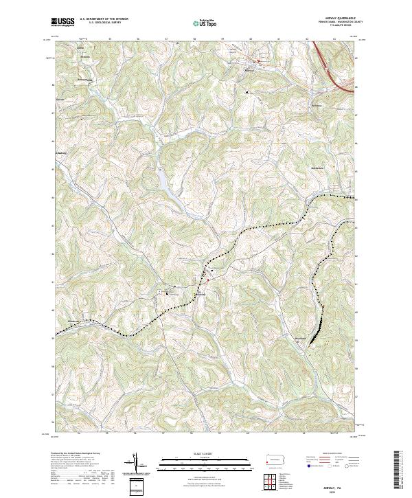 2023 Midway2023 Print · USGSWashington County’s hilly terrain and coal-country history are on full display in this recent survey. Genealogists can trace family roots at Mount Pleasant Cem or Cherry Valley Cem, while following the old rail grade along the Panhandle Trl.
 - 2023 Map of Washington West, 2023 Print
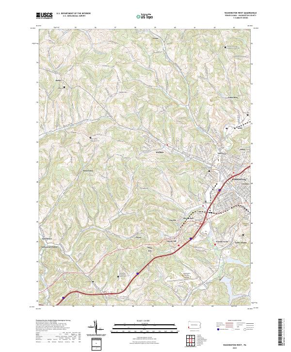 2023 Washington West2023 Print · USGSWestern Washington County during the early twenty-first century maintains its distinct coal-country and agricultural character. Genealogists can trace family names through several historic sites including Horn Cem, Arden Mines, and Buffalo Cem.
 - 2023 Map of Canonsburg, 2023 Print
 2023 Canonsburg2023 Print · USGSWashington County settlement patterns and the industrial geography of the Chartiers Valley are visible in this contemporary survey. Researchers can trace family history through a wealth of local landmarks like Millers Run Presbyterian Cem, McConnells Mills, and the National Cem of the Alleghenies.
 - 2023 Map of Washington East, 2023 Print
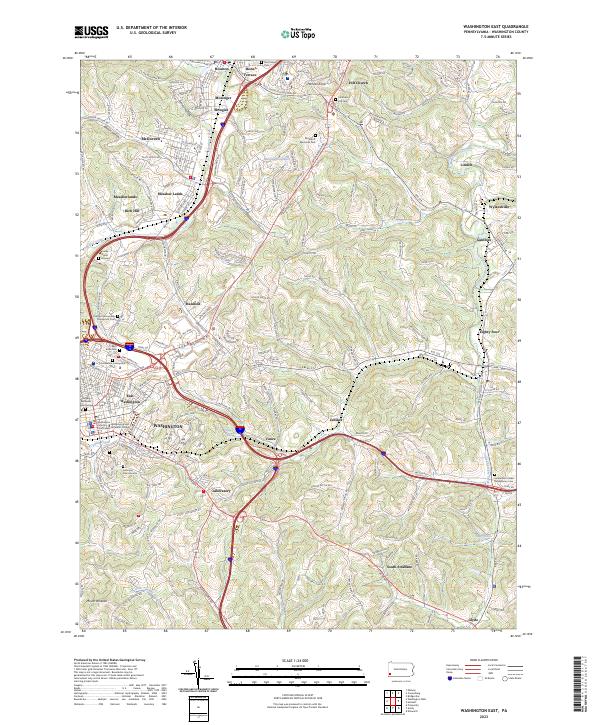 2023 Washington East2023 Print · USGSGreater WASHINGTON and its neighboring boroughs come to life in this contemporary survey of the Pennsylvania countryside. Researchers can trace historic local sites like Washington and Jefferson College, the Beth Israel Cem, and the uniquely named settlement of Eighty Four.
End of results
Showing maps 1-23 of 23
Top cities near Chartiers Township
- Pittsburgh historical maps
- Bethel Park historical maps
- Mount Lebanon historical maps
- Moon Township historical maps
- Upper St. Clair historical maps
- Washington historical maps
See more
Top neighborhoods of Chartiers Township
- McConnells Mills historical maps
- Allison Park historical maps
- McNary historical maps
- Meadow Lands historical maps
- Arden Mines historical maps
- Brevard historical maps
See more
Frequently asked questions
- What are the different types of historical maps available for Chartiers Township?
- What is the oldest map of Chartiers Township?
- Where can I purchase historical maps of Chartiers Township for my home or office?
- Where can I download high-res historical maps of Chartiers Township?
- Are there historical topographic maps available for Chartiers Township?
- Is there historical aerial imagery available for Chartiers Township?
- Where are historical maps of Chartiers Township sourced from?