2020s Maps of Fallowfield Township, Pennsylvania
Explore 3 historic maps of Fallowfield Township from the 2020s. These maps offer a rare glimpse into what life looked like during the 2020s — showing old roads, neighborhoods, homes, and landmarks that have changed or disappeared over time.
Whether you're researching your family's past, planning a metal detecting trip, or studying how Fallowfield Township's landscape evolved across the 2020s, these high-resolution maps are a powerful tool for exploring the history of this region.
- Focus on a specific era: All maps on this page are from the 2020s, giving you a focused view of this time period.
- See what’s changed: Compare century-old streets, trails, and buildings to today's modern landscape using overlays and satellite layers.
- Research with precision: Use these maps for genealogy, historical research, land use analysis, or educational projects.
- View, download, or print: Maps are fully viewable online in high resolution, and can be downloaded or printed for your own records.
Start exploring Fallowfield Township's history through authentic maps from the 2020s. This is your window into the past.
Fallowfield Township, PA maps
(3)- 2023 Map of Hackett, 2023 Print
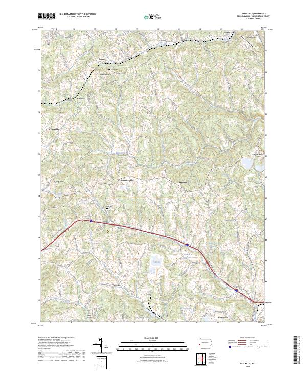 2023 Hackett2023 Print · USGSWashington County at the start of the 2020s shows a landscape where small rural settlements like Eighty Four and Dunningsville meet modern reservoirs and airfields. Researchers can trace local history through sites like Pigeon Creek Cem and the industrially named Mine Number Sixty Reservoir.
 - 2023 Map of California, 2023 Print
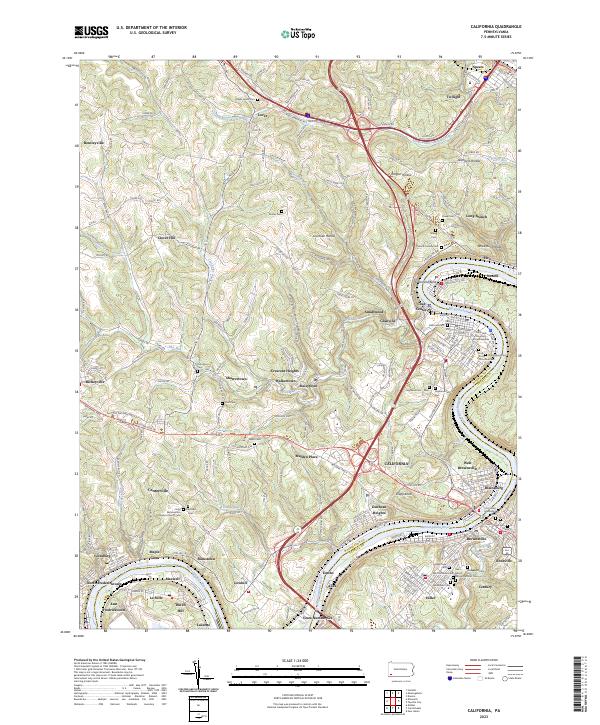 2023 California2023 Print · USGSThe Monongahela River valley comes to life in this detailed record of Washington and Fayette Counties during the early 21st century. Researchers can trace ancestral sites through dozens of local burial grounds like California Cem or explore the riverfront legacy of Coal Center and West Brownsville.
 - 2023 Map of Monongahela, 2023 Print
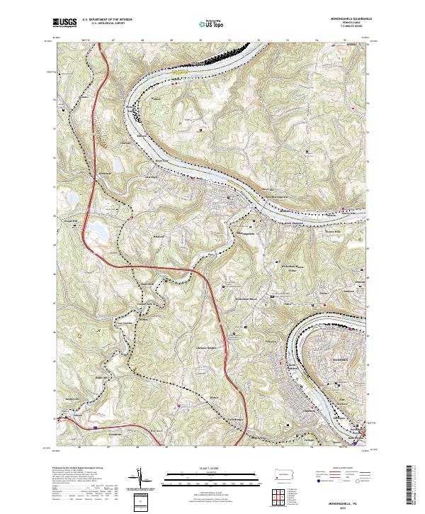 2023 Monongahela2023 Print · USGSThe Monongahela River valley shows its industrial character and deep family roots in the 2020s. Genealogists can trace decades of history through dozens of sites like the Horseshoe Bottom Presbyterian Church Cem and Sholom Cem.
End of results
Showing maps 1-3 of 3
Top cities near Fallowfield Township
- Pittsburgh historical maps
- Bethel Park historical maps
- Mount Lebanon historical maps
- McKeesport historical maps
- Baldwin historical maps
- West Mifflin historical maps
See more
Top neighborhoods of Fallowfield Township
- Sudan historical maps
- Ginger Hill historical maps
- Jonestown historical maps
- Lockview historical maps
- Rogers Stop historical maps
- Twin Bridges historical maps
See more
Frequently asked questions
- What are the different types of historical maps available for Fallowfield Township?
- What is the oldest map of Fallowfield Township?
- Where can I purchase historical maps of Fallowfield Township for my home or office?
- Where can I download high-res historical maps of Fallowfield Township?
- Are there historical topographic maps available for Fallowfield Township?
- Is there historical aerial imagery available for Fallowfield Township?
- Where are historical maps of Fallowfield Township sourced from?