2000s (21st Century) Maps of Paupack Township, Pennsylvania
Explore 5 historic maps of Paupack Township from the 2000s (21st Century). These maps offer a rare glimpse into what life looked like during the 2000s — showing old roads, neighborhoods, homes, and landmarks that have changed or disappeared over time.
Whether you're researching your family's past, planning a metal detecting trip, or studying how Paupack Township's landscape evolved across the 2000s, these high-resolution maps are a powerful tool for exploring the history of this region.
- Focus on a specific era: All maps on this page are from the 2000s, giving you a focused view of this time period.
- See what’s changed: Compare century-old streets, trails, and buildings to today's modern landscape using overlays and satellite layers.
- Research with precision: Use these maps for genealogy, historical research, land use analysis, or educational projects.
- View, download, or print: Maps are fully viewable online in high resolution, and can be downloaded or printed for your own records.
Start exploring Paupack Township's history through authentic maps from the 2000s. This is your window into the past.
Paupack Township, PA maps
(5)- 2023 Map of Honesdale, 2023 Print
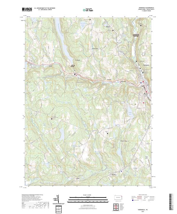 2023 Honesdale2023 Print · USGSWayne County in the early twenty-first century maintains its character through historic river towns and a high density of ancestral burial grounds. Genealogists can trace family names at the Schoonover Cem, Nelson Cem, or the centrally located Wayne County Courthouse.
 - 2023 Map of Hawley, 2023 Print
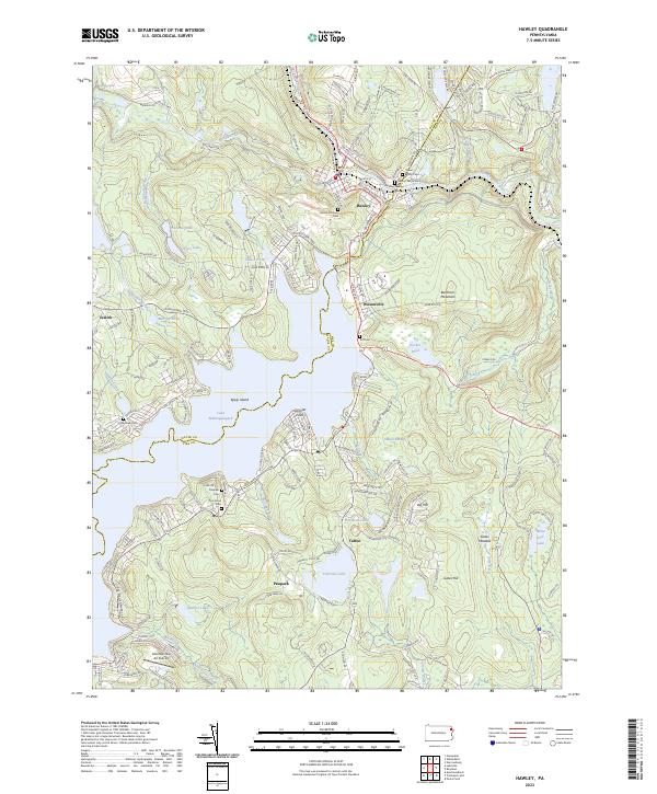 2023 Hawley2023 Print · USGSThe Poconos shoreline at Lake Wallenpaupack and the riverside borough of Hawley are shown here as they appear in the early 2020s. Genealogists can locate numerous local burial sites, including Walnut Grove Cem, Paupack Cem, and Taft Cem, nestled among the surrounding hills.
 - 2023 Map of White Mills, 2023 Print
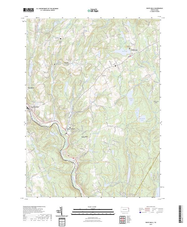 2023 White Mills2023 Print · USGSThe Lackawaxen River valley and the highlands of Wayne County come into focus in this contemporary survey of a historic glass-making and transit corridor. Researchers can trace ancestral sites at the Indian Orchard Cem or follow the path of the old Honesdale and Delaware Tpke.
 - 2023 Map of Newfoundland, 2023 Print
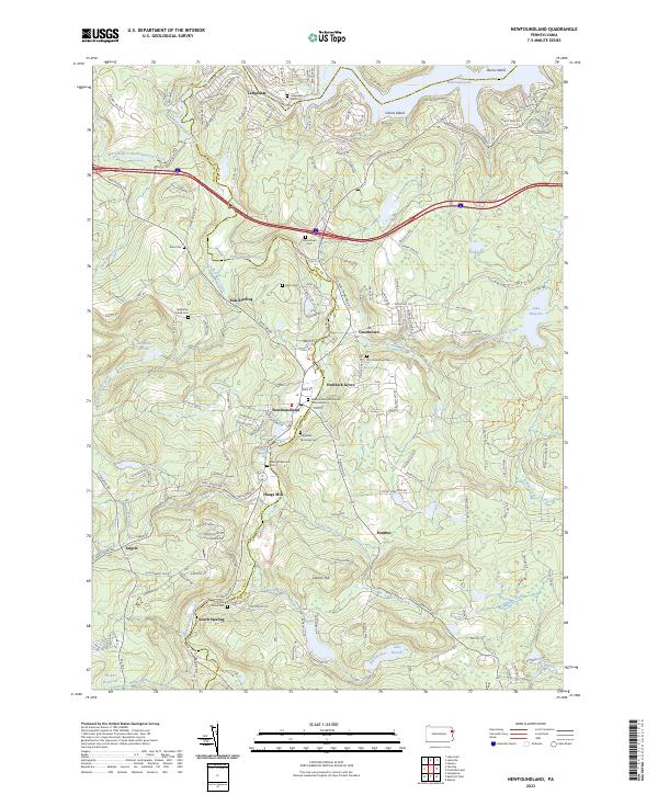 2023 Newfoundland2023 Print · USGSThe Pocono plateau on the Wayne and Pike County line is documented here in the early twenty-first century, centered on the historic Moravian influence near Newfoundland. Genealogists can trace family burial sites at the Heazelton Family Cem or find established communities like Greentown and South Sterling.
 - 2023 Map of Lakeville, 2023 Print
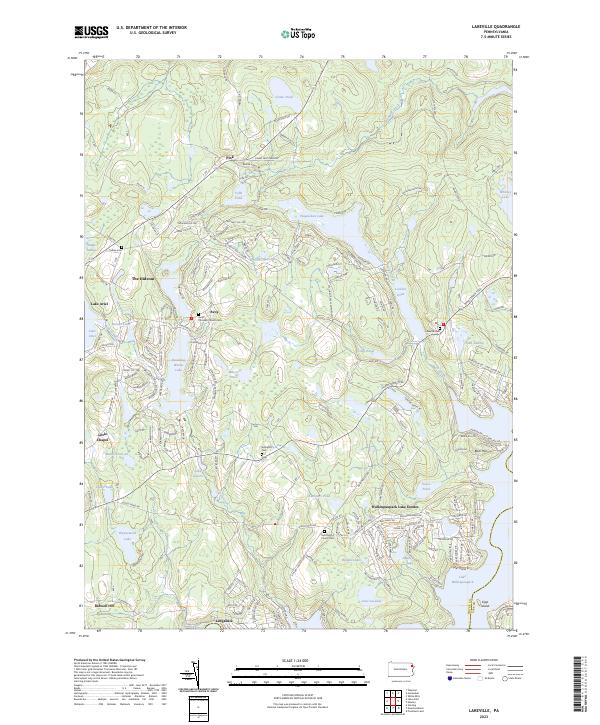 2023 Lakeville2023 Print · USGSWayne and Pike counties are captured here in a period of dense lakeside development and residential growth. Genealogists and local historians can trace family plots at Arlington Cem or Lakeville Cem and explore the modern footprints of The Hideout and Wallenpaupack Lake Estates.
End of results
Showing maps 1-5 of 5
Top cities near Paupack Township
- Lackawaxen Township historical maps
- Honesdale historical maps
- Blooming Grove Township historical maps
- Damascus Township historical maps
- Clifford Township historical maps
- Waymart historical maps
See more
Top neighborhoods of Paupack Township
Frequently asked questions
- What are the different types of historical maps available for Paupack Township?
- What is the oldest map of Paupack Township?
- Where can I purchase historical maps of Paupack Township for my home or office?
- Where can I download high-res historical maps of Paupack Township?
- Are there historical topographic maps available for Paupack Township?
- Is there historical aerial imagery available for Paupack Township?
- Where are historical maps of Paupack Township sourced from?