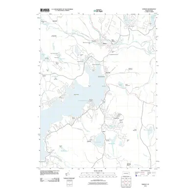
2010 Map of Hawley
USGS Topo · Published 2010About this map
The Lackawaxen River flows through the borough of Hawley and West Hawley, where industrial and civic history is marked by a series of water control structures including the Debris Dam Number One and Lambert Dam. The landscape is dominated by the northern reaches of Lake Wallenpaupack, featuring recreation hubs such as the Wilsonville Recreation Area and Boat Launch and Caffrey Campground. Further south, the map details the planned communities and seasonal landmarks near Tanglewood, including the Tanglewood Ski Area and its associated airport.
Find a feature on this map
106 named features on this map. Tap any name to fly to it.
Don’t see what you’re looking for? This feature index may not catch every label — zoom into the map to look around manually.
Map Details
Editions of this 2010 Hawley Map
This is the sole edition of this map. No revisions or reprints were ever made.
Other maps of this area

1892 · Honesdale
USGS Topo · 1:62,500

1920 · Damascus
USGS Topo · 1:62,500

1923 · Damascus
USGS Topo · 1:62,500

1928 · Ariel
USGS Topo · 1:62,500

1932 · Ariel
USGS Topo · 1:62,500

1935 · Hawley
USGS Topo · 1:62,500

1938 · Hawley
USGS Topo · 1:62,500

1943 · Honesdale
USGS Topo · 1:125,000

1944 · Damascus
USGS Topo · 1:62,500

1946 · Honesdale
USGS Topo · 1:24,000
Featured Places
- Lackawaxen Township, PA
- Blooming Grove Township, PA
- Hawley, PA
- Palmyra Township, PA
- Palmyra Township, PA