Old Maps of Wayne County, Pennsylvania
Explore 90 old maps of Wayne County, spanning from 1892 to today. These high-resolution historic maps reveal how streets, neighborhoods, landmarks, and natural features evolved over time — perfect for genealogy, metal detecting, research, and local history exploration.
What you can do with these maps:
- See how Wayne County changed over time: Compare historical maps to modern-day views to trace roads, homesites, rail lines & more.
- View detailed metadata: Each map includes creators, publishers, year, scale, and archive source.
- Overlay maps with satellite & LiDAR: Visualize the past alongside modern tools to explore terrain & human change.
- Trusted historical sources: Maps sourced from the USGS, Library of Congress, and other archives.
- Access maps your way: View online, download high-res files, or order prints for personal or research use.
Start exploring old maps of Wayne County to uncover forgotten places, hidden landmarks, and the deep history beneath your feet.
Wayne County, PA maps
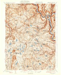
(90)- 1892 Map of Honesdale
 1892 Honesdale1892 Print · USGSCovers Wayne County, including Carbondale, Honesdale, and other nearby areas7 unique versions available
 - 1919 Map of Pocono
 1919 Pocono1919 Print · USGSCovers Wayne County, including Tobyhanna, Mount Pocono, and other nearby areas
 - 1920 Map of Long Eddy
 1920 Long Eddy1920 Print · USGSCovers Wayne County, including Damascus Township, Callicoon, and other nearby areas3 unique versions available
 - 1920 Map of Damascus, 1956 Print
 1920 Damascus1956 Print · USGSCovers Wayne County, including Lackawaxen Township, Honesdale, and other nearby areas2 unique versions available
 - 1921 Map of Long Eddy
 1921 Long Eddy1921 Print · USGSCovers Wayne County, including Damascus Township, Callicoon, and other nearby areas
 - 1921 Map of Pocono, 1962 Print
 1921 Pocono1962 Print · USGSCovers Wayne County, including Tobyhanna, Mount Pocono, and other nearby areas
 - 1922 Map of Stoddartsville, 1958 Print
 1922 Stoddartsville1958 Print · USGSCovers Wayne County, including Clifton Township, Thornhurst Township, and other nearby areas2 unique versions available
 - 1923 Map of Damascus
 1923 Damascus1923 Print · USGSCovers Wayne County, including Lackawaxen Township, Honesdale, and other nearby areas5 unique versions available
 - 1923 Map of Long Eddy
 1923 Long Eddy1923 Print · USGSCovers Wayne County, including Damascus Township, Callicoon, and other nearby areas5 unique versions available
 - 1923 Map of Pocono
 1923 Pocono1923 Print · USGSCovers Wayne County, including Tobyhanna, Mount Pocono, and other nearby areas5 unique versions available
 - 1924 Map of Starrucca
 1924 Starrucca1924 Print · USGSCovers Wayne County, including Hancock, Sanford, and other nearby areas
 - 1924 Map of Stoddartsville
 1924 Stoddartsville1924 Print · USGSCovers Wayne County, including Clifton Township, Thornhurst Township, and other nearby areas5 unique versions available
 - 1926 Map of Starrucca
 1926 Starrucca1926 Print · USGSCovers Wayne County, including Hancock, Sanford, and other nearby areas
 - 1928 Map of Ariel, 1953 Print
 1928 Ariel1953 Print · USGSCovers Wayne County, including Cherry Ridge Township, South Canaan Township, and other nearby areas4 unique versions available
 - 1930 Map of Starrucca
 1930 Starrucca1930 Print · USGSCovers Wayne County, including Hancock, Sanford, and other nearby areas3 unique versions available
 - 1932 Map of Ariel
 1932 Ariel1932 Print · USGSCovers Wayne County, including Cherry Ridge Township, South Canaan Township, and other nearby areas3 unique versions available
 - 1933 Map of Starrucca
 1933 Starrucca1933 Print · USGSCovers Wayne County, including Hancock, Sanford, and other nearby areas3 unique versions available
 - 1935 Map of Hawley, 1955 Print
 1935 Hawley1955 Print · USGSCovers Wayne County, including Lackawaxen Township, Blooming Grove Township, and other nearby areas2 unique versions available
 - 1938 Map of Hawley
 1938 Hawley1938 Print · USGSCovers Wayne County, including Lackawaxen Township, Blooming Grove Township, and other nearby areas3 unique versions available
 - 1943 Map of Scranton
 1943 Scranton1943 Print · USGSCovers Wayne County, including Scranton, Wilkes-Barre, and other nearby areas
 - 1943 Map of Stoddartsville
 1943 Stoddartsville1943 Print · USGSCovers Wayne County, including Clifton Township, Thornhurst Township, and other nearby areas
 - 1943 Map of Honesdale
 1943 Honesdale1943 Print · USGSCovers Wayne County, including Carbondale, Lackawaxen Township, and other nearby areas
 - 1943 Map of Pocono
 1943 Pocono1943 Print · USGSCovers Wayne County, including Tobyhanna, Mount Pocono, and other nearby areas
 - 1944 Map of Long Eddy
 1944 Long Eddy1944 Print · USGSCovers Wayne County, including Damascus Township, Callicoon, and other nearby areas
 - 1944 Map of Damascus
 1944 Damascus1944 Print · USGSCovers Wayne County, including Lackawaxen Township, Honesdale, and other nearby areas
Showing maps 1-25 of 90
Top cities of Wayne County
- Honesdale historical maps
- Damascus Township historical maps
- Waymart historical maps
- Cherry Ridge Township historical maps
- South Canaan Township historical maps
- Dyberry Township historical maps
See more
Frequently asked questions
- What are the different types of historical maps available for Wayne County?
- What is the oldest map of Wayne County?
- Where can I purchase historical maps of Wayne County for my home or office?
- Where can I download high-res historical maps of Wayne County?
- Are there historical topographic maps available for Wayne County?
- Is there historical aerial imagery available for Wayne County?
- Where are historical maps of Wayne County sourced from?