2020s Maps of Peach Bottom Township, Pennsylvania
Explore 5 historic maps of Peach Bottom Township from the 2020s. These maps offer a rare glimpse into what life looked like during the 2020s — showing old roads, neighborhoods, homes, and landmarks that have changed or disappeared over time.
Whether you're researching your family's past, planning a metal detecting trip, or studying how Peach Bottom Township's landscape evolved across the 2020s, these high-resolution maps are a powerful tool for exploring the history of this region.
- Focus on a specific era: All maps on this page are from the 2020s, giving you a focused view of this time period.
- See what’s changed: Compare century-old streets, trails, and buildings to today's modern landscape using overlays and satellite layers.
- Research with precision: Use these maps for genealogy, historical research, land use analysis, or educational projects.
- View, download, or print: Maps are fully viewable online in high resolution, and can be downloaded or printed for your own records.
Start exploring Peach Bottom Township's history through authentic maps from the 2020s. This is your window into the past.
Peach Bottom Township, PA maps
(5)- 2023 Map of Airville, 2023 Print
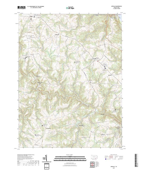 2023 Airville2023 Print · USGSSouthern York County's rural character remains centered on small crossroads and storied congregations in this recent survey. Local researchers can trace family landmarks and rural hubs like Muddy Creek Forks, Old Guinston Church Cem, and the riverfront at York Furnace.
 - 2023 Map of Delta, 2023 Print
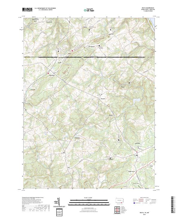 2023 Delta2023 Print · USGSThe Pennsylvania-Maryland line splits the twin towns of Delta and Cardiff on this recent landscape survey. Researchers can trace numerous local burial grounds and historic church sites like Trinity African Methodist Episcopal Zion Cem and Mount Nebo Church Cem.
 - 2023 Map of Holtwood, 2023 Print
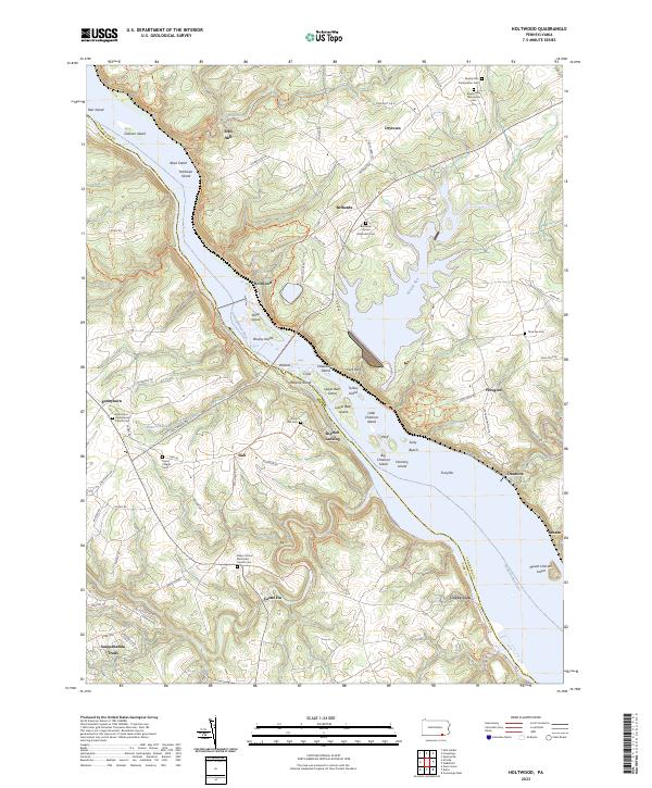 2023 Holtwood2023 Print · USGSThe Susquehanna River corridor at the Lancaster and York county line reveals a landscape shaped by river commerce and rural faith. Genealogists and historians can trace family sites from Boeckel Landing to the Rawlinsville Mennonite Cem and Erbs Mill.
 - 2023 Map of Fawn Grove, 2023 Print
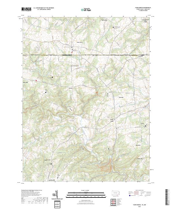 2023 Fawn Grove2023 Print · USGSAcross the Pennsylvania and Maryland border in the early twenty-first century, this landscape preserves a dense network of cross-border settlements and historic sites. Genealogists can trace family lines through numerous rural burial grounds, including Heaps Cem, Saint Marys Cem, and North Harford Cem.
 - 2023 Map of Conowingo Dam, 2023 Print
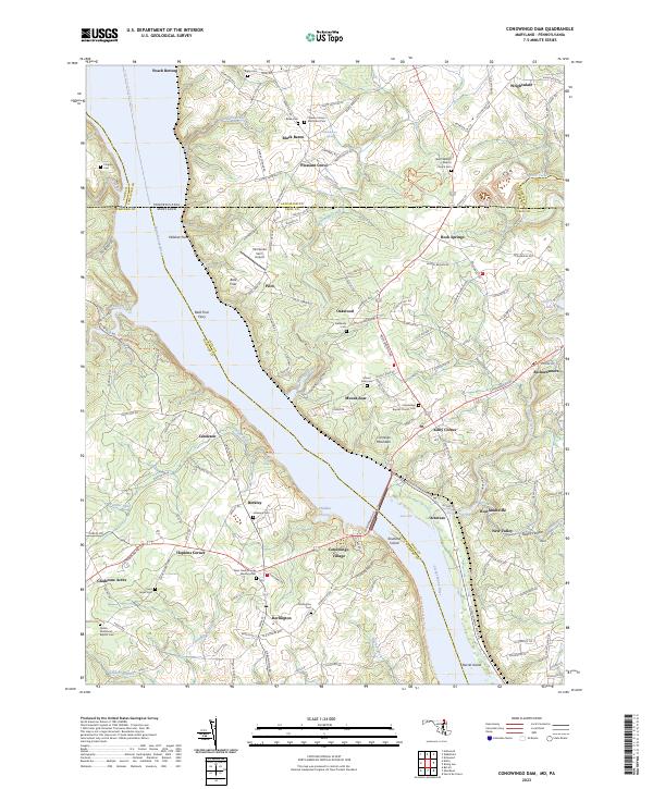 2023 Conowingo Dam2023 Print · USGSThe Susquehanna River valley at the Maryland-Pennsylvania line shows a landscape defined by riverside hamlets and historic crossings in the early twenty-first century. Genealogists and historians can trace family locations through numerous sites like Bald Friar Ferry, Rock Springs, and the Deer Creek Friends Meeting Cem.
End of results
Showing maps 1-5 of 5
Top cities near Peach Bottom Township
- Forest Hill historical maps
- West Lampeter Township historical maps
- Aberdeen historical maps
- Havre de Grace historical maps
- Bel Air historical maps
- Willow Street historical maps
See more
Top neighborhoods of Peach Bottom Township
- Bellevue historical maps
- Susquehanna Trails historical maps
- Woodbine historical maps
- Ailston historical maps
- Delta Ridge historical maps
- Slate Hill historical maps
See more
Frequently asked questions
- What are the different types of historical maps available for Peach Bottom Township?
- What is the oldest map of Peach Bottom Township?
- Where can I purchase historical maps of Peach Bottom Township for my home or office?
- Where can I download high-res historical maps of Peach Bottom Township?
- Are there historical topographic maps available for Peach Bottom Township?
- Is there historical aerial imagery available for Peach Bottom Township?
- Where are historical maps of Peach Bottom Township sourced from?