1990s Maps of Kent County, Rhode Island
Explore 5 historic maps of Kent County from the 1990s. These maps offer a rare glimpse into what life looked like during the 1990s — showing old roads, neighborhoods, homes, and landmarks that have changed or disappeared over time.
Whether you're researching your family's past, planning a metal detecting trip, or studying how Kent County's landscape evolved across the 1990s, these high-resolution maps are a powerful tool for exploring the history of this region.
- Focus on a specific era: All maps on this page are from the 1990s, giving you a focused view of this time period.
- See what’s changed: Compare century-old streets, trails, and buildings to today's modern landscape using overlays and satellite layers.
- Research with precision: Use these maps for genealogy, historical research, land use analysis, or educational projects.
- View, download, or print: Maps are fully viewable online in high resolution, and can be downloaded or printed for your own records.
Start exploring Kent County's history through authentic maps from the 1990s. This is your window into the past.
Kent County, RI maps
(5)- 1995 Map of Crompton, 1998 Print
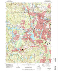 1995 Crompton1998 Print · USGSKent County at the end of the twentieth century shows a dense network of mill towns concentrated along the river forks. Genealogists and historians can trace family roots through the Notre Dame Cem or locate former industrial hubs like Arkwright and Crompton.
 - 1995 Map of Wickford, 1999 Print
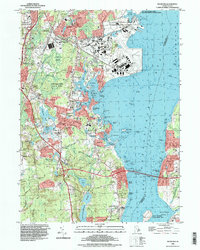 1995 Wickford1999 Print · USGSThe North Kingstown coastline in the mid-1990s shows the bustling maritime economy and naval presence of the West Passage. Genealogists and local historians can trace legacy sites like Quidnessett Cem, the Wickford Lighthouse, and the old rail hub at Wickford Junction.
 - 1996 Map of Slocum, 1999 Print
 1996 Slocum1999 Print · USGSSouthern Rhode Island in the mid-nineties remains a landscape of historic villages and extensive wetlands. Genealogists and historians can trace family-named corners and crossroads like Woods Corner, Wightmans Corner, and the rural community of Liberty.
 - 1996 Map of Providence, 2000 Print
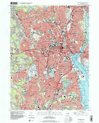 1996 Providence2000 Print · USGSProvidence and its surrounding mill towns are shown here in the mid-nineties, documenting a landscape deeply shaped by academic institutions and industry. Genealogists and researchers can locate historic burial sites like the North Burial Ground and trace the legacy of the Providence & Worcester RR.
 - 1996 Map of East Greenwich, 2000 Print
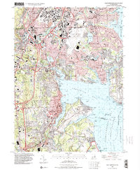 1996 East Greenwich2000 Print · USGSThe mid-century coastal developments of Kent County are shown in detail as the suburbs of Warwick and East Greenwich expand. Genealogists can locate family sites near St Pauls Ch, All Saints Cem, and the historic neighborhoods of Pontiac.
End of results
Showing maps 1-5 of 5
Top cities of Kent County
- Warwick historical maps
- Coventry historical maps
- West Warwick historical maps
- East Greenwich historical maps
- West Greenwich historical maps
Frequently asked questions
- What are the different types of historical maps available for Kent County?
- What is the oldest map of Kent County?
- Where can I purchase historical maps of Kent County for my home or office?
- Where can I download high-res historical maps of Kent County?
- Are there historical topographic maps available for Kent County?
- Is there historical aerial imagery available for Kent County?
- Where are historical maps of Kent County sourced from?