2020s Maps of Burrillville, Rhode Island
Explore 12 historic maps of Burrillville from the 2020s. These maps offer a rare glimpse into what life looked like during the 2020s — showing old roads, neighborhoods, homes, and landmarks that have changed or disappeared over time.
Whether you're researching your family's past, planning a metal detecting trip, or studying how Burrillville's landscape evolved across the 2020s, these high-resolution maps are a powerful tool for exploring the history of this region.
- Focus on a specific era: All maps on this page are from the 2020s, giving you a focused view of this time period.
- See what’s changed: Compare century-old streets, trails, and buildings to today's modern landscape using overlays and satellite layers.
- Research with precision: Use these maps for genealogy, historical research, land use analysis, or educational projects.
- View, download, or print: Maps are fully viewable online in high resolution, and can be downloaded or printed for your own records.
Start exploring Burrillville's history through authentic maps from the 2020s. This is your window into the past.
Burrillville, RI maps
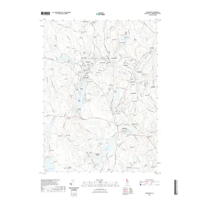
(12)- 2021 Map of Oxford, 2021 Print
 2021 Oxford2021 Print · USGSCovers Burrillville, including Webster, Oxford, and other nearby areas
 - 2021 Map of Chepachet, 2021 Print
 2021 Chepachet2021 Print · USGSCovers Burrillville, including Glocester, Mapleville, and other nearby areas
 - 2021 Map of Blackstone, 2021 Print
 2021 Blackstone2021 Print · USGSCovers Burrillville, including Woonsocket, Milford, and other nearby areas
 - 2021 Map of Thompson, 2021 Print
 2021 Thompson2021 Print · USGSCovers Burrillville, including Killingly, Glocester, and other nearby areas
 - 2021 Map of Georgiaville, 2021 Print
 2021 Georgiaville2021 Print · USGSCovers Burrillville, including Woonsocket, Smithfield, and other nearby areas
 - 2021 Map of Uxbridge, 2021 Print
 2021 Uxbridge2021 Print · USGSCovers Burrillville, including Northbridge, Uxbridge, and other nearby areas
 - 2024 Map of Thompson, 2024 Print
 2024 Thompson2024 Print · USGSThe borderlands of Windham County and Rhode Island's Providence County are detailed here in the twenty-first century. Genealogists can locate family burial sites like Munyan Cem and Ross Cem or trace old property lines at the Captain James Reynolds Lot.
 - 2024 Map of Chepachet, 2024 Print
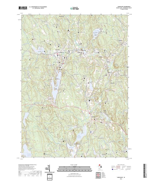 2024 Chepachet2024 Print · USGSProvidence County villages like Pascoag and Chepachet are captured in the 2020s, showing a landscape defined by New England mill history and family-named land lots. Genealogists can trace dozens of private family burial sites, including the Othniel Young Lot Cem and Marsh Hopkins Potter Cem.
 - 2024 Map of Georgiaville, 2024 Print
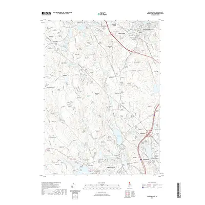
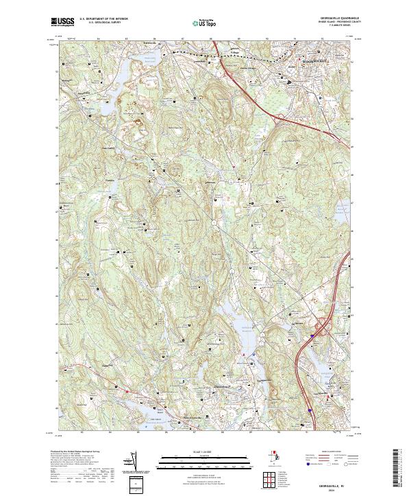 2024 Georgiaville2024 Print · USGSProvidence County in the mid-2020s reveals a landscape where modern academic centers like Bryant University sit alongside an incredible density of ancestral burial sites. Genealogists can trace family lines through dozens of private plots, including the William Caldwell Lot Cem and Samuel Inman Lot Cem.
 - 2024 Map of Blackstone, 2024 Print
 2024 Blackstone2024 Print · USGSThe Massachusetts and Rhode Island borderlands come to life in this detailed survey of the Blackstone River valley and its surrounding mill towns. Genealogists and local historians can trace family roots through dozens of local burial sites, including the Chestnut Hill Meeting House Cem and the Captain James Buxton Cem.
 - 2024 Map of Oxford, 2024 Print
 2024 Oxford2024 Print · USGSIn the tri-state corner of Massachusetts, Connecticut, and Rhode Island, this modern survey tracks the complex shoreline of Lake Chaubunagungamaug. Researchers can trace local lineage through South Cem or the industrial footprint of the Providence & Worcester RR.
 - 2024 Map of Uxbridge, 2024 Print
 2024 Uxbridge2024 Print · USGSThe industrial corridor of the Blackstone River valley comes alive in this survey of south-central Massachusetts. Genealogists can trace family names through dozens of sites like the Douglas Center Cem, Quaker Cem, and the unique Hundred Acre Lot.
End of results
Showing maps 1-12 of 12
Top cities near Burrillville
- Providence historical maps
- Warwick historical maps
- Cranston historical maps
- Woonsocket historical maps
- Cumberland historical maps
- North Providence historical maps
See more
Top neighborhoods of Burrillville
- Oakland historical maps
- Pascoag historical maps
- Glendale historical maps
- Harrisville historical maps
- Mapleville historical maps
- Huntsville historical maps
See more
Frequently asked questions
- What are the different types of historical maps available for Burrillville?
- What is the oldest map of Burrillville?
- Where can I purchase historical maps of Burrillville for my home or office?
- Where can I download high-res historical maps of Burrillville?
- Are there historical topographic maps available for Burrillville?
- Is there historical aerial imagery available for Burrillville?
- Where are historical maps of Burrillville sourced from?