Old Maps of Cranston, Rhode Island
Explore 39 old maps of Cranston, spanning from 1887 to today. These high-resolution historic maps reveal how streets, neighborhoods, landmarks, and natural features evolved over time — perfect for genealogy, metal detecting, research, and local history exploration.
What you can do with these maps:
- See how Cranston changed over time: Compare historical maps to modern-day views to trace roads, homesites, rail lines & more.
- View detailed metadata: Each map includes creators, publishers, year, scale, and archive source.
- Overlay maps with satellite & LiDAR: Visualize the past alongside modern tools to explore terrain & human change.
- Trusted historical sources: Maps sourced from the USGS, Library of Congress, and other archives.
- Access maps your way: View online, download high-res files, or order prints for personal or research use.
Start exploring old maps of Cranston to uncover forgotten places, hidden landmarks, and the deep history beneath your feet.
Cranston, RI maps
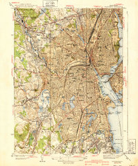
(39)- 1887 Map of Providence
 1887 Providence1887 Print · USGSCovers Cranston, including Providence, Warwick, and other nearby areas
 - 1889 Map of Providence
 1889 Providence1889 Print · USGSCovers Cranston, including Providence, Warwick, and other nearby areas
 - 1889 Map of Burrillville
 1889 Burrillville1889 Print · USGSCovers Cranston, including Woonsocket, Johnston, and other nearby areas
 - 1890 Map of Narragansett Bay
 1890 Narragansett Bay1890 Print · USGSCovers Cranston, including Warwick, East Providence, and other nearby areas
 - 1890 Map of Kent
 1890 Kent1890 Print · USGSCovers Cranston, including Warwick, Coventry, and other nearby areas
 - 1892 Map of Narragansett Bay
 1892 Narragansett Bay1892 Print · USGSCovers Cranston, including Warwick, East Providence, and other nearby areas9 unique versions available
 - 1894 Map of Burrillville
 1894 Burrillville1894 Print · USGSCovers Cranston, including Woonsocket, Johnston, and other nearby areas6 unique versions available
 - 1894 Map of Kent
 1894 Kent1894 Print · USGSCovers Cranston, including Warwick, Coventry, and other nearby areas7 unique versions available
 - 1894 Map of Providence
 1894 Providence1894 Print · USGSCovers Cranston, including Providence, Warwick, and other nearby areas10 unique versions available
 - 1915 Map of Burrillville
 1915 Burrillville1915 Print · USGSCovers Cranston, including Woonsocket, Johnston, and other nearby areas
 - 1919 Map of Narragansett Bay, 1921 Print
 1919 Narragansett Bay1921 Print · USGSCovers Cranston, including Warwick, East Providence, and other nearby areas2 unique versions available
 - 1921 Map of Burrillville
 1921 Burrillville1921 Print · USGSCovers Cranston, including Woonsocket, Johnston, and other nearby areas
 - 1921 Map of Providence
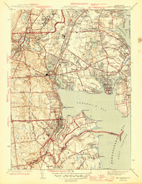
 1921 Providence1921 Print · USGSCovers Cranston, including Providence, Warwick, and other nearby areas
 - 1935 Map of Providence, 1958 Print
 1935 Providence1958 Print · USGSCovers Cranston, including Providence, Warwick, and other nearby areas
 - 1939 Map of Providence
 1939 Providence1939 Print · USGSCovers Cranston, including Providence, Warwick, and other nearby areas3 unique versions available
 - 1942 Map of East Greenwich, 1958 Print
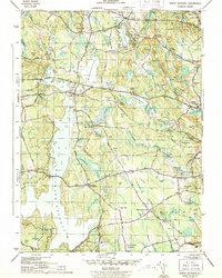
 1942 East Greenwich1958 Print · USGSCovers Cranston, including Warwick, West Warwick, and other nearby areas
 - 1943 Map of Providence
 1943 Providence1943 Print · USGSCovers Cranston, including Providence, Fall River, and other nearby areas
 - 1943 Map of Crompton
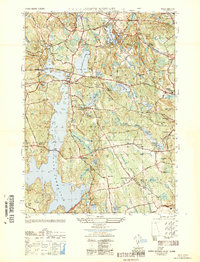
 1943 Crompton1943 Print · USGSCovers Cranston, including Warwick, Coventry, and other nearby areas4 unique versions available
 - 1943 Map of North Scituate
 1943 North Scituate1943 Print · USGSCovers Cranston, including Johnston, Smithfield, and other nearby areas4 unique versions available
 - 1943 Map of Putnam, 1944 Print
 1943 Putnam1944 Print · USGSCovers Cranston, including Warwick, Woonsocket, and other nearby areas
 - 1944 Map of East Greenwich
 1944 East Greenwich1944 Print · USGSCovers Cranston, including Warwick, West Warwick, and other nearby areas2 unique versions available
 - 1947 Map of Providence, 1948 Print
 1947 Providence1948 Print · USGSCovers Cranston, including Providence, New Bedford, and other nearby areas5 unique versions available
 - 1948 Map of Providence, 1951 Print
 1948 Providence1951 Print · USGSCovers Cranston, including Providence, New Bedford, and other nearby areas
 - 1950 Map of North Scituate
 1950 North Scituate1950 Print · USGSCovers Cranston, including Johnston, Smithfield, and other nearby areas
 - 1955 Map of Crompton, 1957 Print
 1955 Crompton1957 Print · USGSCovers Cranston, including Warwick, Coventry, and other nearby areas3 unique versions available
Showing maps 1-25 of 39
Top cities near Cranston
- Providence historical maps
- Warwick historical maps
- Pawtucket historical maps
- East Providence historical maps
- Attleboro historical maps
- Woonsocket historical maps
See more
Top neighborhoods of Cranston
- Knightsville historical maps
- Edgewood historical maps
- Thornton historical maps
- Wayland historical maps
- Auburn historical maps
- Comstock Gardens historical maps
See more
Frequently asked questions
- What are the different types of historical maps available for Cranston?
- What is the oldest map of Cranston?
- Where can I purchase historical maps of Cranston for my home or office?
- Where can I download high-res historical maps of Cranston?
- Are there historical topographic maps available for Cranston?
- Is there historical aerial imagery available for Cranston?
- Where are historical maps of Cranston sourced from?