Old Maps of North Smithfield, Rhode Island for Genealogy
Trace your family roots with 60 historic maps of North Smithfield. These high-res maps reveal old neighborhoods, homesites, landmarks, and streets — helping you uncover where your ancestors lived and how the area evolved over time.
- Explore historic neighborhoods: Identify where your relatives may have lived in the 1800s or 1900s.
- Compare maps over time: Trace the changes in streets, buildings, and landmarks for multi-generational research.
- Perfect for genealogy & ancestry research: Used by family historians and researchers to map out lineage and migration.
These maps are an incredible resource for exploring your personal connection to North Smithfield's past.
North Smithfield, RI maps
(60)- 1886 Map of Blackstone
 1886 Blackstone1886 Print · USGSThe Blackstone Valley at the height of its industrial era reveals a landscape of thriving mill towns and complex rail networks. Genealogists and historians can trace the growth of Whitinsville, Uxbridge, and East Douglas alongside landmarks like Purgatory Chasm.
 - 1887 Map of Providence
 1887 Providence1887 Print · USGSProvidence and its surrounding mill towns are captured here at the height of the industrial era. Trace the rail-and-river infrastructure of the Blackstone River through Lorraine Mills, Saylesville, and the Cranston Print Works.
 - 1889 Map of Providence
 1889 Providence1889 Print · USGSProvidence and its industrial corridors thrive at the close of the nineteenth century as a massive rail-and-water network takes shape. Genealogists and historians can trace the foundations of local industry at the Sayles Bleachery or locate long-standing institutions like Friends School and Dexter Asylum.
 - 1889 Map of Blackstone
 1889 Blackstone1889 Print · USGSThe Blackstone River valley thrives as an industrial powerhouse in the late 1880s, defined by its dense network of mill towns and competing rail lines. Researchers can trace the legacy of textile manufacturing and early commerce through Whitinsville, the Hayden Row P.O., and Millville.
 - 1889 Map of Burrillville
 1889 Burrillville1889 Print · USGSNorthwest Rhode Island at the peak of the industrial era shows a landscape of busy mill villages and vital rail corridors. Genealogists and historians can trace the foundations of local industry and transport at Harrisville, Tarkiln Station, and Slatersville.
 - 1893 Map of Blackstone
 1893 Blackstone1893 Print · USGSThe Blackstone River valley at the height of its industrial era reveals a landscape of vital mill towns and complex rail networks. Genealogists and historians can trace the early footprints of Whitinsville, Uxbridge, and Millville alongside landmarks like Purgatory Chasm.2 unique versions available
 - 1894 Map of Burrillville
 1894 Burrillville1894 Print · USGSNorthwest Rhode Island at the peak of the water-powered textile era reveals a dense network of mill villages and reservoirs. Researchers can trace the path of the Providence and Springfield R. R. and locate family landmarks from Chepachet to Slatersville.6 unique versions available
 - 1894 Map of Providence
 1894 Providence1894 Print · USGSThe industrial corridor from Providence to Pawtucket thrives in the 1890s as a hub of rail and river commerce. Genealogists can trace early neighborhood lines and locate vanished institutions like the Dexter Asylum, Sayles Bleachery, and the Butler Hospital.10 unique versions available
 - 1900 Map of Blackstone
 1900 Blackstone1900 Print · USGSThe Blackstone Valley was a bustling manufacturing corridor when this late Victorian-era survey was published. Genealogists and historians can trace the industrial mill villages along the Blackstone River, including Whitinsville, Manchaug, and Millville.7 unique versions available
 - 1908 Map of Quinsigamond
 1908 Quinsigamond1908 Print · USGSCentral Massachusetts and its bordering states are seen here in the early twentieth century as industry and transit reshaped the Blackstone Valley. Genealogists and historians can trace the early footprints of Worcester, the expansion of the Wachusett Reservoir, and rail lines like the Boston and Albany Railroad.3 unique versions available
 - 1915 Map of Burrillville
 1915 Burrillville1915 Print · USGSNorthwest Rhode Island at the start of the Great War era reveals a landscape of industrial mill villages and extensive reservoir systems. Trace the early road networks and water-powered settlements of Pascoag, Chepachet, and Georgiaville across the Blackstone Valley hills.
 - 1919 Map of Blackstone
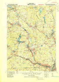 1919 Blackstone1919 Print · USGSThe Blackstone Valley at the end of the Great War was a dense network of industrial villages and crucial rail junctions. Genealogists and historians can trace the family-named landmarks of the era, from Saundersville and Linwood to the heights of Dorothy Hill.2 unique versions available
 - 1921 Map of Burrillville
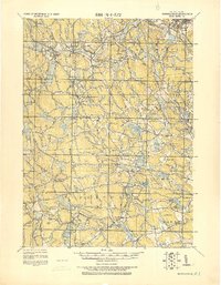 1921 Burrillville1921 Print · USGSProvidence County’s mill towns and upland farms are frozen in time just after the Great War, documenting a landscape shaped by water power. Genealogists and historians can trace family-named heights like Chopmist Hill and locate early mill sites in Harrisville, Slatersville, or Pascoag.
 - 1921 Map of Providence
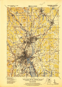 1921 Providence1921 Print · USGSProvidence and its industrial satellites are captured here at the height of the rail-and-mill era. Genealogists and historians can trace old neighborhoods and worksites like Sayles Bleachery, the Dexter Asylum, and Lonsdale Station.
 - 1938 Map of Pawtucket, 1941 Print
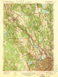 1938 Pawtucket1941 Print · USGSIndustrial Rhode Island at the end of the Depression era is defined here by the river towns of the Blackstone Valley. Genealogists can locate several historic burial sites, including Polish Cem and Clarks Cem, or trace early industrial landmarks like Arnolds Mills.
 - 1942 Map of Pawtucket
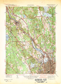 1942 Pawtucket1942 Print · USGSThe Blackstone River valley thrives at the start of the 1940s, showcasing a landscape defined by mill towns and extensive rail infrastructure. Researchers can trace the heritage of local communities through landmarks like the Cistercian Monastery, Lonsdale Sta, and the Moshassuck Cem.
 - 1943 Map of Providence
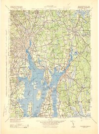 1943 Providence1943 Print · USGSNarragansett Bay and the industrial Blackstone Valley appear here in the midst of the Second World War. Genealogists and researchers can trace local landmarks like Lonsdale Station, the St Marys Reservoir, and the Rhode Island State Airport.
 - 1943 Map of Quinsigamond
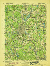 1943 Quinsigamond1943 Print · USGSCentral Massachusetts and its bordering states appear here during the Second World War as a powerhouse of rail infrastructure and public institutions. Researchers can trace the legacy of the region through landmarks like Grafton State Hospital, the Wachusett Reservoir, and the deep industrial roots of the Blackstone River.
 - 1943 Map of Georgiaville
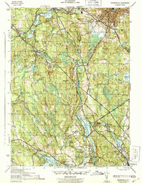 1943 Georgiaville1943 Print · USGSProvidence County is seen here during the early 1940s, highlighting the industrial mill towns along the Branch and Woonasquatucket Rivers. Genealogists and researchers can trace family-named landmarks like Steere Hill or find local community centers such as Union Chapel and The Shrine near Nasonville.3 unique versions available
 - 1943 Map of Putnam, 1944 Print
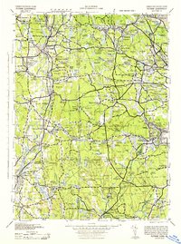 1943 Putnam1944 Print · USGSThe Connecticut and Rhode Island borderlands are captured here during the wartime era, showing a landscape defined by textile river towns and sprawling state forests. Trace the industrial rail corridor of the New York New Haven and Hartford through Putnam, Danielson, and Moosup.
 - 1944 Map of Pawtucket
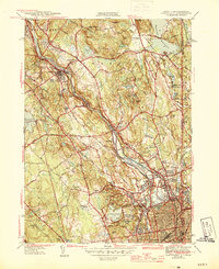 1944 Pawtucket1944 Print · USGSThe industrial corridor of the Blackstone River valley is frozen in time during the mid-1940s, showing the dense rail networks and mill towns of northern Rhode Island. Genealogists and historians can trace family roots through the Moshassuck Cem, find local schools like Garvin Sch, and locate the Cistercian Monastery.3 unique versions available
 - 1944 Map of Blackstone
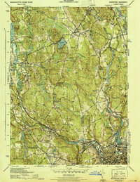 1944 Blackstone1944 Print · USGSThe Blackstone River valley during the mid-forties shows a bustling landscape of industrial mill towns and upland farms along the state line. Genealogists can locate family landmarks like the Chestnut Hill Meeting House, Bicknell Cem, and the Elmdale Sch.5 unique versions available
 - 1947 Map of Providence, 1948 Print
 1947 Providence1948 Print · USGSSouthern New England is captured in the mid-1940s, showing a landscape defined by busy industrial ports and expanding military installations. Researchers can trace the rail lines of the N.Y. N.H. & H. RR or locate coastal defenses like Fort Adams and Quonset Point.5 unique versions available
 - 1948 Map of Boston
 1948 Boston1948 Print · USGSEastern Massachusetts and southern New Hampshire appear at an industrial peak in the late 1940s, just as suburban growth began to accelerate. Genealogists and historians can trace rail lines like the Boston and Albany RR or locate coastal landmarks like Graves Lighthouse and Fort Devens.2 unique versions available
 - 1948 Map of Blackstone
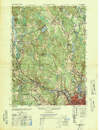 1948 Blackstone1948 Print · USGSThe Blackstone River valley comes alive in this post-war survey of the Massachusetts and Rhode Island borderlands. Genealogists can trace family roots through the Chestnut Hill Meeting House, Precious Blood Cem, and early schools like Elmdale Sch.
Showing maps 1-25 of 60
Top cities near North Smithfield
- Providence historical maps
- Warwick historical maps
- Cranston historical maps
- Pawtucket historical maps
- East Providence historical maps
- Attleboro historical maps
See more
Top neighborhoods of North Smithfield
- Forestdale historical maps
- Union Village historical maps
- Slatersville historical maps
- Waterford historical maps
- Branch Village historical maps
- Primrose historical maps
Frequently asked questions
- What are the different types of historical maps available for North Smithfield?
- What is the oldest map of North Smithfield?
- Where can I purchase historical maps of North Smithfield for my home or office?
- Where can I download high-res historical maps of North Smithfield?
- Are there historical topographic maps available for North Smithfield?
- Is there historical aerial imagery available for North Smithfield?
- Where are historical maps of North Smithfield sourced from?