1900s (20th Century) Maps of Beclabito, Shiprock Agency
Explore 7 historic maps of Beclabito from the 1900s (20th Century). These maps offer a rare glimpse into what life looked like during the 1900s — showing old roads, neighborhoods, homes, and landmarks that have changed or disappeared over time.
Whether you're researching your family's past, planning a metal detecting trip, or studying how Beclabito's landscape evolved across the 1900s, these high-resolution maps are a powerful tool for exploring the history of this region.
- Focus on a specific era: All maps on this page are from the 1900s, giving you a focused view of this time period.
- See what’s changed: Compare century-old streets, trails, and buildings to today's modern landscape using overlays and satellite layers.
- Research with precision: Use these maps for genealogy, historical research, land use analysis, or educational projects.
- View, download, or print: Maps are fully viewable online in high resolution, and can be downloaded or printed for your own records.
Start exploring Beclabito's history through authentic maps from the 1900s. This is your window into the past.
Beclabito, Shiprock Agency maps
(7)- 1953 Map of Pastora Peak SE, 1954 Print
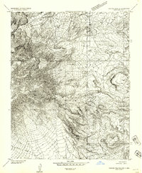 1953 Pastora Peak SE1954 Print · USGSThe high-desert borderlands of Arizona and New Mexico appear in the early 1950s as a landscape of deep canyons and isolated outposts. Researchers can trace the rugged topography of Cottonwood Canyon and locate local landmarks like the Beclabito Trading Post.
 - 1953 Map of Pastora Peak, 1956 Print
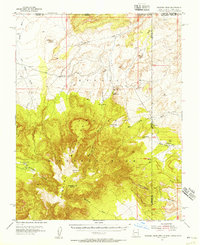 1953 Pastora Peak1956 Print · USGSThe Navajo Nation high country is captured here during the mid-fifties, centered on the towering heights of the Carrizo Mountains. Researchers can locate early outposts and community hubs like Teec Nos Pos, the Carrizo Mission Sch, and Foutz Trading Post.2 unique versions available
 - 1954 Map of Shiprock
 1954 Shiprock1954 Print · USGSThe Four Corners region in the mid-fifties reveals a vast landscape of tribal lands and desert landmarks. Researchers can trace the mid-century footprints of the Navajo Indian Reservation, identifying remote Trading Posts, the early growth of Farmington, and the iconic spire of Ship Rock.5 unique versions available
 - 1958 Map of Shiprock
 1958 Shiprock1958 Print · USGSThe Four Corners region in the mid-fifties shows a vast network of remote outposts and river settlements. You can locate numerous historic sites like the Emmanuel Mission and several commercial hubs such as Burnham Trading Post and Bisti Trading Post.
 - 1959 Map of Shiprock
 1959 Shiprock1959 Print · USGSThe Four Corners region comes alive in the mid-fifties, showing the high desert outposts and river-valley towns of the Navajo Nation and San Juan County. Genealogists and researchers can locate remote landmarks like the Burnham Trading Post, Two Grey Hills, and the early Helium Plant.
 - 1982 Map of Beclabito, 1983 Print
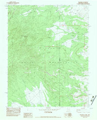 1982 Beclabito1983 Print · USGSThe high desert of the Navajo Nation comes into focus in the early eighties, where the Arizona and New Mexico border meets. Geologists and local historians can trace mining history at Syracuse Mine and the Copper Mine Ruins near Beclabito Dome.
 - 1986 Map of Rock Point, 1987 Print
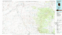 1986 Rock Point1987 Print · USGSThe Navajo Nation's high desert landscape is documented here in the mid-eighties as it spans four states. Researchers can locate remote uranium operations like Sun Tan Mine, seasonal water sources at Sweetwater Wash, and desert outposts like Beclabito and Tes Nez Iah.2 unique versions available
End of results
Showing maps 1-7 of 7
Top cities near Beclabito
- Shiprock Agency historical maps
- Chinle Agency historical maps
- Eastern Navajo Agency historical maps
- Beclabito historical maps
Frequently asked questions
- What are the different types of historical maps available for Beclabito?
- What is the oldest map of Beclabito?
- Where can I purchase historical maps of Beclabito for my home or office?
- Where can I download high-res historical maps of Beclabito?
- Are there historical topographic maps available for Beclabito?
- Is there historical aerial imagery available for Beclabito?
- Where are historical maps of Beclabito sourced from?