Old Maps of Sanostee, Shiprock Agency for Academic Research
Study the evolution of Sanostee with 13 high-resolution historic maps. Whether you're teaching, researching, or modeling changes in land use, these maps provide essential visual documentation of urban, environmental, and geographic change.
- Analyze long-term change: Track patterns in development, transportation, and natural features.
- Ideal for environmental or urban studies: Support academic projects with primary historical map data.
- Use in the classroom or lab: Educators and researchers rely on these maps to bring historical context to life.
These maps are a powerful tool for teaching, research, and visualizing how Sanostee has changed over the decades.
Sanostee, Shiprock Agency maps
(13)- 1889 Map of Chaco
 1889 Chaco1889 Print · USGSNorthwestern New Mexico appears here in the late nineteenth century as a frontier of emerging river settlements and high-desert springs. Researchers can trace early footprints at Farmington and Aztec, or locate watering points like Sheep Spring and Seven Lakes.
 - 1892 Map of Chaco
 1892 Chaco1892 Print · USGSNorthwestern New Mexico in the late nineteenth century reveals the early river-side foundations of the Four Corners region. Genealogists and historians can trace the development of Farmington, Aztec, and Jewett along the San Juan River and the high desert outpost of Seven Lakes.5 unique versions available
 - 1953 Map of Sanostee, 1954 Print
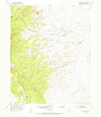 1953 Sanostee1954 Print · USGSThe high desert of northwestern New Mexico is captured here in the mid-fifties, featuring the eastern slopes of the Chuska Mountains. Genealogists and historians can locate early centers of commerce like the Sanostee Trading Post and trace the complex network of irrigation ditches along Pena Blanca Creek.
 - 1954 Map of Shiprock
 1954 Shiprock1954 Print · USGSThe Four Corners region in the mid-fifties reveals a vast landscape of tribal lands and desert landmarks. Researchers can trace the mid-century footprints of the Navajo Indian Reservation, identifying remote Trading Posts, the early growth of Farmington, and the iconic spire of Ship Rock.5 unique versions available
 - 1958 Map of Shiprock
 1958 Shiprock1958 Print · USGSThe Four Corners region in the mid-fifties shows a vast network of remote outposts and river settlements. You can locate numerous historic sites like the Emmanuel Mission and several commercial hubs such as Burnham Trading Post and Bisti Trading Post.
 - 1959 Map of Shiprock
 1959 Shiprock1959 Print · USGSThe Four Corners region comes alive in the mid-fifties, showing the high desert outposts and river-valley towns of the Navajo Nation and San Juan County. Genealogists and researchers can locate remote landmarks like the Burnham Trading Post, Two Grey Hills, and the early Helium Plant.
 - 1966 Map of Sanostee East, 1970 Print
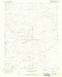 1966 Sanostee East1970 Print · USGSSan Juan County within the Navajo Nation during the mid-1960s shows a landscape of traditional water sources and emerging energy production. Genealogists and historians can trace the paths of Sanostee Wash past Rock Mesa or locate the remote Tocito Springs.2 unique versions available
 - 1980 Map of Toadlena, 1981 Print
 1980 Toadlena1981 Print · USGSSan Juan County and the Navajo Nation are shown in the 1980s as a landscape of high mesas and desert washes. Trace the routes between Toadlena, the Tsaya Trading Post, and the ancient grounds of Chaco Canyon National Monument.3 unique versions available
 - 2010 Map of Sanostee East, 2010 Print
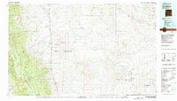
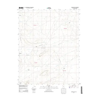
 2010 Sanostee East2010 Print · USGSCovers Sanostee, including Shiprock Agency, Tocito, and other nearby areas
 - 2013 Map of Sanostee East, 2013 Print
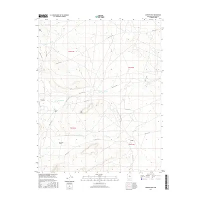
 2013 Sanostee East2013 Print · USGSCovers Sanostee, including Shiprock Agency, Tocito, and other nearby areas
 - 2017 Map of Sanostee East, 2017 Print
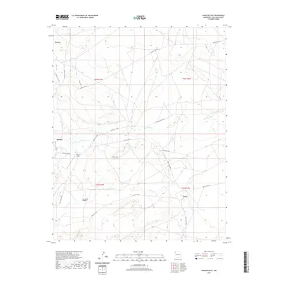
 2017 Sanostee East2017 Print · USGSCovers Sanostee, including Shiprock Agency, Tocito, and other nearby areas
 - 2020 Map of Sanostee East, 2020 Print
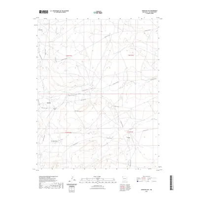
 2020 Sanostee East2020 Print · USGSCovers Sanostee, including Shiprock Agency, Tocito, and other nearby areas
 - 2023 Map of Sanostee East, 2023 Print
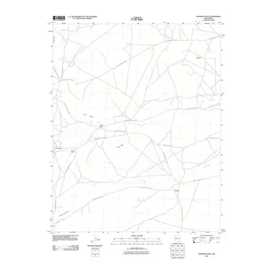
 2023 Sanostee East2023 Print · USGSSanostee and the surrounding high-desert plateaus are shown in detail during the early 2020s. Researchers can trace the local road network and land use near Sanostee Airport and along the seasonal Sanostee Wash.
End of results
Showing maps 1-13 of 13
Top cities near Sanostee
- Shiprock Agency historical maps
- Chinle Agency historical maps
- Fort Defiance Agency historical maps
- Eastern Navajo Agency historical maps
Frequently asked questions
- What are the different types of historical maps available for Sanostee?
- What is the oldest map of Sanostee?
- Where can I purchase historical maps of Sanostee for my home or office?
- Where can I download high-res historical maps of Sanostee?
- Are there historical topographic maps available for Sanostee?
- Is there historical aerial imagery available for Sanostee?
- Where are historical maps of Sanostee sourced from?