Old Maps of Due West, South Carolina
Explore 16 old maps of Due West, spanning from 1892 to today. These high-resolution historic maps reveal how streets, neighborhoods, landmarks, and natural features evolved over time — perfect for genealogy, metal detecting, research, and local history exploration.
What you can do with these maps:
- See how Due West changed over time: Compare historical maps to modern-day views to trace roads, homesites, rail lines & more.
- View detailed metadata: Each map includes creators, publishers, year, scale, and archive source.
- Overlay maps with satellite & LiDAR: Visualize the past alongside modern tools to explore terrain & human change.
- Trusted historical sources: Maps sourced from the USGS, Library of Congress, and other archives.
- Access maps your way: View online, download high-res files, or order prints for personal or research use.
Start exploring old maps of Due West to uncover forgotten places, hidden landmarks, and the deep history beneath your feet.
Due West, SC maps
(16)- 1892 Map of Abbeville
 1892 Abbeville1892 Print · USGSSouth Carolina’s Upstate during the late 1800s reveals a landscape defined by critical river crossings and the arrival of the steam era. Genealogists can trace family roots through localized sites like Smith Ferry, Maddox Mill, and the bustling rail hub of Greenwood.6 unique versions available
 - 1954 Map of Greenville, 1965 Print
 1954 Greenville1965 Print · USGSThe Upstate and Northeast Georgia are captured here during a decade of massive transformation as new reservoirs reshaped the Piedmont. Genealogists and hikers can trace the Appalachian Trail over Brasstown Bald or locate old community centers like Demorest, Westminster, and Royston.3 unique versions available
 - 1958 Map of Greenville
 1958 Greenville1958 Print · USGSThe Piedmont and Blue Ridge foothills come alive in this mid-century survey of the Upstate and Northeast Georgia. Trace the regional rail-and-river economy through the Southern Railway corridors and early reservoir developments like Lake Sidney Lanier.
 - 1971 Map of Due West, 1975 Print
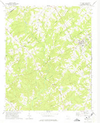 1971 Due West1975 Print · USGSThe Upstate South Carolina piedmont appears here in the early seventies, centered on the academic and historic hub of Due West. Genealogists and historians can trace deep-rooted community ties at Erskine College, Little River Ch, and the rural crossroads of Level Land.
 - 1971 Map of Shoals Junction, 1975 Print
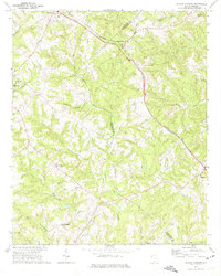 1971 Shoals Junction1975 Print · USGSThe rural Upstate South Carolina corridor comes into focus in the early seventies, centered on the Shoals Junction rail crossing. Genealogists can trace family roots at Gilgal Cem, Mt Zion Ch, and the growing communities of Due West and Arborville.
 - 1979 Map of Abbeville, 1980 Print
 1979 Abbeville1980 Print · USGSThe South Carolina and Georgia borderlands are captured here during a period of significant hydroelectric development and regional growth. Researchers can trace the rail-and-river economy through the Seaboard Coast Line and landmarks like Hartwell Dam or the Silk Mills.2 unique versions available
 - 2011 Map of Shoals Junction, 2011 Print
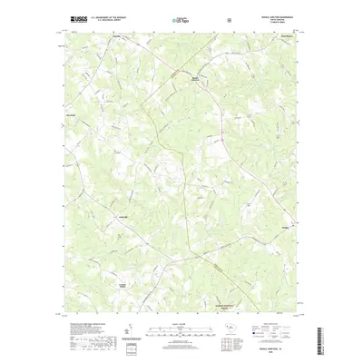
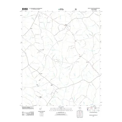 2011 Shoals Junction2011 Print · USGSCovers Due West, including Donalds, Hodges, and other nearby areas
 - 2011 Map of Due West, 2011 Print
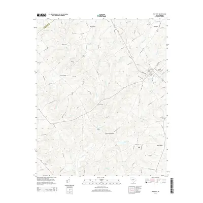
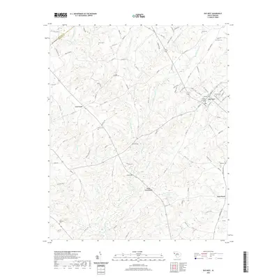
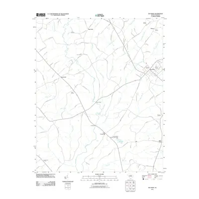 2011 Due West2011 Print · USGSCovers Due West, including Winona, Buck Stand, and other nearby areas
 - 2014 Map of Due West, 2014 Print
 2014 Due West2014 Print · USGSCovers Due West, including Winona, Buck Stand, and other nearby areas
 - 2014 Map of Shoals Junction, 2014 Print
 2014 Shoals Junction2014 Print · USGSCovers Due West, including Donalds, Hodges, and other nearby areas
 - 2017 Map of Shoals Junction, 2017 Print
 2017 Shoals Junction2017 Print · USGSCovers Due West, including Donalds, Hodges, and other nearby areas
 - 2017 Map of Due West, 2017 Print
 2017 Due West2017 Print · USGSCovers Due West, including Winona, Buck Stand, and other nearby areas
 - 2020 Map of Due West, 2020 Print
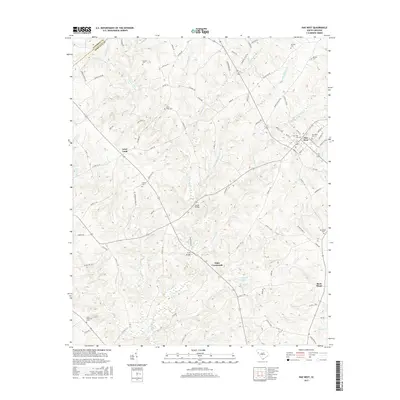
 2020 Due West2020 Print · USGSCovers Due West, including Winona, Buck Stand, and other nearby areas
 - 2020 Map of Shoals Junction, 2020 Print
 2020 Shoals Junction2020 Print · USGSCovers Due West, including Donalds, Hodges, and other nearby areas
 - 2024 Map of Shoals Junction, 2024 Print
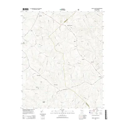
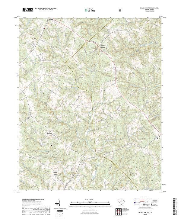 2024 Shoals Junction2024 Print · USGSAbbeville and Greenwood counties are shown here in the contemporary era, where rural settlements and ancestral burial grounds define the landscape. Researchers can trace family history at Old Gilgal Cem or locate homesites near Arborville and Shoals Junction.
 - 2024 Map of Due West, 2024 Print
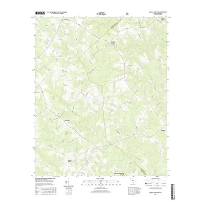
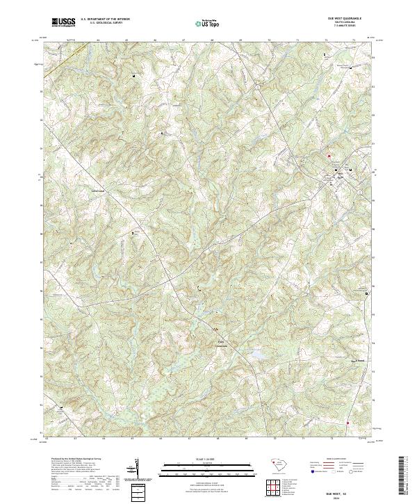 2024 Due West2024 Print · USGSDue West and the surrounding South Carolina Piedmont appear here in their modern context, centered on a storied college town and its rural crossroads. Researchers can trace local heritage through numerous burial sites like Little Mountain Cem and landmarks such as Erskine College and Seminary.
End of results
Showing maps 1-16 of 16
Top cities near Due West
- Anderson historical maps
- Greenwood historical maps
- Abbeville historical maps
- Belton historical maps
- Honea Path historical maps
- Calhoun Falls historical maps
See more
Frequently asked questions
- What are the different types of historical maps available for Due West?
- What is the oldest map of Due West?
- Where can I purchase historical maps of Due West for my home or office?
- Where can I download high-res historical maps of Due West?
- Are there historical topographic maps available for Due West?
- Is there historical aerial imagery available for Due West?
- Where are historical maps of Due West sourced from?