Old Maps of Cedar Reef Villas, South Carolina for Academic Research
Study the evolution of Cedar Reef Villas with 14 high-resolution historic maps. Whether you're teaching, researching, or modeling changes in land use, these maps provide essential visual documentation of urban, environmental, and geographic change.
- Analyze long-term change: Track patterns in development, transportation, and natural features.
- Ideal for environmental or urban studies: Support academic projects with primary historical map data.
- Use in the classroom or lab: Educators and researchers rely on these maps to bring historical context to life.
These maps are a powerful tool for teaching, research, and visualizing how Cedar Reef Villas has changed over the decades.
Cedar Reef Villas, SC maps
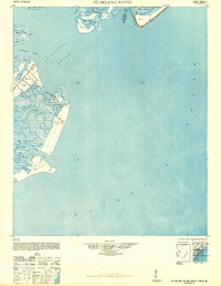
(14)- 1920 Map of St. Helena Sound
 1920 St. Helena Sound1920 Print · USGSCoastal South Carolina is captured here in the early twentieth century, showing a labyrinth of marsh and sea islands before the era of modern bridges. Researchers can trace the shifting shoals and original shorelines of Hunting Island, Edisto Island, and St. Helena Island.
 - 1947 Map of Savannah
 1947 Savannah1947 Print · USGSCoastal Georgia and South Carolina are captured here in the mid-forties, showing the rail-and-river networks of the Lowcountry. Genealogists and researchers can trace old crossroads and river towns from Statesboro to Beaufort, alongside military sites like Camp Stewart and Parris Island.
 - 1948 Map of St. Helena Sound
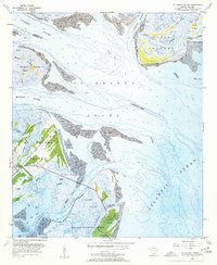
 1948 St. Helena Sound1948 Print · USGSCoastal South Carolina is captured here in the late 1940s, showing the intricate network of sea islands and tidal sounds before extensive modern development. Researchers can trace the shoreline of Hunting Island, locate the Tower marker, and study the remote marshlands of Otter Island and Fripps Island.2 unique versions available
 - 1948 Map of Savannah
 1948 Savannah1948 Print · USGSThe Georgia and South Carolina Lowcountry comes alive in this post-war survey of the coast and its river-fed hinterlands. Genealogists and historians can trace rail lines like the Central of Georgia RR and find established settlements such as Isle of Hope and Sylvania.
 - 1956 Map of St. Helena Sound, 1957 Print
 1956 St. Helena Sound1957 Print · USGSCoastal Beaufort County comes alive in the mid-fifties, showing a landscape defined by tidal rivers and the historic plantations of the Sea Islands. Genealogists and historians can trace the foundations of St Helena Island through Coffin Point Cem and the Hunting Island Lighthouse.4 unique versions available
 - 1957 Map of Savannah, 1967 Print
 1957 Savannah1967 Print · USGSThe Lowcountry and Georgia coastal plain are shown here in the late fifties, prior to modern expansion. Researchers can trace the rail-and-river economy through the Central of Georgia lines and the Ogeechee River wetlands.4 unique versions available
 - 1960 Map of Savannah
 1960 Savannah1960 Print · USGSCoastal Georgia and the South Carolina Lowcountry are captured in the late fifties, showcasing the intricate web of islands and tidal rivers before modern expansion. Researchers can trace the rail lines of the Atlantic Coast Line or locate sites like Parris Island, Beaufort, and the Tybee Lighthouse.
 - 1961 Map of Savannah
 1961 Savannah1961 Print · USGSThe Georgia and South Carolina Lowcountry comes alive in this mid-century survey of coastal marshes, barrier islands, and river networks. Genealogists and historians can trace the paths of the Seaboard Air Line RR, locate family sites near Isle of Hope, or study the grounds of Fort Stewart Military Reservation.2 unique versions available
 - 1978 Map of Beaufort
 1978 Beaufort1978 Print · USGSCoastal South Carolina and Georgia come to life in this detailed bathymetric study from the late seventies, featuring the intricate Sea Islands and the Savannah River mouth. Researchers can trace military history at Parris Island or locate inland settlements like Switzerland and Old Sheldon.2 unique versions available
 - 2011 Map of Saint Helena Sound, 2011 Print
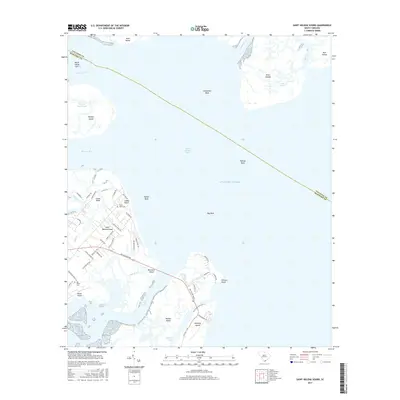
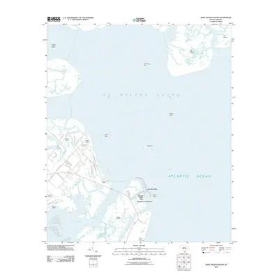 2011 Saint Helena Sound2011 Print · USGSCovers Cedar Reef Villas, including Oceanmarsh Subdivision, Nautical Watch Villas, and other nearby areas
 - 2014 Map of Saint Helena Sound, 2014 Print
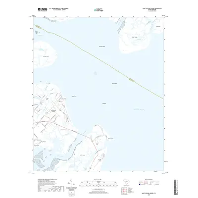
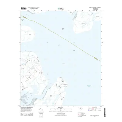 2014 Saint Helena Sound2014 Print · USGSCovers Cedar Reef Villas, including Oceanmarsh Subdivision, Nautical Watch Villas, and other nearby areas
 - 2017 Map of Saint Helena Sound, 2017 Print
 2017 Saint Helena Sound2017 Print · USGSCovers Cedar Reef Villas, including Oceanmarsh Subdivision, Nautical Watch Villas, and other nearby areas
 - 2020 Map of Saint Helena Sound, 2020 Print
 2020 Saint Helena Sound2020 Print · USGSCovers Cedar Reef Villas, including Oceanmarsh Subdivision, Nautical Watch Villas, and other nearby areas
 - 2024 Map of Saint Helena Sound, 2024 Print
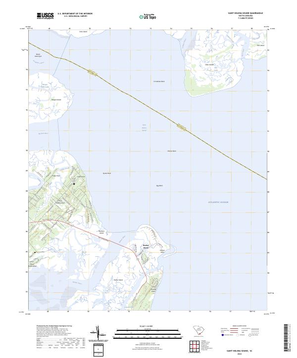 2024 Saint Helena Sound2024 Print · USGSCoastal Beaufort County comes to life in this recent study of the sea islands and their winding waterways. Genealogists can locate specific burial sites at Coffin Point Cem and Big House Cem or trace family land near Coffin Point and Village Creek.
End of results
Showing maps 1-14 of 14
Top cities near Cedar Reef Villas
Frequently asked questions
- What are the different types of historical maps available for Cedar Reef Villas?
- What is the oldest map of Cedar Reef Villas?
- Where can I purchase historical maps of Cedar Reef Villas for my home or office?
- Where can I download high-res historical maps of Cedar Reef Villas?
- Are there historical topographic maps available for Cedar Reef Villas?
- Is there historical aerial imagery available for Cedar Reef Villas?
- Where are historical maps of Cedar Reef Villas sourced from?