Old Maps of Goose Creek, South Carolina
Explore 39 old maps of Goose Creek, spanning from 1919 to today. These high-resolution historic maps reveal how streets, neighborhoods, landmarks, and natural features evolved over time — perfect for genealogy, metal detecting, research, and local history exploration.
What you can do with these maps:
- See how Goose Creek changed over time: Compare historical maps to modern-day views to trace roads, homesites, rail lines & more.
- View detailed metadata: Each map includes creators, publishers, year, scale, and archive source.
- Overlay maps with satellite & LiDAR: Visualize the past alongside modern tools to explore terrain & human change.
- Trusted historical sources: Maps sourced from the USGS, Library of Congress, and other archives.
- Access maps your way: View online, download high-res files, or order prints for personal or research use.
Start exploring old maps of Goose Creek to uncover forgotten places, hidden landmarks, and the deep history beneath your feet.
Goose Creek, SC maps
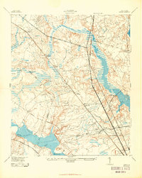
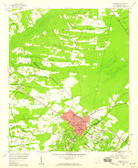
(39)- 1919 Map of Ladson
 1919 Ladson1919 Print · USGSCovers Goose Creek, including North Charleston, Summerville, and other nearby areas
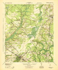
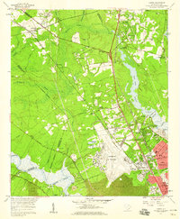
 - 1919 Map of Summerville
 1919 Summerville1919 Print · USGSCovers Goose Creek, including Summerville, Moncks Corner, and other nearby areas
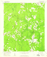
 - 1919 Map of Cordesville
 1919 Cordesville1919 Print · USGSCovers Goose Creek, including Moncks Corner, Charity, and other nearby areas
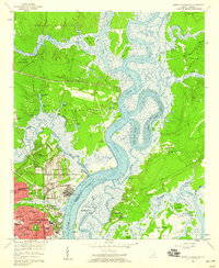
 - 1919 Map of Melgrove
 1919 Melgrove1919 Print · USGSCovers Goose Creek, including Charleston, North Charleston, and other nearby areas2 unique versions available
 - 1920 Map of Ravenels
 1920 Ravenels1920 Print · USGSCovers Goose Creek, including Charleston, North Charleston, and other nearby areas2 unique versions available
 - 1920 Map of Summerville
 1920 Summerville1920 Print · USGSCovers Goose Creek, including Summerville, Moncks Corner, and other nearby areas2 unique versions available
 - 1940 Map of Melgrove
 1940 Melgrove1940 Print · USGSCovers Goose Creek, including Charleston, North Charleston, and other nearby areas
 - 1943 Map of Ladson
 1943 Ladson1943 Print · USGSCovers Goose Creek, including North Charleston, Summerville, and other nearby areas2 unique versions available
 - 1944 Map of Ravenels
 1944 Ravenels1944 Print · USGSCovers Goose Creek, including Charleston, North Charleston, and other nearby areas
 - 1944 Map of Summerville
 1944 Summerville1944 Print · USGSCovers Goose Creek, including Summerville, Moncks Corner, and other nearby areas
 - 1947 Map of Savannah
 1947 Savannah1947 Print · USGSCovers Goose Creek, including Charleston, Savannah, and other nearby areas
 - 1948 Map of James Island
 1948 James Island1948 Print · USGSCovers Goose Creek, including Charleston, North Charleston, and other nearby areas
 - 1948 Map of Savannah
 1948 Savannah1948 Print · USGSCovers Goose Creek, including Charleston, Savannah, and other nearby areas
 - 1949 Map of Georgetown, 1953 Print
 1949 Georgetown1953 Print · USGSCovers Goose Creek, including Myrtle Beach, Conway, and other nearby areas
 - 1950 Map of Kittredge
 1950 Kittredge1950 Print · USGSCovers Goose Creek, including Hagan Landing, Richmond, and other nearby areas3 unique versions available
 - 1954 Map of Augusta
 1954 Augusta1954 Print · USGSCovers Goose Creek, including Augusta, Columbia, and other nearby areas
 - 1957 Map of Mount Holly, 1959 Print
 1957 Mount Holly1959 Print · USGSCovers Goose Creek, including Beverly Hills, College Park, and other nearby areas4 unique versions available
 - 1957 Map of Augusta, 1966 Print
 1957 Augusta1966 Print · USGSCovers Goose Creek, including Augusta, Columbia, and other nearby areas3 unique versions available
 - 1957 Map of Savannah, 1967 Print
 1957 Savannah1967 Print · USGSCovers Goose Creek, including Charleston, Savannah, and other nearby areas4 unique versions available
 - 1958 Map of Augusta
 1958 Augusta1958 Print · USGSCovers Goose Creek, including Augusta, Columbia, and other nearby areas
 - 1958 Map of North Charleston, 1959 Print
 1958 North Charleston1959 Print · USGSCovers Goose Creek, including Charleston, North Charleston, and other nearby areas4 unique versions available
 - 1958 Map of Summerville, 1959 Print
 1958 Summerville1959 Print · USGSCovers Goose Creek, including Summerville, Lincolnville, and other nearby areas4 unique versions available
 - 1958 Map of Ladson, 1959 Print
 1958 Ladson1959 Print · USGSCovers Goose Creek, including North Charleston, Summerville, and other nearby areas4 unique versions available
 - 1960 Map of Savannah
 1960 Savannah1960 Print · USGSCovers Goose Creek, including Charleston, Savannah, and other nearby areas
 - 1961 Map of Augusta
 1961 Augusta1961 Print · USGSCovers Goose Creek, including Augusta, Columbia, and other nearby areas2 unique versions available
Showing maps 1-25 of 39
Top cities near Goose Creek
- Charleston historical maps
- North Charleston historical maps
- Mount Pleasant historical maps
- Summerville historical maps
- Hanahan historical maps
- Moncks Corner historical maps
See more
Top neighborhoods of Goose Creek
- Hound Run historical maps
- Liberty Hall Plantation historical maps
- Longleaf historical maps
- Naval Nuclear Power Training Command historical maps
- Boulder Bluff historical maps
- Camelot Village historical maps
See more
Frequently asked questions
- What are the different types of historical maps available for Goose Creek?
- What is the oldest map of Goose Creek?
- Where can I purchase historical maps of Goose Creek for my home or office?
- Where can I download high-res historical maps of Goose Creek?
- Are there historical topographic maps available for Goose Creek?
- Is there historical aerial imagery available for Goose Creek?
- Where are historical maps of Goose Creek sourced from?