Old Maps of Berkeley County, South Carolina
Explore 266 old maps of Berkeley County, spanning from 1919 to today. These high-resolution historic maps reveal how streets, neighborhoods, landmarks, and natural features evolved over time — perfect for genealogy, metal detecting, research, and local history exploration.
What you can do with these maps:
- See how Berkeley County changed over time: Compare historical maps to modern-day views to trace roads, homesites, rail lines & more.
- View detailed metadata: Each map includes creators, publishers, year, scale, and archive source.
- Overlay maps with satellite & LiDAR: Visualize the past alongside modern tools to explore terrain & human change.
- Trusted historical sources: Maps sourced from the USGS, Library of Congress, and other archives.
- Access maps your way: View online, download high-res files, or order prints for personal or research use.
Start exploring old maps of Berkeley County to uncover forgotten places, hidden landmarks, and the deep history beneath your feet.
Berkeley County, SC maps
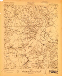
(266)- 1919 Map of Ladson
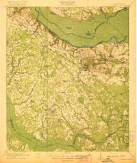
 1919 Ladson1919 Print · USGSThe South Carolina lowcountry is captured here just after the Great War, showing a landscape of riverfront estates and rail-connected settlements. Researchers can trace the grounds of Magnolia Gardens or locate rural centers like Ladson and Otranto.2 unique versions available
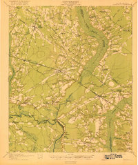
 - 1919 Map of Summerville
 1919 Summerville1919 Print · USGSSummerville and the surrounding Lowcountry wetlands are captured here just after the Great War, during a period of established rail reliance and rural growth. Genealogists and researchers can trace local landmarks like St Johns Church, the Clemson Coast Express Station, and numerous early school sites including Barrow School.
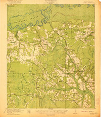
 - 1919 Map of Ridgeville
 1919 Ridgeville1919 Print · USGSCoastal South Carolina at the end of the Great War era reveals a landscape of dense swamps and rail-side settlements. Genealogists can trace family roots through numerous local landmarks like Cypress Camp Meeting Grounds, Mudville School, and Limestone Church.
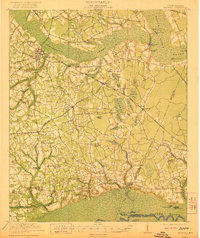
 - 1919 Map of Wando
 1919 Wando1919 Print · USGSCoastal Berkeley and Charleston Counties come alive in this survey from just after the Great War. Genealogists can locate family landmarks like St Matthews Church, trace the winding Lumber R. R., or find old river access at Lachicotte Landing.5 unique versions available
 - 1919 Map of Cordesville
 1919 Cordesville1919 Print · USGSBerkeley County was a landscape of dense swamps and historic parish chapels just after the First World War. Genealogists can trace family roots through numerous sites like Strawberry Chapel, Bethera Church, and the rural Pine Grove Flag Station.2 unique versions available
 - 1919 Map of Melgrove
 1919 Melgrove1919 Print · USGSThe South Carolina lowcountry emerges in detail during the post-WWI era as industry begins to touch the Cooper River. Genealogists can trace early neighborhood footprints in North Charleston or locate rural landmarks like St.Johns Church and Redbank Landing.3 unique versions available
 - 1919 Map of Charleston
 1919 Charleston1919 Print · USGSCoastal South Carolina thrives at the height of its naval and rail importance in the years following the Great War. Genealogists and historians can trace the development of the Navy Yard and local landmarks like Castle Pinckney and Magnolia Cem.3 unique versions available
 - 1919 Map of Fort Moultrie
 1919 Fort Moultrie1919 Print · USGSThe Charleston coast at the end of the Great War reveals a landscape of strategic coastal fortifications and early island settlements. Genealogists and historians can trace the layouts of Moultrieville, Mt Pleasant, and the grounds of Fort Moultrie.3 unique versions available
 - 1919 Map of Sewee Bay
 1919 Sewee Bay1919 Print · USGSThe Charleston County coastline at the end of the Great War reveals a landscape of tidal marshes and interior timber operations. Genealogists can trace the rural school system through Twelvemile School and Eighteenmile School or locate the early footprints of Andersonville and Woodville.
 - 1920 Map of Eutawville
 1920 Eutawville1920 Print · USGSCoastal South Carolina comes to life in the years following the Great War, showing a landscape defined by the Santee River and Four Hole Swamp. Genealogists can trace family roots through numerous local landmarks like Black Creek Church, Unity School, and the settlement at Holly Hill.
 - 1920 Map of Chicora
 1920 Chicora1920 Print · USGSBerkeley County was a landscape of river landings and bay-country settlements just after the turn of the century. Genealogists can locate family-named landmarks like Prioleau and numerous community anchors like St Luke Church, Eadytown, and the Francis Marion Tomb.
 - 1920 Map of Manning
 1920 Manning1920 Print · USGSClarendon County in the early twentieth century was a land of timber-rich wetlands and growing rail junctions. Genealogists can trace family footprints through numerous rural landmarks like Biggers School, St Marks Church, and settlements like Alcolu or Davis Station.
 - 1920 Map of Ravenels
 1920 Ravenels1920 Print · USGSThe Ashley River and its surrounding swamps were the heart of this Lowcountry landscape just after the First World War. Researchers can trace the footprints of Old Dorchester, the operations at Bula Mines, and the unique Tyler Tea Farm.3 unique versions available
 - 1920 Map of Ridgeville
 1920 Ridgeville1920 Print · USGSDorchester County and the surrounding Lowcountry wetlands are captured here just after the Great War, as railroads and swamp crossings defined local life. Trace the old rail lines through Ridgeville and Harleyville or find historic sites like the Two Run Church and Mudville School.3 unique versions available
 - 1920 Map of Summerville
 1920 Summerville1920 Print · USGSThe South Carolina Lowcountry at the close of the Great War reveals a landscape of deep cypress basins and burgeoning rail-side towns. Genealogists can locate numerous rural landmarks like Appii Church, Whitesville School, and the Clemson Coast Experiment Station.3 unique versions available
 - 1921 Map of Chicora
 1921 Chicora1921 Print · USGSBerkeley County's riverfront and wetlands are captured in the early 1920s, showing the landscape before the Santee Cooper project transformed the region. Genealogists can locate family-named sites like the Francis Marion Tomb, Eadytown, and Rocks Creek School.4 unique versions available
 - 1921 Map of Manning
 1921 Manning1921 Print · USGSClarendon County was a hub of rail lines and swamp-bordering settlements in the years following the Great War. You can trace early 20th-century family landmarks like White Oak Church, the Wilson Mill School, and the path of the Southern Railroad as it crosses the Pocotaligo Swamp.3 unique versions available
 - 1921 Map of Eutawville
 1921 Eutawville1921 Print · USGSCoastal South Carolina comes to life in this early twentieth-century survey of the Santee River lowlands and the growing railroad towns of the coastal plain. Genealogists can trace the location of community anchors like Gerizim Church, the Eutaw Springs Battle Monument, and Nelsons Ferry.3 unique versions available
 - 1940 Map of Melgrove
 1940 Melgrove1940 Print · USGSThe South Carolina lowcountry near Charleston appears here just before the mid-century industrial boom. Researchers can locate community anchors like St Johns Ch, the No 6 School, and the rail stop at Inness Sta along the SOUTHERN line.
 - 1942 Map of Cedar Creek, 1962 Print
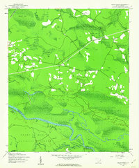 1942 Cedar Creek1962 Print · USGSThe coastal plains of Georgetown and Berkeley counties are documented here in the early 1940s, showcasing a landscape of dense swamps and scattered landings. Genealogists and historians can trace rail-side life in Lambert or explore the riverfront at Price Landing and Trinity Ch.2 unique versions available
 - 1942 Map of Honey Hill, 1962 Print
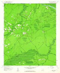 1942 Honey Hill1962 Print · USGSBerkeley County was still largely defined by its river-and-swamp geography during the early 1940s. Local researchers can trace old crossroads like Honey Hill and Charley Bridges, or locate river access points including Pleasant Hill Landing and Pitch Landing.3 unique versions available
 - 1943 Map of Fort Moultrie
 1943 Fort Moultrie1943 Print · USGSThe Charleston coast at the height of the war reveals a landscape of tactical significance and growing seaside communities. Genealogists and historians can trace old homesteads near Porchers Bluff or locate the Atlanticville P O and Sevenmile Sch.2 unique versions available
 - 1943 Map of Chicora
 1943 Chicora1943 Print · USGSThe Santee River lowlands are captured here in the early 1940s, just as modern water management began to reshape the region. Genealogists can locate family-named landmarks like the Francis Marion Tomb, Eadytown, and the Oakland Club.
 - 1943 Map of Wando
 1943 Wando1943 Print · USGSThe Lowcountry river system near Wando and Cainhoy is captured here during the mid-forties, showing the intricate tidal creeks and rural landings of the era. Genealogists and local historians can locate family landmarks like St Pauls Ch, Philips Sch, and the winding Lumber Railroad.3 unique versions available
 - 1943 Map of Sewee Bay
 1943 Sewee Bay1943 Print · USGSThe Charleston County coastline in the early 1940s reveals a quiet landscape of rural schools and tidal marshes before the onset of modern coastal development. Local historians can trace the positions of Twelvemile Sch and Eighteenmile Sch or explore the waterfronts of Woodville and Andersonville.
Showing maps 1-25 of 266
Top cities of Berkeley County
- Goose Creek historical maps
- Hanahan historical maps
- Moncks Corner historical maps
- Bonneau historical maps
- Jamestown historical maps
Frequently asked questions
- What are the different types of historical maps available for Berkeley County?
- What is the oldest map of Berkeley County?
- Where can I purchase historical maps of Berkeley County for my home or office?
- Where can I download high-res historical maps of Berkeley County?
- Are there historical topographic maps available for Berkeley County?
- Is there historical aerial imagery available for Berkeley County?
- Where are historical maps of Berkeley County sourced from?