Old Maps of Alcolu, South Carolina for Hiking & Exploration
Hike through history with 16 historic maps of Alcolu. Explore old trails, ghost towns, and forgotten backroads — perfect for outdoor adventurers and local explorers.
- Rediscover forgotten places: Map out old mining camps, roads, and footpaths that no longer exist on modern maps.
- Layer with modern tools: Combine with LiDAR or satellite views to plan hikes through historical terrain.
- Made for exploration: Popular among hikers, overlanders, and local history lovers.
Use these maps to find adventure and explore the hidden past of Alcolu.
Alcolu, SC maps
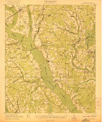
(16)- 1920 Map of Mayesville
 1920 Mayesville1920 Print · USGSThe rural lowcountry of Sumter and Clarendon counties is captured here in the years following World War I, when the Black River and its dense swamps dictated the pace of local life. Researchers can trace early twentieth-century community life through numerous rural landmarks like Brick Church, Tomlinson School, and the path of the Alcolu RR.
 - 1921 Map of Mayesville
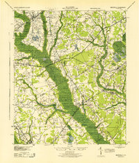
 1921 Mayesville1921 Print · USGSThe rural lowcountry of Sumter and Clarendon counties comes into focus during the early 1920s as the railroad era reached its peak. Researchers can trace historic family-named landmarks like Frierson's Store, numerous rural houses of worship such as Beulah Church, and old river crossings like Midway Crossing.3 unique versions available
 - 1943 Map of Mayesville
 1943 Mayesville1943 Print · USGSThe rural landscape of Sumter and Clarendon counties is captured here in the 1940s, highlighting a region defined by the Black River swamp. Genealogists can trace early family landmarks and community centers like Mayesville, Gamble Chapel, and the Malina Sch.
 - 1954 Map of Augusta
 1954 Augusta1954 Print · USGSThe Savannah River valley and South Carolina Midlands are captured here during a period of post-war growth. Researchers can trace the rail-and-river economy through the Southern RR corridor and locate historic settlements like Aiken, Orangeburg, and Sumter.
 - 1957 Map of Augusta, 1966 Print
 1957 Augusta1966 Print · USGSThe Savannah River and Santee basins are captured here during a period of massive military and industrial expansion in the late fifties. Genealogists can trace family footprints across Four Hole Swamp or near the Savannah River Plant.3 unique versions available
 - 1958 Map of Augusta
 1958 Augusta1958 Print · USGSThe borderlands between Georgia and South Carolina come alive in the 1950s, showing the early footprint of the Savannah River Plant. Genealogists and historians can trace rail-dependent towns and rural landmarks from Orangeburg to the Fort Jackson Military Reservation.
 - 1961 Map of Augusta
 1961 Augusta1961 Print · USGSThe South Carolina lowcountry and CSRA appear here in the early sixties, during a period of massive military and industrial growth. Researchers can trace the development of the Savannah River Plant or locate legacy landmarks like Nelson Ferry and Magnolia Cemetery.2 unique versions available
 - 1962 Map of Augusta
 1962 Augusta1962 Print · USGSThe South Carolina and Georgia borderlands are seen here in the early sixties, showing the rise of the Savannah River Plant and the expansion of Fort Jackson. Researchers can trace old rail lines like the Southern Railway and find landmarks such as St. Pauls Church or the Santee Canal.
 - 1983 Map of Tearcoat Branch
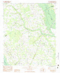 1983 Tearcoat Branch1983 Print · USGSSumter and Clarendon counties are captured here in the early eighties, where agricultural life centers on the fringes of the Black River Swamp. Genealogists and historians can trace local family roots through sites like Brunsons Cem, Harvin, and Westminster Ch.
 - 1986 Map of Sumter
 1986 Sumter1986 Print · USGSMid-South Carolina in the mid-eighties reveals a landscape of massive river bottomlands and significant military installations. Genealogists and historians can trace the rural networks around Fort Motte, Lone Star, and Sardinia alongside Lake Marion.
 - 1990 Map of Sumter
 1990 Sumter1990 Print · USGSCentral South Carolina's river systems and military landscapes are captured here during the late twentieth century. Genealogists and historians can trace the growth of Sumter or locate rural communities such as Wedgefield and Kingville near the Congaree River.
 - 2011 Map of Tearcoat Branch, 2011 Print
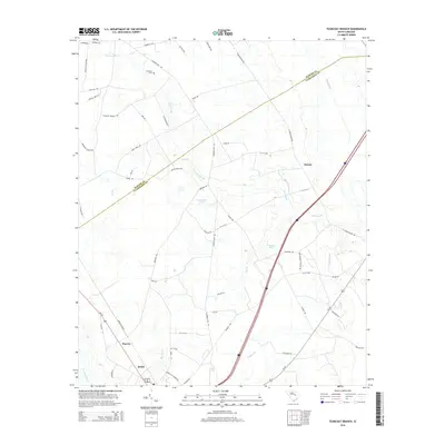
 2011 Tearcoat Branch2011 Print · USGSCovers Alcolu, including Durant, Harvin, and other nearby areas
 - 2014 Map of Tearcoat Branch, 2014 Print
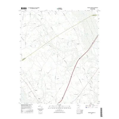
 2014 Tearcoat Branch2014 Print · USGSCovers Alcolu, including Durant, Harvin, and other nearby areas
 - 2017 Map of Tearcoat Branch, 2017 Print
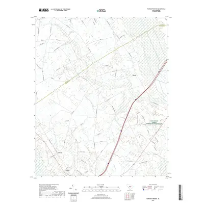
 2017 Tearcoat Branch2017 Print · USGSCovers Alcolu, including Durant, Harvin, and other nearby areas
 - 2020 Map of Tearcoat Branch, 2020 Print
 2020 Tearcoat Branch2020 Print · USGSCovers Alcolu, including Durant, Harvin, and other nearby areas
 - 2024 Map of Tearcoat Branch, 2024 Print
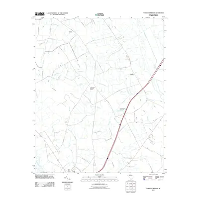
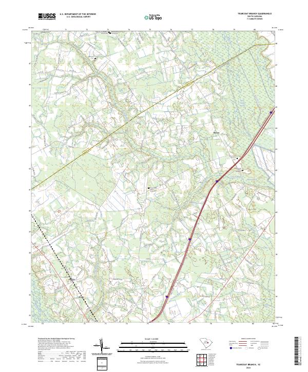 2024 Tearcoat Branch2024 Print · USGSClarendon County settlement and rural life are detailed here in this contemporary look at the lowlands around the Pocotaligo River. Genealogists can locate family landmarks like Brunsons Cem and the historic Mount Nebo Church Graveyard near Alcolu.
End of results
Showing maps 1-16 of 16
Top cities near Alcolu
- Sumter historical maps
- Manning historical maps
- Summerton historical maps
- Mayesville historical maps
- Turbeville historical maps
- Greeleyville historical maps
See more
Frequently asked questions
- What are the different types of historical maps available for Alcolu?
- What is the oldest map of Alcolu?
- Where can I purchase historical maps of Alcolu for my home or office?
- Where can I download high-res historical maps of Alcolu?
- Are there historical topographic maps available for Alcolu?
- Is there historical aerial imagery available for Alcolu?
- Where are historical maps of Alcolu sourced from?