Old Maps of Edgefield County, South Carolina for Metal Detecting
Plan your next treasure hunt with 120 historic maps of Edgefield County. Find old homesites, ghost towns, trails, and gathering spots that may be lost to time — perfect for identifying promising metal detecting locations.
- Locate forgotten sites: Uncover places like long-lost settlements, abandoned rail lines, or gathering spots.
- Plan better hunts: Use map overlays combined with LiDAR or satellite views to narrow in on historically rich areas.
- Made for detectorists: Thousands of hobbyists use these maps to discover relics, coins, and hidden history.
Use these historic maps to boost your research and find new opportunities beneath the surface of Edgefield County.
Edgefield County, SC maps
(120)- 1892 Map of Mc Cormick
 1892 Mc Cormick1892 Print · USGSThe Savannah River borderlands in the 1890s reveal a network of historic ferries and early mills connecting Georgia and South Carolina. Genealogists can trace family roots through landmarks like Dunn Chapel, Searle Mill, and the crossings at Barksdale Ferry.5 unique versions available
 - 1912 Map of Mc Cormick, 1913 Print
 1912 Mc Cormick1913 Print · USGSThe Georgia and South Carolina borderlands come alive in the 1890s, centered on the rail junction at Mc Cormick and the Savannah River. Genealogists can trace family footprints across numerous river crossings like Fury Ferry and through rural centers such as Appling and Sharon Church.
 - 1920 Map of Aiken
 1920 Aiken1920 Print · USGSThe rural districts around Aiken are shown in the years following the Great War, when the landscape was a tapestry of small schools and country churches. Researchers can trace the heritage of Montmorenci or locate specific landmarks like Livingstons Mill and the Fountain Academy School.
 - 1920 Map of Clarks Hill
 1920 Clarks Hill1920 Print · USGSThe Savannah River border between South Carolina and Georgia comes alive in this survey, showing the region as it was before the creation of the massive Clarks Hill Lake. Genealogists can trace family landmarks like Gilchrist Ferry, Hosannah Church, and Flat Rock School during the heyday of the Charleston and Western Carolina railroad.
 - 1921 Map of Aiken
 1921 Aiken1921 Print · USGSAiken and its surrounding countryside are captured here just after the Great War, showing a landscape of family farms and growing rail towns. Researchers can trace the heritage of local communities through dozens of named sites like Fountain Academy, Livingstons Mill, and the Tory Trail.3 unique versions available
 - 1921 Map of Clarks Hill
 1921 Clarks Hill1921 Print · USGSThe Savannah River valley in the early twenties was a landscape of ferries and railroad sidings before the creation of modern reservoirs. Genealogists can trace family footprints through dozens of rural landmarks like Hosannah Church, Dorn School, and Gilchrist Ferry.3 unique versions available
 - 1923 Map of Warrenville
 1923 Warrenville1923 Print · USGSAiken and Edgefield counties thrive during the early twentieth-century textile boom, showing a landscape shaped by mill towns and rural academies. Genealogists can trace family roots through numerous landmarks like Bettis Academy, Eureka Station, and Hammond Grove Church.2 unique versions available
 - 1928 Map of Warrenville
 1928 Warrenville1928 Print · USGSAiken and Edgefield counties are shown in the late 1920s as a thriving corridor of textile mills and rural academies. Researchers can trace the development of historic communities and landmarks like Bettis Academy, Vaucluse, and Meeting Grove Ch.3 unique versions available
 - 1941 Map of Clarks Hill, 1957 Print
 1941 Clarks Hill1957 Print · USGSThe Savannah River valley remained a landscape of ferries and river-to-rail commerce just before the era of major dam construction. Genealogists and historians can trace family roots through numerous rural landmarks like Cary Hill Ch, Modoc, and Gilchrist Ferry.2 unique versions available
 - 1942 Map of Clarks Hill
 1942 Clarks Hill1942 Print · USGSThe Savannah River valley along the South Carolina and Georgia border comes alive in this survey from the era of river ferries and local rail. Genealogists can trace family landmarks like Hosannah Church, Dents Ferry, and the Flat Rock School.
 - 1943 Map of Aiken
 1943 Aiken1943 Print · USGSAiken and its rural outskirts come alive in the 1940s, showing a landscape defined by the Southern railroad and the South Fork Edisto River. Researchers can trace old family schoolhouses and local congregations, from Fountain Academy to the Welcome Traveler Ch.
 - 1943 Map of Warrenville
 1943 Warrenville1943 Print · USGSThe industrial corridor of Aiken County is captured here in the early 1940s, highlighting the mill towns along Horse Creek. Genealogists can trace family roots through numerous community landmarks like Bettis Academy, Horn Creek Ch, and the settlement at Vaucluse.
 - 1953 Map of Athens, 1966 Print
 1953 Athens1966 Print · USGSGeorgia's Piedmont and Savannah River borderlands come alive in this mid-century survey of the region surrounding Athens and Augusta. Trace the rail-and-river economy through the Georgia RR and landmarks like the Fort Gordon Military Reservation.3 unique versions available
 - 1954 Map of Augusta
 1954 Augusta1954 Print · USGSThe Savannah River valley and South Carolina Midlands are captured here during a period of post-war growth. Researchers can trace the rail-and-river economy through the Southern RR corridor and locate historic settlements like Aiken, Orangeburg, and Sumter.
 - 1957 Map of Augusta, 1966 Print
 1957 Augusta1966 Print · USGSThe Savannah River and Santee basins are captured here during a period of massive military and industrial expansion in the late fifties. Genealogists can trace family footprints across Four Hole Swamp or near the Savannah River Plant.3 unique versions available
 - 1958 Map of Augusta
 1958 Augusta1958 Print · USGSThe borderlands between Georgia and South Carolina come alive in the 1950s, showing the early footprint of the Savannah River Plant. Genealogists and historians can trace rail-dependent towns and rural landmarks from Orangeburg to the Fort Jackson Military Reservation.
 - 1958 Map of Athens
 1958 Athens1958 Print · USGSNorth-central Georgia and the Savannah River valley are captured in the late fifties, showing the region as the new reservoirs were filling. Researchers can trace historic rail lines like the Georgia RR and locate rural landmarks such as Social Circle, Graves Mountain, and the Fort Gordon Military Reservation.
 - 1959 Map of Athens
 1959 Athens1959 Print · USGSNortheast Georgia and the South Carolina borderlands appear here in the mid-fifties, during a decade of infrastructure growth. Genealogists and historians can trace the rail-and-river geography of towns like Social Circle, the sprawl of Fort Gordon Military Reservation, and the newly formed Clark Hill Reservoir.
 - 1961 Map of Augusta
 1961 Augusta1961 Print · USGSThe South Carolina lowcountry and CSRA appear here in the early sixties, during a period of massive military and industrial growth. Researchers can trace the development of the Savannah River Plant or locate legacy landmarks like Nelson Ferry and Magnolia Cemetery.2 unique versions available
 - 1962 Map of Augusta
 1962 Augusta1962 Print · USGSThe South Carolina and Georgia borderlands are seen here in the early sixties, showing the rise of the Savannah River Plant and the expansion of Fort Jackson. Researchers can trace old rail lines like the Southern Railway and find landmarks such as St. Pauls Church or the Santee Canal.
 - 1963 Map of Athens
 1963 Athens1963 Print · USGSGeorgia's Piedmont and the Savannah River valley are captured in the early sixties as major reservoirs and military installations reshaped the landscape. Researchers can trace the development of Clark Hill Reservoir, locate the Fort Gordon Military Reservation, and find historic towns like Social Circle and Eatonton.
 - 1964 Map of Ridge Spring, 1965 Print
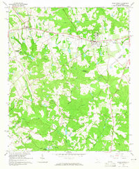 1964 Ridge Spring1965 Print · USGSRidge Spring and the surrounding tri-county area are captured here in the mid-1960s, a landscape shaped by the SOUTHERN railroad and deep-rooted rural communities. Genealogists and historians can trace numerous family landmarks, including Yonce Cem, Spann Ch, and the historical path of the Old Plank Road.2 unique versions available
 - 1964 Map of Aiken NW, 1965 Print
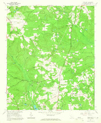 1964 Aiken NW1965 Print · USGSNorthwest of Aiken in the mid-sixties, this rural landscape was defined by its claypits, timbered branches, and the South Fork Edisto River. Researchers can trace family history through Seiglers Crossroads and numerous local burial sites like Mt Pisgah Cem.2 unique versions available
 - 1964 Map of Owdoms, 1965 Print
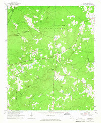 1964 Owdoms1965 Print · USGSEdgefield and Saluda counties appear here in the mid-1960s, showing a quiet landscape of timber and traditional farmsteads. Researchers can trace family roots at Dorn Cem or find local landmarks like the Southern Gold Mine and McKendree Ch.2 unique versions available
 - 1964 Map of Saluda South, 1965 Print
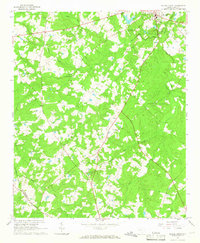 1964 Saluda South1965 Print · USGSSouth Carolina's Piedmont countryside south of the county seat is captured in the mid-1960s, showing a transition from traditional agriculture to modern land use. Genealogists can trace family landmarks like Wright Cem and Cedar Grove Ch, or follow the path of the Old Railroad Grade.2 unique versions available
Showing maps 1-25 of 120
Top cities of Edgefield County
Frequently asked questions
- What are the different types of historical maps available for Edgefield County?
- What is the oldest map of Edgefield County?
- Where can I purchase historical maps of Edgefield County for my home or office?
- Where can I download high-res historical maps of Edgefield County?
- Are there historical topographic maps available for Edgefield County?
- Is there historical aerial imagery available for Edgefield County?
- Where are historical maps of Edgefield County sourced from?