1980s Maps of Autumn Ridge, Greenville County
Explore 4 historic maps of Autumn Ridge from the 1980s. These maps offer a rare glimpse into what life looked like during the 1980s — showing old roads, neighborhoods, homes, and landmarks that have changed or disappeared over time.
Whether you're researching your family's past, planning a metal detecting trip, or studying how Autumn Ridge's landscape evolved across the 1980s, these high-resolution maps are a powerful tool for exploring the history of this region.
- Focus on a specific era: All maps on this page are from the 1980s, giving you a focused view of this time period.
- See what’s changed: Compare century-old streets, trails, and buildings to today's modern landscape using overlays and satellite layers.
- Research with precision: Use these maps for genealogy, historical research, land use analysis, or educational projects.
- View, download, or print: Maps are fully viewable online in high resolution, and can be downloaded or printed for your own records.
Start exploring Autumn Ridge's history through authentic maps from the 1980s. This is your window into the past.
Autumn Ridge, Greenville County maps
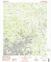
(4)- 1983 Map of Tigerville
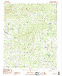 1983 Tigerville1983 Print · USGSTigerville and the upper Tyger River valley are captured in the early 1980s as the rural Greenville County landscape began to modernize. Genealogists and historians can locate the Campbell Covered Bridge, North Greenville Jr College, and numerous family-named landmarks like Berrys Millpond.2 unique versions available
 - 1983 Map of Taylors
 1983 Taylors1983 Print · USGSGreenville County enters a period of rapid suburban transition in the early eighties as residential tracts expand toward the Enoree River. Genealogists and local historians can trace family sites at Jackson Grove Ch Cem, the Southern Bleachery, and Chick Springs.
 - 1984 Map of Greenville
 1984 Greenville1984 Print · USGSThe South Carolina Upstate undergoes rapid suburban growth in the mid-eighties as modern interstates begin to reshape the landscape. Researchers can trace historic rail lines like the Greenville and Northern Railway and locate local landmarks such as Clemson University and Paris Mountain State Park.
 - 1986 Map of Hendersonville
 1986 Hendersonville1986 Print · USGSThe Blue Ridge foothills of North and South Carolina are documented here in the mid-eighties as modern highways began to reshape mountain travel. Local historians can trace the paths of the Southern Railway through Hendersonville or locate landmarks like Looking Glass Rock and Inman Mills.2 unique versions available
End of results
Showing maps 1-4 of 4
Frequently asked questions
- What are the different types of historical maps available for Autumn Ridge?
- What is the oldest map of Autumn Ridge?
- Where can I purchase historical maps of Autumn Ridge for my home or office?
- Where can I download high-res historical maps of Autumn Ridge?
- Are there historical topographic maps available for Autumn Ridge?
- Is there historical aerial imagery available for Autumn Ridge?
- Where are historical maps of Autumn Ridge sourced from?