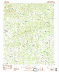
1983 Map of Tigerville
USGS Topo · Published 1983About this map
North Greenville Jr College serves as a focal point for the Tigerville community, located at the base of the rising foothills. This landscape is defined by the headwaters and branches of the Middle Tyger River and Tyger River, which carve through the terrain near Tillet Mtn and Pax Mountain. The map reveals a post-war rural infrastructure transitioning toward modern institutional use, evidenced by the presence of both the O'Neal Detention Center and the State Fish Hatchery near Beaverdam Creek.
Find a feature on this map
49 named features on this map. Tap any name to fly to it.
Don’t see what you’re looking for? This feature index may not catch every label — zoom into the map to look around manually.
Map Details
Editions of this 1983 Tigerville Map
2 editions found
Other maps of this area

1907 · Saluda
USGS Topo · 1:125,000

1935 · Greer
USGS Topo · 1:48,000

1935 · Greenville
USGS Topo · 1:48,000

1935 · Zirconia
USGS Topo · 1:24,000

1938 · Greenville
USGS Topo · 1:62,500

1938 · Greer
USGS Topo · 1:62,500

1946 · Zirconia
USGS Topo · 1:24,000
1947 · Zirconia
USGS Topo · 1:24,000
1954 · Zirconia
USGS Topo · 1:25,000

1954 · Greenville
USGS Topo · 1:250,000