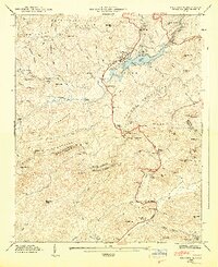
1947 Map of Zirconia
USGS Topo · Published 1947About this map
The Blue Ridge Divide and the Saluda Mountains define this high-elevation landscape along the border of North Carolina and South Carolina. In the north, the industrial footprint of the Green River is prominent, centered on the Lake Summit reservoir. The infrastructure here includes a Hydro-Electric Flume, a Power Plant, and a Surge Tank, all supporting the community at Tuxedo and Zirconia.
Find a feature on this map
90 named features on this map. Tap any name to fly to it.
Don’t see what you’re looking for? This feature index may not catch every label — zoom into the map to look around manually.
Map Details
Editions of this 1947 Zirconia Map
2 editions found
Other maps of this area

1905 · Pisgah
USGS Topo · 1:125,000

1906 · Pisgah
USGS Topo · 1:125,000

1907 · Saluda
USGS Topo · 1:125,000

1935 · Standingstone Mtn.
USGS Topo · 1:24,000

1935 · Horse Shoe
USGS Topo · 1:24,000

1935 · Hendersonville
USGS Topo · 1:24,000

1935 · Fishtop
USGS Topo · 1:24,000

1935 · Zirconia
USGS Topo · 1:24,000
1942 · Horse Shoe
USGS Topo · 1:24,000
1946 · Standingstone Mtn.
USGS Topo · 1:24,000