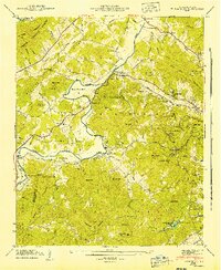
1942 Map of Horse Shoe
USGS Topo · Published 1942About this map
The French Broad River snakes through the heart of this Henderson County landscape, defining the character of the valley with the dramatic Horse Shoe Bend. In the early 1940s, this area supported a network of small agricultural and river communities like Etowah and Horse Shoe, connected by the Southern Railway and river crossings such as Kings Bridge and McLean Bridge. The map captures a transitional landscape where the flat valley floor meets the rising peaks of the Pisgah National Forest and the Crab Creek region.
Find a feature on this map
72 named features on this map. Tap any name to fly to it.
Don’t see what you’re looking for? This feature index may not catch every label — zoom into the map to look around manually.
Map Details
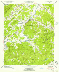
Editions of this 1942 Horse Shoe Map
2 editions found
Other maps of this area

1905 · Pisgah
USGS Topo · 1:125,000

1906 · Pisgah
USGS Topo · 1:125,000

1907 · Saluda
USGS Topo · 1:125,000

1935 · Brevard
USGS Topo · 1:24,000

1935 · Standingstone Mtn.
USGS Topo · 1:24,000

1935 · Horse Shoe
USGS Topo · 1:24,000

1935 · Hendersonville
USGS Topo · 1:24,000

1935 · Zirconia
USGS Topo · 1:24,000

1935 · Pisgah Forest
USGS Topo · 1:24,000

1936 · Skyland
USGS Topo · 1:24,000