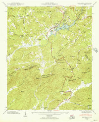
1946 Map of Zirconia
USGS Topo · Published 1957About this map
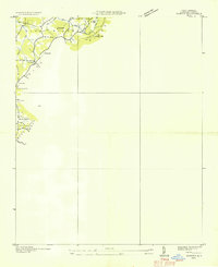
Lake Summit and the Green River define the terrain of the Blue Ridge and Saluda Mountains along the border of North Carolina and South Carolina. This 1946 field examination by the Tennessee Valley Authority captures a landscape shaped by hydroelectric development, featuring a Power Plant and Surge Tank downstream from the lake. The settlement of Tuxedo serves as a local hub along the Southern railroad line, while the Dixie Highway provides a primary automotive corridor through the valley. This era was marked by a concentration of recreational and youth camps, including Camp Greystone, Camp Noahs Ark, and Elks Club Camp. Further south, the map reveals the rural community of Merrittsville and the North Fork Ch near the banks of the North Fork Saluda River, illustrating the persistence of mountain settlements near the state line.
Find a feature on this map
87 named features on this map. Tap any name to fly to it.
Don’t see what you’re looking for? This feature index may not catch every label — zoom into the map to look around manually.
Map Details
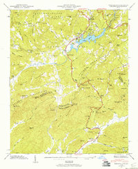
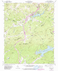
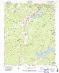
Editions of this 1946 Zirconia Map
4 editions found
Other maps of this area

1905 · Pisgah
USGS Topo · 1:125,000

1906 · Pisgah
USGS Topo · 1:125,000

1907 · Saluda
USGS Topo · 1:125,000

1935 · Standingstone Mtn.
USGS Topo · 1:24,000

1935 · Horse Shoe
USGS Topo · 1:24,000

1935 · Hendersonville
USGS Topo · 1:24,000
1935 · Fishtop
USGS Topo · 1:24,000

1935 · Zirconia
USGS Topo · 1:24,000
1942 · Horse Shoe
USGS Topo · 1:24,000
1946 · Standingstone Mtn.
USGS Topo · 1:24,000