1946 Map of Zirconia
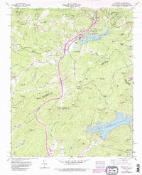
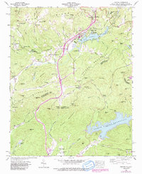
USGS Topo · Published 1991About this map
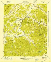
Lake Summit and the North Saluda Reservoir dominate the landscape of the Saluda Mountains in the mid-1940s. The area serves as a significant recreational and hydroelectric hub, evidenced by the presence of numerous summer camps such as Kings Mountain Camp, Camp Windy Wood, and Camp Green Cove. The Zirconia (Tuxedo Station) provides a vital rail link through the mountain terrain, supporting small communities like Tuxedo and Mountain Valley.
Find a feature on this map
108 named features on this map. Tap any name to fly to it.
Don’t see what you’re looking for? This feature index may not catch every label — zoom into the map to look around manually.
Map Details
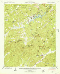
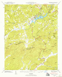
Editions of this 1946 Zirconia Map
4 editions found
Other maps of this area

1905 · Pisgah
USGS Topo · 1:125,000

1906 · Pisgah
USGS Topo · 1:125,000

1907 · Saluda
USGS Topo · 1:125,000

1935 · Standingstone Mtn.
USGS Topo · 1:24,000

1935 · Horse Shoe
USGS Topo · 1:24,000

1935 · Hendersonville
USGS Topo · 1:24,000
1935 · Fishtop
USGS Topo · 1:24,000

1935 · Zirconia
USGS Topo · 1:24,000
1942 · Horse Shoe
USGS Topo · 1:24,000
1946 · Standingstone Mtn.
USGS Topo · 1:24,000