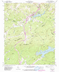
1946 Map of Zirconia
USGS Topo · Published 1991About this map
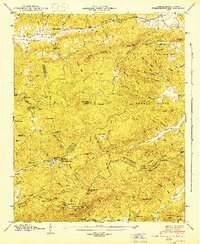
The Blue Ridge Divide defines the high country of this mid-century survey, where the Southern Railway winds through the village of Zirconia and the settlement of Tuxedo. Water management and recreation dominate the landscape, centered on the Lake Summit and the North Saluda Reservoir, which spans the North Carolina and South Carolina border. The map documents a well-established network of mountain institutions, from the Mountain Valley School to various rural congregations like Zion Hill Church and Holy Creek Church. Local genealogy is well-represented through family-named landmarks and resting places such as Andrews Cemetery and Pace Cemetery. The presence of several summer retreats, including Camp Windy Wood and Camp Arrowhead, signals the region's long-standing transition from isolated mountain hollows to a hub for seasonal tourism and hydroelectric power development.
Find a feature on this map
113 named features on this map. Tap any name to fly to it.
Don’t see what you’re looking for? This feature index may not catch every label — zoom into the map to look around manually.
Map Details
Editions of this 1946 Zirconia Map
4 editions found

Other maps of this area

1905 · Pisgah
USGS Topo · 1:125,000

1906 · Pisgah
USGS Topo · 1:125,000

1907 · Saluda
USGS Topo · 1:125,000

1935 · Standingstone Mtn.
USGS Topo · 1:24,000

1935 · Horse Shoe
USGS Topo · 1:24,000

1935 · Hendersonville
USGS Topo · 1:24,000

1935 · Fishtop
USGS Topo · 1:24,000

1935 · Zirconia
USGS Topo · 1:24,000
1942 · Horse Shoe
USGS Topo · 1:24,000
1946 · Standingstone Mtn.
USGS Topo · 1:24,000