Old Maps of Simpsonville, South Carolina
Explore 16 old maps of Simpsonville, spanning from 1935 to today. These high-resolution historic maps reveal how streets, neighborhoods, landmarks, and natural features evolved over time — perfect for genealogy, metal detecting, research, and local history exploration.
What you can do with these maps:
- See how Simpsonville changed over time: Compare historical maps to modern-day views to trace roads, homesites, rail lines & more.
- View detailed metadata: Each map includes creators, publishers, year, scale, and archive source.
- Overlay maps with satellite & LiDAR: Visualize the past alongside modern tools to explore terrain & human change.
- Trusted historical sources: Maps sourced from the USGS, Library of Congress, and other archives.
- Access maps your way: View online, download high-res files, or order prints for personal or research use.
Start exploring old maps of Simpsonville to uncover forgotten places, hidden landmarks, and the deep history beneath your feet.
Simpsonville, SC maps
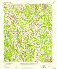
(16)- 1935 Map of Greer
 1935 Greer1935 Print · USGSCovers Simpsonville, including Greer, Lyman, and other nearby areas
 - 1935 Map of Greenville
 1935 Greenville1935 Print · USGSCovers Simpsonville, including Greenville, Greer, and other nearby areas
 - 1938 Map of Greenville
 1938 Greenville1938 Print · USGSCovers Simpsonville, including Greenville, Greer, and other nearby areas2 unique versions available
 - 1938 Map of Greer
 1938 Greer1938 Print · USGSCovers Simpsonville, including Greer, Lyman, and other nearby areas2 unique versions available
 - 1954 Map of Greenville, 1965 Print
 1954 Greenville1965 Print · USGSCovers Simpsonville, including Athens, Greenville, and other nearby areas2 unique versions available
 - 1957 Map of Fountain Inn, 1958 Print
 1957 Fountain Inn1958 Print · USGSCovers Simpsonville, including Fountain Inn, Laurens, and other nearby areas
 - 1957 Map of Williamston, 1958 Print
 1957 Williamston1958 Print · USGSCovers Simpsonville, including Mauldin, Piedmont, and other nearby areas2 unique versions available
 - 1957 Map of Greer, 1959 Print
 1957 Greer1959 Print · USGSCovers Simpsonville, including Greer, Lyman, and other nearby areas2 unique versions available
 - 1957 Map of Greenville, 1959 Print
 1957 Greenville1959 Print · USGSCovers Simpsonville, including Greenville, Greer, and other nearby areas
 - 1958 Map of Greenville
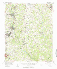
 1958 Greenville1958 Print · USGSCovers Simpsonville, including Athens, Greenville, and other nearby areas
 - 1983 Map of Simpsonville
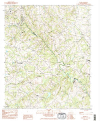
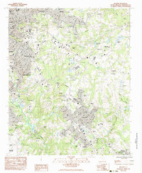
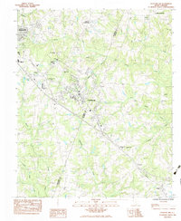
 1983 Simpsonville1983 Print · USGSCovers Simpsonville, including Mauldin, Cherokee Heights, and other nearby areas2 unique versions available
 - 1983 Map of Pelham
 1983 Pelham1983 Print · USGSCovers Simpsonville, including Greer, Reidville, and other nearby areas2 unique versions available
 - 1983 Map of Mauldin
 1983 Mauldin1983 Print · USGSCovers Simpsonville, including Greenville, Mauldin, and other nearby areas2 unique versions available
 - 1983 Map of Fountain Inn
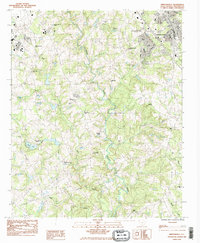
 1983 Fountain Inn1983 Print · USGSCovers Simpsonville, including Fountain Inn, Cooks Crossroads, and other nearby areas
 - 1984 Map of Greenville
 1984 Greenville1984 Print · USGSCovers Simpsonville, including Greenville, Greer, and other nearby areas
 - 1991 Map of Greenville
 1991 Greenville1991 Print · USGSCovers Simpsonville, including Greenville, Greer, and other nearby areas
End of results
Showing maps 1-16 of 16
Top cities near Simpsonville
- Greenville historical maps
- Greer historical maps
- Mauldin historical maps
- Wade Hampton historical maps
- Fountain Inn historical maps
- Laurens historical maps
See more
Top neighborhoods of Simpsonville
- Poinsetta historical maps
- Powderhorn historical maps
- The Cedars historical maps
- Westwood historical maps
- Cherokee Heights historical maps
- Grandview Townes historical maps
See more
Frequently asked questions
- What are the different types of historical maps available for Simpsonville?
- What is the oldest map of Simpsonville?
- Where can I purchase historical maps of Simpsonville for my home or office?
- Where can I download high-res historical maps of Simpsonville?
- Are there historical topographic maps available for Simpsonville?
- Is there historical aerial imagery available for Simpsonville?
- Where are historical maps of Simpsonville sourced from?