Old Maps of Lancaster County, South Carolina
Explore 41 old maps of Lancaster County, spanning from 1905 to today. These high-resolution historic maps reveal how streets, neighborhoods, landmarks, and natural features evolved over time — perfect for genealogy, metal detecting, research, and local history exploration.
What you can do with these maps:
- See how Lancaster County changed over time: Compare historical maps to modern-day views to trace roads, homesites, rail lines & more.
- View detailed metadata: Each map includes creators, publishers, year, scale, and archive source.
- Overlay maps with satellite & LiDAR: Visualize the past alongside modern tools to explore terrain & human change.
- Trusted historical sources: Maps sourced from the USGS, Library of Congress, and other archives.
- Access maps your way: View online, download high-res files, or order prints for personal or research use.
Start exploring old maps of Lancaster County to uncover forgotten places, hidden landmarks, and the deep history beneath your feet.
Lancaster County, SC maps
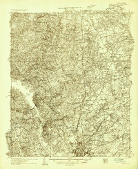
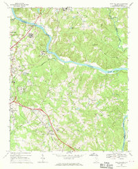
(41)- 1905 Map of Charlotte
 1905 Charlotte1905 Print · USGSCovers Lancaster County, including Charlotte, Matthews, and other nearby areas3 unique versions available
 - 1907 Map of Charlotte
 1907 Charlotte1907 Print · USGSCovers Lancaster County, including Charlotte, Matthews, and other nearby areas5 unique versions available
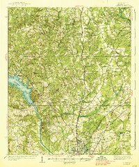
 - 1935 Map of Camden
 1935 Camden1935 Print · USGSCovers Lancaster County, including Camden, Knights Hill, and other nearby areas2 unique versions available
 - 1938 Map of Camden
 1938 Camden1938 Print · USGSCovers Lancaster County, including Camden, Knights Hill, and other nearby areas
 - 1941 Map of Charlotte
 1941 Charlotte1941 Print · USGSCovers Lancaster County, including Charlotte, Concord, and other nearby areas
 - 1941 Map of Spartanburg
 1941 Spartanburg1941 Print · USGSCovers Lancaster County, including Columbia, Rock Hill, and other nearby areas
 - 1942 Map of Charlotte
 1942 Charlotte1942 Print · USGSCovers Lancaster County, including Charlotte, Concord, and other nearby areas2 unique versions available
 - 1942 Map of Camden
 1942 Camden1942 Print · USGSCovers Lancaster County, including Columbia, Forest Acres, and other nearby areas
 - 1953 Map of Spartanburg, 1966 Print
 1953 Spartanburg1966 Print · USGSCovers Lancaster County, including Columbia, Rock Hill, and other nearby areas4 unique versions available
 - 1953 Map of Charlotte, 1968 Print
 1953 Charlotte1968 Print · USGSCovers Lancaster County, including Charlotte, Winston-Salem, and other nearby areas3 unique versions available
 - 1954 Map of Charlotte
 1954 Charlotte1954 Print · USGSCovers Lancaster County, including Charlotte, Winston-Salem, and other nearby areas2 unique versions available
 - 1960 Map of Charlotte
 1960 Charlotte1960 Print · USGSCovers Lancaster County, including Charlotte, Winston-Salem, and other nearby areas2 unique versions available
 - 1960 Map of Spartanburg
 1960 Spartanburg1960 Print · USGSCovers Lancaster County, including Columbia, Rock Hill, and other nearby areas
 - 1962 Map of Charlotte
 1962 Charlotte1962 Print · USGSCovers Lancaster County, including Charlotte, Winston-Salem, and other nearby areas
 - 1964 Map of Spartanburg
 1964 Spartanburg1964 Print · USGSCovers Lancaster County, including Columbia, Rock Hill, and other nearby areas
 - 1967 Map of Mount Pisgah, 1970 Print
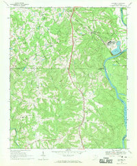
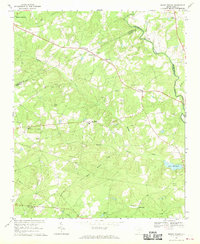 1967 Mount Pisgah1970 Print · USGSCovers Lancaster County, including Mount Pisgah, Minton Mill, and other nearby areas2 unique versions available
 - 1968 Map of Van Wyck, 1970 Print
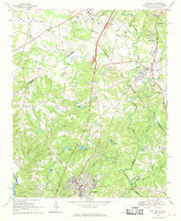
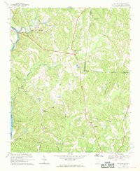 1968 Van Wyck1970 Print · USGSCovers Lancaster County, including Lancaster, Fosters Crossroads, and other nearby areas2 unique versions available
 - 1968 Map of Catawba, 1970 Print
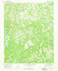
 1968 Catawba1970 Print · USGSCovers Lancaster County, including Roddey, Landsford, and other nearby areas
 - 1968 Map of Fort Mill, 1970 Print
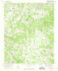
 1968 Fort Mill1970 Print · USGSCovers Lancaster County, including Charlotte, Fort Mill, and other nearby areas2 unique versions available
 - 1968 Map of Catawba NE, 1970 Print
 1968 Catawba NE1970 Print · USGSCovers Lancaster County, including Waxhaw, Weddington, and other nearby areas4 unique versions available
 - 1968 Map of Weddington, 1970 Print
 1968 Weddington1970 Print · USGSCovers Lancaster County, including Charlotte, Matthews, and other nearby areas4 unique versions available
 - 1968 Map of Rock Hill East, 1970 Print
 1968 Rock Hill East1970 Print · USGSCovers Lancaster County, including Rock Hill, Fort Mill, and other nearby areas4 unique versions available
 - 1968 Map of Lancaster SE, 1971 Print
 1968 Lancaster SE1971 Print · USGSCovers Lancaster County, including Blakley Crossroads, Cauthens Crossroads, and other nearby areas2 unique versions available
 - 1968 Map of Heath Springs, 1971 Print
 1968 Heath Springs1971 Print · USGSCovers Lancaster County, including Heath Springs, Stoneboro, and other nearby areas2 unique versions available
 - 1968 Map of Jefferson, 1971 Print
 1968 Jefferson1971 Print · USGSCovers Lancaster County, including Jefferson, White Plains, and other nearby areas
Showing maps 1-25 of 41
Top cities of Lancaster County
- Indian Land historical maps
- Lancaster historical maps
- Kershaw historical maps
- Heath Springs historical maps
Frequently asked questions
- What are the different types of historical maps available for Lancaster County?
- What is the oldest map of Lancaster County?
- Where can I purchase historical maps of Lancaster County for my home or office?
- Where can I download high-res historical maps of Lancaster County?
- Are there historical topographic maps available for Lancaster County?
- Is there historical aerial imagery available for Lancaster County?
- Where are historical maps of Lancaster County sourced from?