Old Maps of Lancaster County, South Carolina for Hiking & Exploration
Hike through history with 153 historic maps of Lancaster County. Explore old trails, ghost towns, and forgotten backroads — perfect for outdoor adventurers and local explorers.
- Rediscover forgotten places: Map out old mining camps, roads, and footpaths that no longer exist on modern maps.
- Layer with modern tools: Combine with LiDAR or satellite views to plan hikes through historical terrain.
- Made for exploration: Popular among hikers, overlanders, and local history lovers.
Use these maps to find adventure and explore the hidden past of Lancaster County.
Lancaster County, SC maps
(153)- 1905 Map of Charlotte
 1905 Charlotte1905 Print · USGSMecklenburg County at the start of the twentieth century shows a region connected by the early Southern Railway and a burgeoning city center. Genealogists can trace family roots through numerous rural landmarks like McClintock Church, Pineville, and Shopton.2 unique versions available
 - 1907 Map of Charlotte
 1907 Charlotte1907 Print · USGSGreater Charlotte was a bustling rail and textile corridor at the dawn of the twentieth century, bridging the two Carolinas. Genealogists can locate old family landmarks like Sutton School and Steel Creek Church or trace the early growth of Dilworth.4 unique versions available
 - 1935 Map of Camden
 1935 Camden1935 Print · USGSCamden and the Wateree River basin are captured here in the mid-1930s, showing a region balanced between traditional river-powered mills and new infrastructure. Genealogists can trace family footprints near rural landmarks like Rabon Cross Roads, Kirkley Mill, and the Baron de Kalb Sch.2 unique versions available
 - 1938 Map of Camden
 1938 Camden1938 Print · USGSMid-century Kershaw County comes alive here, showing the river-and-rail economy of the 1930s before modern development altered the landscape. Genealogists can trace family roots at Rabon Crossroads, Westville, and the many rural sites like Knight Hill Sch.2 unique versions available
 - 1941 Map of Charlotte
 1941 Charlotte1941 Print · USGSMecklenburg and its surrounding counties are captured here at a pivotal moment in the early 1940s. Genealogists and local historians can trace the rail-driven growth of Charlotte or locate smaller rural landmarks like Alexanders Store, Wesley Chapel, and the community at Stallings.
 - 1941 Map of Spartanburg
 1941 Spartanburg1941 Print · USGSSouth Carolina’s Piedmont and Sandhills regions are shown here during the mid-century peak of the rail era. Researchers can trace the sprawling Fort Jackson Military Reservation and the industrial growth of hubs like Spartanburg and Rock Hill.
 - 1942 Map of Charlotte
 1942 Charlotte1942 Print · USGSCharlotte and its surrounding Piedmont communities are captured here during the early years of the Second World War. Researchers can trace the rail corridors of the Southern and Seaboard Air Line or locate family-named sites like Alexanders Store, Hoods Cross Road, and Wesley Chapel.2 unique versions available
 - 1942 Map of Camden
 1942 Camden1942 Print · USGSMid-century South Carolina comes into focus along the Wateree River as the region's rail and agricultural networks reached their peak. Genealogists and historians can trace old community hubs like Boykin Mill, Friends Neck Ch, and the grounds of the Sand Hill Experimental Station.
 - 1953 Map of Spartanburg, 1966 Print
 1953 Spartanburg1966 Print · USGSMid-century South Carolina comes into focus through this survey of the Piedmont and the Sand Hills at a time of significant reservoir expansion. Researchers can trace the legacy of industrial transit and resource extraction from the Haile Gold Mine to the rail hubs of the Seaboard Air Line.4 unique versions available
 - 1953 Map of Charlotte, 1968 Print
 1953 Charlotte1968 Print · USGSThe North Carolina Piedmont and South Carolina borderlands are shown in detail during a period of significant growth and reservoir development. Trace the rail corridors of the Southern Railway or find family roots in towns like China Grove, Misenheimer, and Lincolnton.3 unique versions available
 - 1954 Map of Charlotte
 1954 Charlotte1954 Print · USGSThe North Carolina Piedmont in the mid-1950s shows a region of rapid growth and industrial expansion centered around Charlotte. Trace the era's infrastructure through the Southern railroad lines and locate significant landmarks like the Charlotte Naval Ammunition Depot and Lake Norman.2 unique versions available
 - 1960 Map of Charlotte
 1960 Charlotte1960 Print · USGSMid-century North Carolina and South Carolina meet in this 1960 survey of the Piedmont's industrial and textile heartland. Trace the growth of Charlotte alongside historic landmarks like Kings Mountain National Military Park and the Charlotte Naval Ammunition Depot.2 unique versions available
 - 1960 Map of Spartanburg
 1960 Spartanburg1960 Print · USGSThe South Carolina Piedmont and North Carolina borderlands come alive in this mid-century survey of the region between Spartanburg and Columbia. Researchers can trace the Seaboard Air Line railroad and explore landmarks like Anderson Quarry, Lake Murray, and Mount Croghan.2 unique versions available
 - 1962 Map of Charlotte
 1962 Charlotte1962 Print · USGSThe North Carolina Piedmont in the early sixties showcases a landscape transformed by massive reservoirs and industrial growth. Researchers can trace the development of Lake Norman, locate the Charlotte Naval Ammunition Depot, or find family landmarks like Wesley Chapel and Brown & Norcott Mills.
 - 1963 Map of Spartanburg
 1963 Spartanburg1963 Print · USGSMid-century South Carolina comes alive in this survey, showing the rail-linked corridor between the Upstate and the Midlands. Genealogists can trace family lands near old hubs like Union and Lancaster, or along the banks of the Broad River and Pee Dee River.
 - 1964 Map of Spartanburg
 1964 Spartanburg1964 Print · USGSMid-century South Carolina comes alive in this survey of the Piedmont and Upcountry, stretching from the Blue Ridge foothills to the Sandhills. Genealogists and historians can trace the rail-and-river economy through Monarch Mills, Glenn Springs, and the Southern Railway corridor.
 - 1967 Map of Mount Pisgah, 1970 Print
 1967 Mount Pisgah1970 Print · USGSKershaw County in the mid-1960s is a landscape of rural congregations and small-scale industry along the Lynches River. Researchers can locate family-named sites like Stroud Cem, historic mills such as Minton Mill, and community centers like Midway Crossroads.2 unique versions available
 - 1968 Map of Van Wyck, 1970 Print
 1968 Van Wyck1970 Print · USGSUpper Lancaster County comes into focus in the late sixties as the rail lines and river valleys shaped local life. Genealogists can locate family landmarks like White Oak Ch, Fosters Crossroads, and the Andrew Jackson Memorial.2 unique versions available
 - 1968 Map of Catawba, 1970 Print
 1968 Catawba1970 Print · USGSCatawba and the river valley are captured here in the late sixties as industry met the traditional rural landscape. Researchers can trace the footprints of community life at Lando Sch, the Worthy Boys Camp, and numerous country churches like Bethel Ch.
 - 1968 Map of Fort Mill, 1970 Print
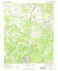 1968 Fort Mill1970 Print · USGSThe Carolina borderlands come to life in the late sixties as Fort Mill and Pineville transition from rural hubs to suburban neighborhoods. Genealogists can trace family roots at McClintock Ch, the Dinkins Cem, or near the James K Polk Birthplace.4 unique versions available
 - 1968 Map of Catawba NE, 1970 Print
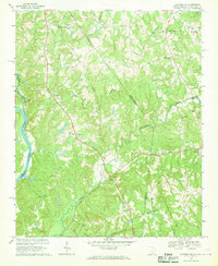 1968 Catawba NE1970 Print · USGSThe Carolina borderlands north of Lancaster come into focus in the late sixties, showing a landscape of rural school districts and crossroads churches. Genealogists can trace family footprints near Indian Land High Sch, Steel Hill Ch, and along the Seaboard Coast Line.4 unique versions available
 - 1968 Map of Weddington, 1970 Print
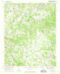 1968 Weddington1970 Print · USGSThe borderlands of Mecklenburg and Union counties are captured in the late sixties as suburban expansion begins to reach rural crossroads. Genealogists and local historians can trace legacy sites like Providence Ch, Weddington, and the early development of Olde Providence.4 unique versions available
 - 1968 Map of Rock Hill East, 1970 Print
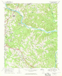 1968 Rock Hill East1970 Print · USGSYork and Lancaster counties meet along the winding Catawba River during a period of mid-century growth. Genealogists can trace family landmarks and rural life through Hopewell Cem, Hillcrest Sch, and the community of Red River.4 unique versions available
 - 1968 Map of Lancaster SE, 1971 Print
 1968 Lancaster SE1971 Print · USGSUpper South Carolina in the late sixties remains a landscape of rural crossroads and riverfront industry along the Catawba River. Genealogists and historians can trace family locations near Cauthens Crossroads, New Hope Ch, and Mount Carmel Cem.2 unique versions available
 - 1968 Map of Heath Springs, 1971 Print
 1968 Heath Springs1971 Print · USGSThe Lancaster and Kershaw county border comes alive in the late sixties, showing the rural communities along the Southern rail line. Researchers can locate the Hanging Rock Battleground, rural schools like Hillside High Sch, and numerous family cemeteries.2 unique versions available
Showing maps 1-25 of 153
Top cities of Lancaster County
- Indian Land historical maps
- Lancaster historical maps
- Kershaw historical maps
- Heath Springs historical maps
Frequently asked questions
- What are the different types of historical maps available for Lancaster County?
- What is the oldest map of Lancaster County?
- Where can I purchase historical maps of Lancaster County for my home or office?
- Where can I download high-res historical maps of Lancaster County?
- Are there historical topographic maps available for Lancaster County?
- Is there historical aerial imagery available for Lancaster County?
- Where are historical maps of Lancaster County sourced from?