Old Maps of Blenheim, South Carolina for Academic Research
Study the evolution of Blenheim with 10 high-resolution historic maps. Whether you're teaching, researching, or modeling changes in land use, these maps provide essential visual documentation of urban, environmental, and geographic change.
- Analyze long-term change: Track patterns in development, transportation, and natural features.
- Ideal for environmental or urban studies: Support academic projects with primary historical map data.
- Use in the classroom or lab: Educators and researchers rely on these maps to bring historical context to life.
These maps are a powerful tool for teaching, research, and visualizing how Blenheim has changed over the decades.
Blenheim, SC maps
(10)- 1942 Map of Rockingham, 1944 Print
 1942 Rockingham1944 Print · USGSThe North Carolina and South Carolina borderlands come alive in this wartime survey of the Pee Dee River valley. Researchers can trace historic mill sites like Burnt Factory Pond or locate family landmarks such as Roberdell and Old Sneedsboro.
 - 1943 Map of Gum Swamp
 1943 Gum Swamp1943 Print · USGSCoastal plain settlements and river islands define the Pee Dee region during the early years of World War II. Researchers can locate rural hubs like Bethea Cross Roads and trace family history through landmarks like Lower Marlboro High School and Annarate Church.2 unique versions available
 - 1953 Map of Florence, 1964 Print
 1953 Florence1964 Print · USGSThe Carolina borderlands in the mid-fifties were a landscape of vast river swamps and rising rail towns. Trace the legacy of the Seaboard Air Line through Florence or explore the wetlands surrounding Lake Waccamaw and the Green Swamp.3 unique versions available
 - 1954 Map of Florence
 1954 Florence1954 Print · USGSThe Carolinas borderlands come alive in the early fifties, showing the vital rail-and-river networks of the coastal plain. Genealogists can trace family footprints across the Green Swamp or through settlements like Red Springs, Chadbourn, and McColl.
 - 1972 Map of Drake, 1975 Print
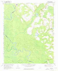 1972 Drake1975 Print · USGSMarlboro County rural life in the early seventies centered on the river bottoms and crossroads communities along the Pee Dee River. Researchers can locate family landmarks such as Cedar Falls Ch, Blenheim Sch, and the settlement of Drake.
 - 1972 Map of Bennettsville South, 1976 Print
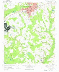 1972 Bennettsville South1976 Print · USGSBennettsville and the southern Marlboro County countryside are shown in detail during the early 1970s. Genealogists and researchers can trace family-named sites such as Driggers Chapel, McCall Cem, and Covington Millpond across this river-and-rail landscape.
 - 1983 Map of Laurinburg, 1984 Print
 1983 Laurinburg1984 Print · USGSThe Carolina borderlands come into focus in the early 1980s, showcasing a landscape defined by the Sandhills Game Land and major river systems. Genealogists and rail historians can trace the paths of the Seaboard Coast Line Railroad through Hamlet or locate St Andrews College and Cheraw State Park.2 unique versions available
 - 1983 Map of Florence, 1985 Print
 1983 Florence1985 Print · USGSThe Pee Dee region in the early eighties shows a landscape shaped by river commerce and rail expansion. Researchers can trace historic river crossings at Galivants Ferry or locate vanished rail stops like Willow Creek Siding and Blue Brick.
 - 2024 Map of Bennettsville South, 2024 Print
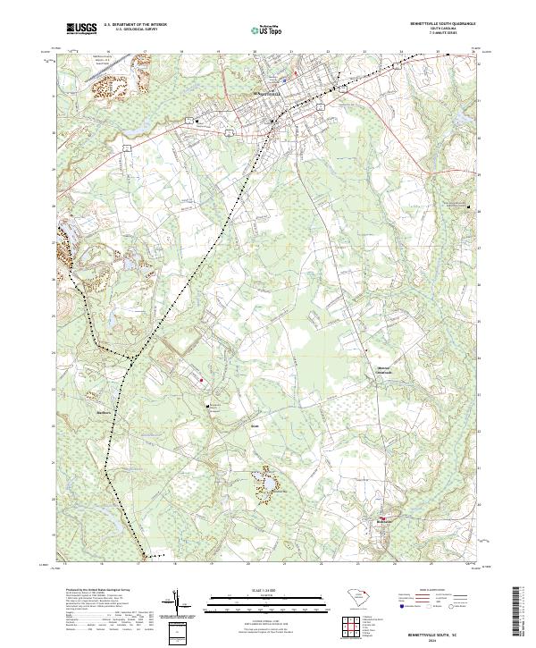 2024 Bennettsville South2024 Print · USGSMarlboro County centers on the growing town of Bennettsville and the rural agricultural tracts of the South Carolina Pee Dee. Genealogists can trace local roots at Evergreen Cem, Macedonia Church, and across the smaller settlements of Blenheim and Scott.
 - 2024 Map of Drake, 2024 Print
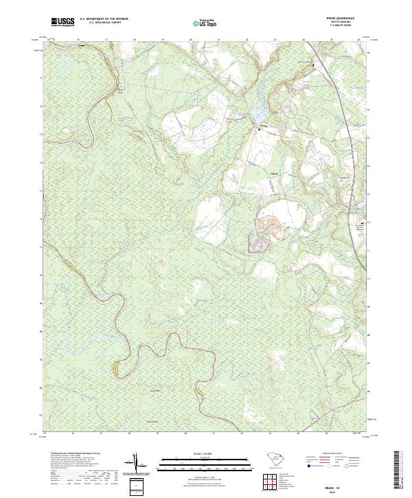 2024 Drake2024 Print · USGSMarlboro County’s riverine landscape is captured in the modern era as the Great Pee Dee River winds through the low country. Trace family history at Parnassus Graveyard or explore the rural surroundings of Drake and Genoa.
End of results
Showing maps 1-10 of 10
Top cities near Blenheim
- Laurinburg historical maps
- Bennettsville historical maps
- Darlington historical maps
- Cheraw historical maps
- McColl historical maps
- Clio historical maps
See more
Frequently asked questions
- What are the different types of historical maps available for Blenheim?
- What is the oldest map of Blenheim?
- Where can I purchase historical maps of Blenheim for my home or office?
- Where can I download high-res historical maps of Blenheim?
- Are there historical topographic maps available for Blenheim?
- Is there historical aerial imagery available for Blenheim?
- Where are historical maps of Blenheim sourced from?