Old Maps of Palmetto Garden, South Carolina for Genealogy
Trace your family roots with 14 historic maps of Palmetto Garden. These high-res maps reveal old neighborhoods, homesites, landmarks, and streets — helping you uncover where your ancestors lived and how the area evolved over time.
- Explore historic neighborhoods: Identify where your relatives may have lived in the 1800s or 1900s.
- Compare maps over time: Trace the changes in streets, buildings, and landmarks for multi-generational research.
- Perfect for genealogy & ancestry research: Used by family historians and researchers to map out lineage and migration.
These maps are an incredible resource for exploring your personal connection to Palmetto Garden's past.
Palmetto Garden, SC maps
(14)- 1946 Map of St. Matthews
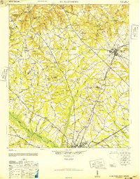 1946 St. Matthews1946 Print · USGSSouth Carolina’s agricultural heartland is documented here in the mid-forties as the rail lines connected rural crossroads to the county seat. Genealogists can trace family landmarks and community centers like Bethlehem Church, Hammond Crossroads, and the historic Old Ninety-Six Road.2 unique versions available
 - 1954 Map of Augusta
 1954 Augusta1954 Print · USGSThe Savannah River valley and South Carolina Midlands are captured here during a period of post-war growth. Researchers can trace the rail-and-river economy through the Southern RR corridor and locate historic settlements like Aiken, Orangeburg, and Sumter.
 - 1957 Map of Augusta, 1966 Print
 1957 Augusta1966 Print · USGSThe Savannah River and Santee basins are captured here during a period of massive military and industrial expansion in the late fifties. Genealogists can trace family footprints across Four Hole Swamp or near the Savannah River Plant.3 unique versions available
 - 1958 Map of Augusta
 1958 Augusta1958 Print · USGSThe borderlands between Georgia and South Carolina come alive in the 1950s, showing the early footprint of the Savannah River Plant. Genealogists and historians can trace rail-dependent towns and rural landmarks from Orangeburg to the Fort Jackson Military Reservation.
 - 1961 Map of Augusta
 1961 Augusta1961 Print · USGSThe South Carolina lowcountry and CSRA appear here in the early sixties, during a period of massive military and industrial growth. Researchers can trace the development of the Savannah River Plant or locate legacy landmarks like Nelson Ferry and Magnolia Cemetery.2 unique versions available
 - 1962 Map of Augusta
 1962 Augusta1962 Print · USGSThe South Carolina and Georgia borderlands are seen here in the early sixties, showing the rise of the Savannah River Plant and the expansion of Fort Jackson. Researchers can trace old rail lines like the Southern Railway and find landmarks such as St. Pauls Church or the Santee Canal.
 - 1986 Map of Sumter
 1986 Sumter1986 Print · USGSMid-South Carolina in the mid-eighties reveals a landscape of massive river bottomlands and significant military installations. Genealogists and historians can trace the rural networks around Fort Motte, Lone Star, and Sardinia alongside Lake Marion.
 - 1987 Map of Orangeburg North, 1988 Print
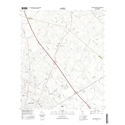
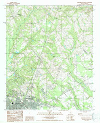 1987 Orangeburg North1988 Print · USGSThe northern reaches of Orangeburg and the surrounding rural plains are captured in the late eighties just as the city began expanding. Genealogists and local historians can trace family-named areas like Riley, Jamison, and Fersners amidst the reaches of Four Hole Swamp.
 - 1990 Map of Sumter
 1990 Sumter1990 Print · USGSCentral South Carolina's river systems and military landscapes are captured here during the late twentieth century. Genealogists and historians can trace the growth of Sumter or locate rural communities such as Wedgefield and Kingville near the Congaree River.
 - 2011 Map of Orangeburg North, 2011 Print
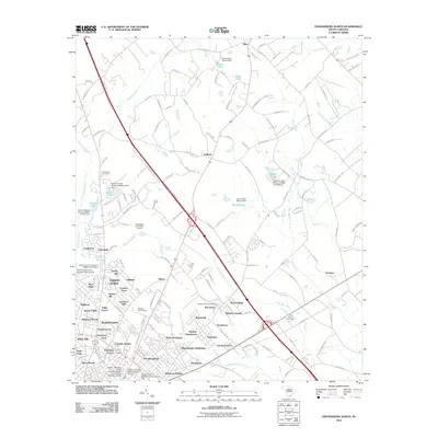 2011 Orangeburg North2011 Print · USGSCovers Palmetto Garden, including Orangeburg, Mackay Subdivision, and other nearby areas
 - 2014 Map of Orangeburg North, 2014 Print
 2014 Orangeburg North2014 Print · USGSCovers Palmetto Garden, including Orangeburg, Mackay Subdivision, and other nearby areas
 - 2017 Map of Orangeburg North, 2017 Print
 2017 Orangeburg North2017 Print · USGSCovers Palmetto Garden, including Orangeburg, Mackay Subdivision, and other nearby areas
 - 2020 Map of Orangeburg North, 2020 Print
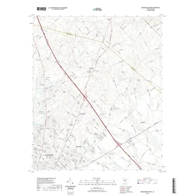 2020 Orangeburg North2020 Print · USGSCovers Palmetto Garden, including Orangeburg, Mackay Subdivision, and other nearby areas
 - 2024 Map of Orangeburg North, 2024 Print
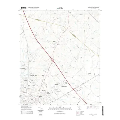
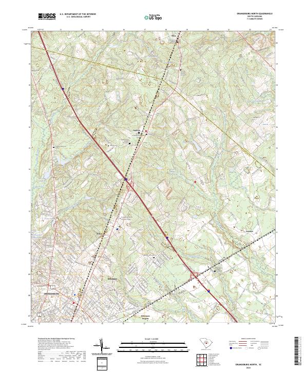 2024 Orangeburg North2024 Print · USGSThe northern reaches of Orangeburg and the edge of Calhoun County appear here in the early twenty-first century. Researchers can locate community landmarks such as Mount Sinai Church, the Prospect Cem, and the rural crossroads of Jamison.
End of results
Showing maps 1-14 of 14
Top cities near Palmetto Garden
- Orangeburg historical maps
- Bamberg historical maps
- Saint Matthews historical maps
- Bowman historical maps
- Cameron historical maps
- Rowesville historical maps
See more
Frequently asked questions
- What are the different types of historical maps available for Palmetto Garden?
- What is the oldest map of Palmetto Garden?
- Where can I purchase historical maps of Palmetto Garden for my home or office?
- Where can I download high-res historical maps of Palmetto Garden?
- Are there historical topographic maps available for Palmetto Garden?
- Is there historical aerial imagery available for Palmetto Garden?
- Where are historical maps of Palmetto Garden sourced from?