1950s Maps of North Trace, Richland County
Explore 3 historic maps of North Trace from the 1950s. These maps offer a rare glimpse into what life looked like during the 1950s — showing old roads, neighborhoods, homes, and landmarks that have changed or disappeared over time.
Whether you're researching your family's past, planning a metal detecting trip, or studying how North Trace's landscape evolved across the 1950s, these high-resolution maps are a powerful tool for exploring the history of this region.
- Focus on a specific era: All maps on this page are from the 1950s, giving you a focused view of this time period.
- See what’s changed: Compare century-old streets, trails, and buildings to today's modern landscape using overlays and satellite layers.
- Research with precision: Use these maps for genealogy, historical research, land use analysis, or educational projects.
- View, download, or print: Maps are fully viewable online in high resolution, and can be downloaded or printed for your own records.
Start exploring North Trace's history through authentic maps from the 1950s. This is your window into the past.
North Trace, Richland County maps
(3)- 1953 Map of Blythewood, 1957 Print
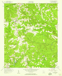 1953 Blythewood1957 Print · USGSMid-century Richland County is captured here at a time when rural schoolhouses and local rail lines still shaped the community north of Columbia. Genealogists can trace family footprints at Browns Cemetery or follow the SOUTHERN railroad through Blythewood and Killian.
 - 1953 Map of Fort Jackson North, 1957 Print
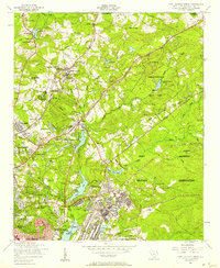 1953 Fort Jackson North1957 Print · USGSMid-century Richland County is caught in transition as the outskirts of Columbia expand toward the Fort Jackson Military Reservation. Researchers can trace the development of early suburbs like Forest Acres alongside older landmarks like the South Carolina Sanatorium and the Alta Vista Drive-In Theater.2 unique versions available
 - 1953 Map of Spartanburg, 1966 Print
 1953 Spartanburg1966 Print · USGSMid-century South Carolina comes into focus through this survey of the Piedmont and the Sand Hills at a time of significant reservoir expansion. Researchers can trace the legacy of industrial transit and resource extraction from the Haile Gold Mine to the rail hubs of the Seaboard Air Line.4 unique versions available
End of results
Showing maps 1-3 of 3
Frequently asked questions
- What are the different types of historical maps available for North Trace?
- What is the oldest map of North Trace?
- Where can I purchase historical maps of North Trace for my home or office?
- Where can I download high-res historical maps of North Trace?
- Are there historical topographic maps available for North Trace?
- Is there historical aerial imagery available for North Trace?
- Where are historical maps of North Trace sourced from?