
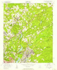
1953 Map of Blythewood
USGS Topo · Published 1957About this map
Blythewood serves as a central hub on this mid-century survey of the South Carolina midlands, situated where the Southern RR railway cuts through the rolling landscape of Richland and Fairfield counties. The town is surrounded by a dense network of country schools and churches that define its social geography, including Bethel High School, Blythewood School, and Saint Marks Church. To the south, the landscape shifts toward agricultural research and recreation at the Clemson College Sandhill Experiment Station, located near the small community of Killian.
Find a feature on this map
45 named features on this map. Tap any name to fly to it.
Don’t see what you’re looking for? This feature index may not catch every label — zoom into the map to look around manually.
Map Details
Editions of this 1953 Blythewood Map
This is the sole edition of this map. No revisions or reprints were ever made.
Other maps of this area

1904 · Columbia
USGS Topo · 1:125,000

1935 · Killian
USGS Topo · 1:48,000

1937 · Killian
USGS Topo · 1:62,500

1941 · Spartanburg
USGS Topo · 1:250,000

1942 · Camden
USGS Topo · 1:125,000

1947 · Columbia North
USGS Topo · 1:24,000

1948 · Columbia North
USGS Topo · 1:24,000

1949 · Irmo NE
USGS Topo · 1:24,000

1953 · Messers Pond
USGS Topo · 1:24,000
1953 · Fort Jackson North
USGS Topo · 1:24,000