
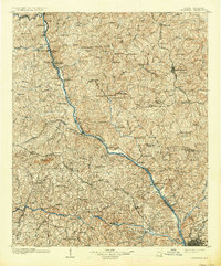
1904 Map of Columbia
USGS Topo · Published 1904About this map
Broad River and Little River anchor this early 20th-century landscape, where a dense network of ferries and fords facilitated movement before modern bridges dominated the region. The map reveals a rural economy centered on settlements like Winnsboro and Shelton, connected by the Southern R.R. and the Asheville and Columbia Road. Local history is preserved through numerous ecclesiastical landmarks, such as The Old Brick Church and Salem Church, alongside industrial and agricultural features like Anderson Quarry and the State Farm near the capital. The convergence of the Tiger River, Enoree River, and Broad River in the northwest highlights the geographic importance of these waterways for the regional boundary lines of Fairfield, Newberry, and Richland counties. From the mills like Frosts Mill to the post office at Simpson, the survey documents a transition era where river-crossings like Bells Bridge and Shelton Ferry remained vital to local transit.
Find a feature on this map
132 named features on this map. Tap any name to fly to it.
Don’t see what you’re looking for? This feature index may not catch every label — zoom into the map to look around manually.
Map Details
Editions of this 1904 Columbia Map
2 editions found
Other maps of this area

1935 · Killian
USGS Topo · 1:48,000

1937 · Killian
USGS Topo · 1:62,500

1941 · Spartanburg
USGS Topo · 1:250,000

1942 · Camden
USGS Topo · 1:125,000

1944 · Gilbert
USGS Topo · 1:62,500

1944 · Edmund
USGS Topo · 1:62,500

1946 · Irmo
USGS Topo · 1:24,000

1947 · Columbia North
USGS Topo · 1:24,000

1947 · Richtex
USGS Topo · 1:24,000

1948 · Hopkins
USGS Topo · 1:62,500