Old Maps of Springfeild, Spartanburg County for Hiking & Exploration
Hike through history with 33 historic maps of Springfeild. Explore old trails, ghost towns, and forgotten backroads — perfect for outdoor adventurers and local explorers.
- Rediscover forgotten places: Map out old mining camps, roads, and footpaths that no longer exist on modern maps.
- Layer with modern tools: Combine with LiDAR or satellite views to plan hikes through historical terrain.
- Made for exploration: Popular among hikers, overlanders, and local history lovers.
Use these maps to find adventure and explore the hidden past of Springfeild.
Springfeild, Spartanburg County maps
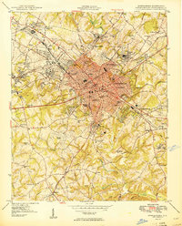
(33)- 1907 Map of Saluda
 1907 Saluda1907 Print · USGSCovers Springfeild, including Greer, Hendersonville, and other nearby areas3 unique versions available
 - 1935 Map of Greer
 1935 Greer1935 Print · USGSCovers Springfeild, including Greer, Simpsonville, and other nearby areas
 - 1938 Map of Greer
 1938 Greer1938 Print · USGSCovers Springfeild, including Greer, Simpsonville, and other nearby areas2 unique versions available
 - 1941 Map of Spartanburg
 1941 Spartanburg1941 Print · USGSCovers Springfeild, including Columbia, Rock Hill, and other nearby areas
 - 1947 Map of Spartanburg, 1969 Print
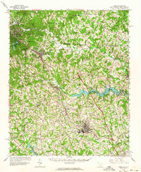
 1947 Spartanburg1969 Print · USGSCovers Springfeild, including Spartanburg, Pacolet, and other nearby areas
 - 1949 Map of Spartanburg
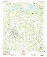
 1949 Spartanburg1949 Print · USGSCovers Springfeild, including Spartanburg, Roebuck, and other nearby areas3 unique versions available
 - 1949 Map of Spartanburg
 1949 Spartanburg1949 Print · USGSCovers Springfeild, including Spartanburg, Pacolet, and other nearby areas
 - 1953 Map of Spartanburg, 1966 Print
 1953 Spartanburg1966 Print · USGSCovers Springfeild, including Columbia, Rock Hill, and other nearby areas4 unique versions available
 - 1953 Map of Charlotte, 1968 Print
 1953 Charlotte1968 Print · USGSCovers Springfeild, including Charlotte, Winston-Salem, and other nearby areas3 unique versions available
 - 1954 Map of Charlotte
 1954 Charlotte1954 Print · USGSCovers Springfeild, including Charlotte, Winston-Salem, and other nearby areas2 unique versions available
 - 1954 Map of Greenville, 1965 Print
 1954 Greenville1965 Print · USGSCovers Springfeild, including Athens, Greenville, and other nearby areas2 unique versions available
 - 1955 Map of Knoxville
 1955 Knoxville1955 Print · USGSCovers Springfeild, including Knoxville, Asheville, and other nearby areas
 - 1957 Map of Greer, 1959 Print
 1957 Greer1959 Print · USGSCovers Springfeild, including Greer, Simpsonville, and other nearby areas2 unique versions available
 - 1957 Map of Knoxville, 1966 Print
 1957 Knoxville1966 Print · USGSCovers Springfeild, including Knoxville, Asheville, and other nearby areas4 unique versions available
 - 1958 Map of Greenville
 1958 Greenville1958 Print · USGSCovers Springfeild, including Athens, Greenville, and other nearby areas
 - 1959 Map of Cowpens, 1961 Print
 1959 Cowpens1961 Print · USGSCovers Springfeild, including Cowpens, Chesnee, and other nearby areas2 unique versions available
 - 1960 Map of Knoxville
 1960 Knoxville1960 Print · USGSCovers Springfeild, including Knoxville, Asheville, and other nearby areas2 unique versions available
 - 1960 Map of Charlotte
 1960 Charlotte1960 Print · USGSCovers Springfeild, including Charlotte, Winston-Salem, and other nearby areas2 unique versions available
 - 1960 Map of Spartanburg
 1960 Spartanburg1960 Print · USGSCovers Springfeild, including Columbia, Rock Hill, and other nearby areas
 - 1961 Map of Inman, 1964 Print
 1961 Inman1964 Print · USGSCovers Springfeild, including Inman, Landrum, and other nearby areas
 - 1962 Map of Charlotte
 1962 Charlotte1962 Print · USGSCovers Springfeild, including Charlotte, Winston-Salem, and other nearby areas
 - 1964 Map of Spartanburg
 1964 Spartanburg1964 Print · USGSCovers Springfeild, including Columbia, Rock Hill, and other nearby areas
 - 1964 Map of Knoxville
 1964 Knoxville1964 Print · USGSCovers Springfeild, including Knoxville, Asheville, and other nearby areas
 - 1983 Map of Inman
 1983 Inman1983 Print · USGSCovers Springfeild, including Inman, Boiling Springs, and other nearby areas
 - 1983 Map of Spartanburg
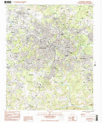 1983 Spartanburg1983 Print · USGSCovers Springfeild, including Spartanburg, Roebuck, and other nearby areas
Showing maps 1-25 of 33
Frequently asked questions
- What are the different types of historical maps available for Springfeild?
- What is the oldest map of Springfeild?
- Where can I purchase historical maps of Springfeild for my home or office?
- Where can I download high-res historical maps of Springfeild?
- Are there historical topographic maps available for Springfeild?
- Is there historical aerial imagery available for Springfeild?
- Where are historical maps of Springfeild sourced from?