1900s (20th Century) Maps of Tapp Circle, South Carolina
Explore 17 historic maps of Tapp Circle from the 1900s (20th Century). These maps offer a rare glimpse into what life looked like during the 1900s — showing old roads, neighborhoods, homes, and landmarks that have changed or disappeared over time.
Whether you're researching your family's past, planning a metal detecting trip, or studying how Tapp Circle's landscape evolved across the 1900s, these high-resolution maps are a powerful tool for exploring the history of this region.
- Focus on a specific era: All maps on this page are from the 1900s, giving you a focused view of this time period.
- See what’s changed: Compare century-old streets, trails, and buildings to today's modern landscape using overlays and satellite layers.
- Research with precision: Use these maps for genealogy, historical research, land use analysis, or educational projects.
- View, download, or print: Maps are fully viewable online in high resolution, and can be downloaded or printed for your own records.
Start exploring Tapp Circle's history through authentic maps from the 1900s. This is your window into the past.
Tapp Circle, SC maps
(17)- 1907 Map of Saluda
 1907 Saluda1907 Print · USGSNorth Carolina's mountain frontier meets the South Carolina foothills in this 1900s survey of the Blue Ridge. Genealogists and researchers can trace the early rail network through Saluda and locate old landmarks like Rockcliff PO and Pleasant Grove Church.3 unique versions available
 - 1935 Map of Greer
 1935 Greer1935 Print · USGSThe industrial textile hubs and rural communities of the South Carolina Piedmont thrive along the rail lines during the mid-thirties. Genealogists and local historians can trace family locations near Victor Mills, Hanson Academy, and numerous country churches like Woods Chapel.
 - 1938 Map of Greer
 1938 Greer1938 Print · USGSUpstate South Carolina during the mid-1930s was a landscape of bustling textile centers and quiet rural crossroads. Genealogists and historians can trace family roots through numerous local landmarks like Woods Chapel, Jackson Mill, and the CCC Camp near Switzer.3 unique versions available
 - 1954 Map of Greenville, 1965 Print
 1954 Greenville1965 Print · USGSThe Upstate and Northeast Georgia are captured here during a decade of massive transformation as new reservoirs reshaped the Piedmont. Genealogists and hikers can trace the Appalachian Trail over Brasstown Bald or locate old community centers like Demorest, Westminster, and Royston.3 unique versions available
 - 1955 Map of Knoxville
 1955 Knoxville1955 Print · USGSThe Southern Appalachians and the Smoky Mountains are shown here at a peak of mid-century development and conservation. Genealogists and historians can trace the early road networks connecting Gatlinburg, Waynesville, and the Cherokee Indian Reservation across the high ridges.
 - 1957 Map of Greer, 1959 Print
 1957 Greer1959 Print · USGSThe Upstate South Carolina textile corridor comes to life in this mid-century survey of the Tyger River valleys. Researchers can trace the industrial footprint of Victor Mills, locate early country churches like Old Pilgrim Ch, and explore the residential growth around Greer and Lyman.2 unique versions available
 - 1957 Map of Knoxville, 1966 Print
 1957 Knoxville1966 Print · USGSThe Southern Appalachians of Tennessee and North Carolina are mapped here during the mid-twentieth century as new highways reached the high country. Genealogists and historians can trace the topography between Knoxville and Asheville, locating family landmarks near Fontana Lake or along the Blue Ridge Parkway.4 unique versions available
 - 1958 Map of Greenville
 1958 Greenville1958 Print · USGSThe Piedmont and Blue Ridge foothills come alive in this mid-century survey of the Upstate and Northeast Georgia. Trace the regional rail-and-river economy through the Southern Railway corridors and early reservoir developments like Lake Sidney Lanier.
 - 1960 Map of Knoxville
 1960 Knoxville1960 Print · USGSThe Southern Appalachians come alive in the 1950s, showing the intersection of new national park tourism and deep-rooted mountain industry. Trace old rail lines like the Clinchfield RR and find high-altitude landmarks from Mt Le Conte to the Cherokee Indian Reservation.2 unique versions available
 - 1961 Map of Inman, 1964 Print
 1961 Inman1964 Print · USGSUpper Spartanburg County and Polk County thrive in the early sixties as the textile industry and new reservoirs reshape the landscape. Genealogists can locate family names at Morgan Chapel Cem and Polk Memorial Gardens, or trace early industrial hubs like Inman Mills.
 - 1964 Map of Knoxville
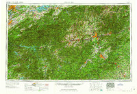 1964 Knoxville1964 Print · USGSThe Southern Appalachians and Great Smokies are captured here during the mid-sixties, showing the rugged borderlands of Tennessee and North Carolina. Researchers can trace historic mountain routes like U S 441, the expanse of Pisgah National Forest, and the growing footprints of Asheville and Knoxville.
 - 1983 Map of Campobello
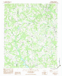 1983 Campobello1983 Print · USGSThe Greenville and Spartanburg borderlands appear here in the early 1980s, centered on the railroad town of Campobello. Genealogists and local historians can trace rural family landmarks like Pleasant Grove Cemetery and old country churches including Motlow Creek Church and Mt View Church.
 - 1983 Map of Greer
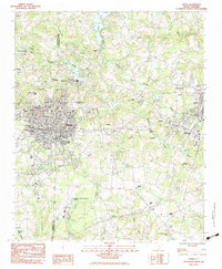 1983 Greer1983 Print · USGSThe industrial and rail corridor of the South Carolina Upstate comes into focus here in the early eighties. Researchers can trace textile heritage and community roots through Victor Mills, Apalache, and old landmarks like Woods Chapel.
 - 1984 Map of Greenville
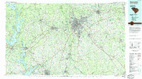 1984 Greenville1984 Print · USGSThe South Carolina Upstate undergoes rapid suburban growth in the mid-eighties as modern interstates begin to reshape the landscape. Researchers can trace historic rail lines like the Greenville and Northern Railway and locate local landmarks such as Clemson University and Paris Mountain State Park.
 - 1986 Map of Hendersonville
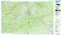 1986 Hendersonville1986 Print · USGSThe Blue Ridge foothills of North and South Carolina are documented here in the mid-eighties as modern highways began to reshape mountain travel. Local historians can trace the paths of the Southern Railway through Hendersonville or locate landmarks like Looking Glass Rock and Inman Mills.2 unique versions available
 - 1991 Map of Greenville
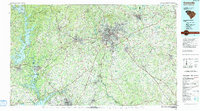 1991 Greenville1991 Print · USGSThe South Carolina Upstate was a landscape of rapid growth and engineering in the early nineties. Researchers can trace the expansion of Greenville and Spartanburg, find Clemson University, or study the massive reservoirs of Hartwell Lake and Lake Keowee.
 - 1994 Map of Greer, 2000 Print
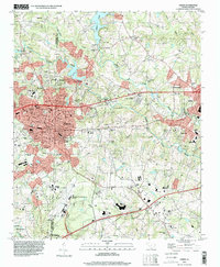 1994 Greer2000 Print · USGSThe industrial corridor between Greenville and Spartanburg comes to life in the mid-1990s as it transitions from its textile roots toward modern regional infrastructure. Genealogists and historians can trace the legacy of local congregations and family landmarks from Victor Mills and Washington Cem to the banks of Lake Lyman.
End of results
Showing maps 1-17 of 17
Frequently asked questions
- What are the different types of historical maps available for Tapp Circle?
- What is the oldest map of Tapp Circle?
- Where can I purchase historical maps of Tapp Circle for my home or office?
- Where can I download high-res historical maps of Tapp Circle?
- Are there historical topographic maps available for Tapp Circle?
- Is there historical aerial imagery available for Tapp Circle?
- Where are historical maps of Tapp Circle sourced from?