Old Maps of Derian Subdivision, Aberdeen Township for Hiking & Exploration
Hike through history with 9 historic maps of Derian Subdivision. Explore old trails, ghost towns, and forgotten backroads — perfect for outdoor adventurers and local explorers.
- Rediscover forgotten places: Map out old mining camps, roads, and footpaths that no longer exist on modern maps.
- Layer with modern tools: Combine with LiDAR or satellite views to plan hikes through historical terrain.
- Made for exploration: Popular among hikers, overlanders, and local history lovers.
Use these maps to find adventure and explore the hidden past of Derian Subdivision.
Derian Subdivision, Aberdeen Township maps
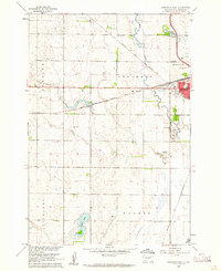
(9)- 1899 Map of Northville
 1899 Northville1899 Print · USGSNortheastern South Dakota in the 1890s was a landscape defined by the expansion of the rails and the settlement of the prairie. You can trace the path of the Chicago and Northwestern RR through early townsites like Northville and Rudolph.2 unique versions available
 - 1954 Map of Aberdeen, 1964 Print
 1954 Aberdeen1964 Print · USGSNortheastern South Dakota in the mid-fifties remains a world of rail-dependent prairie towns and sweeping waterfowl refuges. Genealogists can trace family roots through settlements like Eureka and Ipswich or locate rural landmarks near Richmond Lake.2 unique versions available
 - 1956 Map of Aberdeen
 1956 Aberdeen1956 Print · USGSUpper South Dakota during the mid-fifties remains a landscape of rail-connected farming towns and expansive glacial lake basins. Genealogists and historians can trace the paths of the Minneapolis and St Louis railroad through Gettysburg or locate vanished stops near Elm Lake and Richmond Lake.
 - 1960 Map of Aberdeen West, 1961 Print
 1960 Aberdeen West1961 Print · USGSAberdeen in the early sixties was a bustling rail hub where major prairie lines converged near the growing city center. Researchers can trace local landmarks like Riverside Cemetery, find neighborhood schools such as Lincoln Sch, and locate the mid-century Drive-in Theater.3 unique versions available
 - 1985 Map of Aberdeen
 1985 Aberdeen1985 Print · USGSThe James River valley of South Dakota is seen here in the mid-eighties, centered on the growing hub of Aberdeen. Genealogists and historians can trace the rail corridors of the Chicago and North Western or find rural landmarks like Bath Corner and South Scatterwood Lake.2 unique versions available
 - 2012 Map of Aberdeen West, 2012 Print
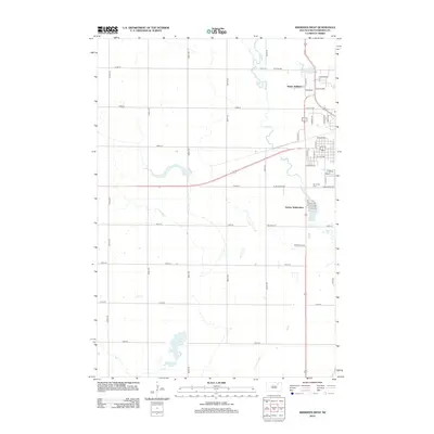 2012 Aberdeen West2012 Print · USGSCovers Derian Subdivision, including Aberdeen, Mercier Township, and other nearby areas
 - 2015 Map of Aberdeen West, 2015 Print
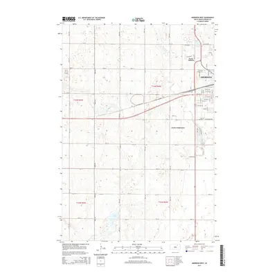 2015 Aberdeen West2015 Print · USGSCovers Derian Subdivision, including Aberdeen, Mercier Township, and other nearby areas
 - 2017 Map of Aberdeen West, 2017 Print
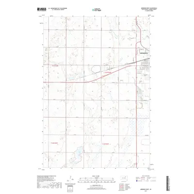 2017 Aberdeen West2017 Print · USGSCovers Derian Subdivision, including Aberdeen, Mercier Township, and other nearby areas
 - 2021 Map of Aberdeen West, 2021 Print
 2021 Aberdeen West2021 Print · USGSAberdeen and its surrounding prairie landscape are documented in this recent survey of Brown County. Family researchers and locals can trace the development of the city grid out to Riverside Cem and water features like Wylie Lake and Lords Lake.
End of results
Showing maps 1-9 of 9
Top cities near Derian Subdivision
- Aberdeen historical maps
- Bath historical maps
- Warner historical maps
- Ordway historical maps
- Columbia historical maps
- Westport historical maps
See more
Frequently asked questions
- What are the different types of historical maps available for Derian Subdivision?
- What is the oldest map of Derian Subdivision?
- Where can I purchase historical maps of Derian Subdivision for my home or office?
- Where can I download high-res historical maps of Derian Subdivision?
- Are there historical topographic maps available for Derian Subdivision?
- Is there historical aerial imagery available for Derian Subdivision?
- Where are historical maps of Derian Subdivision sourced from?