1900s (20th Century) Maps of Eldorado Township, South Dakota
Explore 17 historic maps of Eldorado Township from the 1900s (20th Century). These maps offer a rare glimpse into what life looked like during the 1900s — showing old roads, neighborhoods, homes, and landmarks that have changed or disappeared over time.
Whether you're researching your family's past, planning a metal detecting trip, or studying how Eldorado Township's landscape evolved across the 1900s, these high-resolution maps are a powerful tool for exploring the history of this region.
- Focus on a specific era: All maps on this page are from the 1900s, giving you a focused view of this time period.
- See what’s changed: Compare century-old streets, trails, and buildings to today's modern landscape using overlays and satellite layers.
- Research with precision: Use these maps for genealogy, historical research, land use analysis, or educational projects.
- View, download, or print: Maps are fully viewable online in high resolution, and can be downloaded or printed for your own records.
Start exploring Eldorado Township's history through authentic maps from the 1900s. This is your window into the past.
Eldorado Township, SD maps
(17)- 1941 Map of Pukwana
 1941 Pukwana1941 Print · USGSBrule County farming and the Crow Creek Indian Reservation meet in this pre-war survey of central South Dakota. Researchers can locate nearly twenty individual schoolhouses, such as Victory Sch and Olson Sch, alongside the Vega Cem and Row Creek Cem.
 - 1941 Map of Kimball North
 1941 Kimball North1941 Print · USGSBrule County's agricultural heartland is documented here on the eve of the Second World War, showing a landscape defined by rail and rural schools. Genealogists can trace family footprints near Kimball or locate specific country schools like Fagerhaug Sch and Brooks Sch.
 - 1951 Map of Pukwana, 1953 Print
 1951 Pukwana1953 Print · USGSBrule County in the early fifties is mapped here during a period of established rail transport and rural schoolhouse networks. Genealogists can locate family names and sites such as St Peters Mission, Coolidge Sch, and the town of Pukwana.
 - 1951 Map of Kimball North, 1953 Print
 1951 Kimball North1953 Print · USGSBrule County and the surrounding prairie are captured here in the early fifties, showing a landscape defined by small-town life and rural school districts. Genealogists can locate family landmarks like Lyonville, Crow Lake Ch, and the Brooks Sch.
 - 1953 Map of Huron, 1959 Print
 1953 Huron1959 Print · USGSCentral South Dakota comes alive in the mid-1950s as a thriving rail and agricultural corridor between the Missouri and James Rivers. Trace the legacy of family farms and prairie towns like Huron, Faulkton, and Wessington Springs along the historic Chicago and North Western rail lines.3 unique versions available
 - 1954 Map of Huron, 1977 Print
 1954 Huron1977 Print · USGSCentral South Dakota was a landscape of grain elevators and river bends during the mid-fifties. Genealogists and historians can trace the development of the James River valley through railroad towns like Redfield and the sprawling Crow Creek Indian Reservation.
 - 1955 Map of Mitchell, 1973 Print
 1955 Mitchell1973 Print · USGSThe Missouri River valley undergoes a massive transformation in the mid-1950s as the Fort Randall Dam creates Lake Francis Case. You can trace the rail lines of the Chicago Milwaukee St Paul and Pacific through Mitchell or locate local landmarks like Butler Town Hall.2 unique versions available
 - 1959 Map of Mitchell
 1959 Mitchell1959 Print · USGSSouth Dakota’s river and rail corridors come alive in the late fifties as the Missouri River valley undergoes dramatic change. Genealogists and historians can trace family roots through numerous small towns and schools such as Academy, Stickney, and Gregory.2 unique versions available
 - 1973 Map of Big Bend Dam 4 SE, 1976 Print
 1973 Big Bend Dam 4 SE1976 Print · USGSBuffalo County is documented here in the 1970s, showcasing the prairie townships and historical survey lines of central South Dakota. Researchers can locate the small settlements of Anderson and Gann and trace the path of the Old Indian Treaty Boundary.2 unique versions available
 - 1973 Map of Gannvalley, 1976 Print
 1973 Gannvalley1976 Print · USGSThe Buffalo and Jerauld county line comes alive in the mid-1970s, showcasing the communal Spring Valley Colony and the rural reaches of Crow Creek. Local researchers can trace family lands in Eden or Elvira and locate the Spring Hill Cem.
 - 1982 Map of Lyonville, 1983 Print
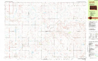 1982 Lyonville1983 Print · USGSThe rural crossroads of South Dakota come to life in this early 1980s survey of the plains where four counties converge. Genealogists and local historians can locate community pillars like Lyon Sch, the Crow Lake Ch, and the Salem Cem.
 - 1983 Map of Pukwana NE
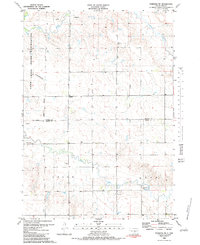 1983 Pukwana NE1983 Print · USGSBuffalo and Brule counties in the early 1980s showcase a vast stretch of prairie defined by the Crow Creek Indian Reservation. Local history enthusiasts can trace the meandering paths of Crow Creek and Smith Creek through the open landscape.
 - 1985 Map of Huron, 1986 Print
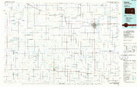 1985 Huron1986 Print · USGSThe James River valley and the city of Huron come into focus during the mid-eighties as centers of rail and prairie commerce. Genealogists and historians can trace communal sites like Riverside Colony and established rail towns from Wolsey to Woonsocket.2 unique versions available
 - 1985 Map of Big Bend Dam, 1986 Print
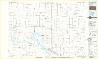 1985 Big Bend Dam1986 Print · USGSThe Missouri River landscape of the mid-1980s is defined by the massive Big Bend Dam and the sprawling waters of Lake Sharpe. Genealogists and historians can trace reservation boundaries and rural outposts like Fort Thompson, Stephan, and the Miller Dale Colony.2 unique versions available
 - 1986 Map of Chamberlain
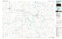 1986 Chamberlain1986 Print · USGSCentral South Dakota during the mid-eighties shows a landscape shaped by the Missouri River and the rise of Interstate 90. Researchers can trace the development of river towns like Chamberlain and Oacoma or locate remote landmarks like Bijou Hills and Hamill.2 unique versions available
 - 1986 Map of Mitchell
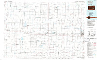 1986 Mitchell1986 Print · USGSMitchell and the surrounding prairie towns are documented in the mid-1980s as the regional rail and agricultural network matured. Genealogists can locate specific sites like the State Training Sch, Aurora Center, and the Cedar Grove Colony.2 unique versions available
 - 1990 Map of Mitchell, 1991 Print
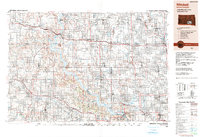 1990 Mitchell1991 Print · USGSThe Missouri River and the surrounding South Dakota plains are captured here in the early nineties, showing a landscape shaped by water and wire. Genealogists and historians can trace the gridded townships from Mitchell to the Bijou Hills, locating sites like the Platte Colony and Academy.
End of results
Showing maps 1-17 of 17
Top cities near Eldorado Township
Frequently asked questions
- What are the different types of historical maps available for Eldorado Township?
- What is the oldest map of Eldorado Township?
- Where can I purchase historical maps of Eldorado Township for my home or office?
- Where can I download high-res historical maps of Eldorado Township?
- Are there historical topographic maps available for Eldorado Township?
- Is there historical aerial imagery available for Eldorado Township?
- Where are historical maps of Eldorado Township sourced from?