Old Maps of Buffalo County, South Dakota for Metal Detecting
Plan your next treasure hunt with 95 historic maps of Buffalo County. Find old homesites, ghost towns, trails, and gathering spots that may be lost to time — perfect for identifying promising metal detecting locations.
- Locate forgotten sites: Uncover places like long-lost settlements, abandoned rail lines, or gathering spots.
- Plan better hunts: Use map overlays combined with LiDAR or satellite views to narrow in on historically rich areas.
- Made for detectorists: Thousands of hobbyists use these maps to discover relics, coins, and hidden history.
Use these historic maps to boost your research and find new opportunities beneath the surface of Buffalo County.
Buffalo County, SD maps
(95)- 1935 Map of Chamberlain, 1975 Print
 1935 Chamberlain1975 Print · USGSMid-century South Dakota river life centers on the Missouri crossing between Chamberlain and Oacoma during the mid-thirties. Genealogists can locate numerous country schools like Pleasant View Sch and historical sites such as the CCC Camp.
 - 1939 Map of Chamberlain
 1939 Chamberlain1939 Print · USGSChamberlain and Oacoma face one another across the Missouri River in the late thirties, just as the region transitioned into the modern era. Genealogists and researchers can locate numerous country schools and churches, including St Albans Ch, Grace Mission Sch, and Riverview Cem.2 unique versions available
 - 1941 Map of Pukwana
 1941 Pukwana1941 Print · USGSBrule County farming and the Crow Creek Indian Reservation meet in this pre-war survey of central South Dakota. Researchers can locate nearly twenty individual schoolhouses, such as Victory Sch and Olson Sch, alongside the Vega Cem and Row Creek Cem.
 - 1941 Map of Kimball North
 1941 Kimball North1941 Print · USGSBrule County's agricultural heartland is documented here on the eve of the Second World War, showing a landscape defined by rail and rural schools. Genealogists can trace family footprints near Kimball or locate specific country schools like Fagerhaug Sch and Brooks Sch.
 - 1951 Map of Pukwana, 1953 Print
 1951 Pukwana1953 Print · USGSBrule County in the early fifties is mapped here during a period of established rail transport and rural schoolhouse networks. Genealogists can locate family names and sites such as St Peters Mission, Coolidge Sch, and the town of Pukwana.
 - 1951 Map of Kimball North, 1953 Print
 1951 Kimball North1953 Print · USGSBrule County and the surrounding prairie are captured here in the early fifties, showing a landscape defined by small-town life and rural school districts. Genealogists can locate family landmarks like Lyonville, Crow Lake Ch, and the Brooks Sch.
 - 1953 Map of Huron, 1959 Print
 1953 Huron1959 Print · USGSCentral South Dakota comes alive in the mid-1950s as a thriving rail and agricultural corridor between the Missouri and James Rivers. Trace the legacy of family farms and prairie towns like Huron, Faulkton, and Wessington Springs along the historic Chicago and North Western rail lines.3 unique versions available
 - 1954 Map of Huron, 1977 Print
 1954 Huron1977 Print · USGSCentral South Dakota was a landscape of grain elevators and river bends during the mid-fifties. Genealogists and historians can trace the development of the James River valley through railroad towns like Redfield and the sprawling Crow Creek Indian Reservation.
 - 1955 Map of Mitchell, 1973 Print
 1955 Mitchell1973 Print · USGSThe Missouri River valley undergoes a massive transformation in the mid-1950s as the Fort Randall Dam creates Lake Francis Case. You can trace the rail lines of the Chicago Milwaukee St Paul and Pacific through Mitchell or locate local landmarks like Butler Town Hall.2 unique versions available
 - 1959 Map of Mitchell
 1959 Mitchell1959 Print · USGSSouth Dakota’s river and rail corridors come alive in the late fifties as the Missouri River valley undergoes dramatic change. Genealogists and historians can trace family roots through numerous small towns and schools such as Academy, Stickney, and Gregory.2 unique versions available
 - 1966 Map of Big Bend Dam NE, 1967 Print
 1966 Big Bend Dam NE1967 Print · USGSThe Missouri River Basin in the mid-1960s reveals a sparse ranching landscape divided by the Crow Creek Indian Reservation Boundary. Genealogists and researchers can locate landmarks like the Knippling Ranch, Como, and Curtis Sch among the forks of Elm Creek.
 - 1966 Map of Big Bend Dam SE, 1967 Print
 1966 Big Bend Dam SE1967 Print · USGSBuffalo County during the mid-sixties shows a landscape shaped by the Missouri River Basin development. Researchers can trace the tribal boundaries of the Crow Creek Indian Reservation and locate landmarks like Lees Corner and Lake Francis Case.
 - 1966 Map of Stephan, 1967 Print
 1966 Stephan1967 Print · USGSThe borderlands of Hyde and Buffalo counties are captured in the mid-1960s, showing the settlement of Stephan and the Indian Reservation Boundary. Researchers can locate community anchors like the Stephan Sch and trace the headwaters of Campbell Creek.
 - 1966 Map of Big Bend Dam, 1967 Print
 1966 Big Bend Dam1967 Print · USGSThe Missouri River landscape near the Crow Creek and Lower Brule reservations underwent dramatic changes in the mid-1960s following dam construction. Researchers can trace the layout of Fort Thompson, locate the St Joseph Cem, and identify old sites like the Big Bend Landing Strip.
 - 1966 Map of Lower Brule NE, 1967 Print
 1966 Lower Brule NE1967 Print · USGSThe Missouri River valley in the mid-sixties reveals a landscape reshaped by the rising waters of Missouri River Lake Sharpe. Local historians can trace the borders of the Lower Brule Indian Reservation Boundary and locate a small Cem near the bluffs.
 - 1966 Map of Lower Brule, 1967 Print
 1966 Lower Brule1967 Print · USGSThe Missouri River breaks and the waters of Lake Sharpe define this mid-1960s look at the Lower Brule community. Researchers can locate the Council House, Christ Ch, and early recreation sites like the Counselor Creek Recreation Area.2 unique versions available
 - 1973 Map of Big Bend Dam 4 SE, 1976 Print
 1973 Big Bend Dam 4 SE1976 Print · USGSBuffalo County is documented here in the 1970s, showcasing the prairie townships and historical survey lines of central South Dakota. Researchers can locate the small settlements of Anderson and Gann and trace the path of the Old Indian Treaty Boundary.2 unique versions available
 - 1973 Map of Gannvalley, 1976 Print
 1973 Gannvalley1976 Print · USGSThe Buffalo and Jerauld county line comes alive in the mid-1970s, showcasing the communal Spring Valley Colony and the rural reaches of Crow Creek. Local researchers can trace family lands in Eden or Elvira and locate the Spring Hill Cem.
 - 1973 Map of Big Bend Dam 4 NW, 1976 Print
 1973 Big Bend Dam 4 NW1976 Print · USGSBuffalo County and Hand County are shown in the 1970s, a period when the prairie landscape remained largely agricultural and sparsely settled. Genealogists and local historians can trace the Old Indian Treaty Boundary and locate rural landmarks like Prairie Center Sch and Elm Creek.2 unique versions available
 - 1973 Map of Big Bend Dam 4 NE, 1976 Print
 1973 Big Bend Dam 4 NE1976 Print · USGSBuffalo and Hand counties meet on the South Dakota prairie in the early 1970s, showing a rural landscape defined by wide townships. You can trace local landmarks like Duncan Ch and the winding path of Crow Creek through Eden and Mondamin.2 unique versions available
 - 1973 Map of Big Bend Dam 4 SW, 1976 Print
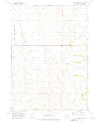 1973 Big Bend Dam 4 SW1976 Print · USGSBuffalo County prairie lands are documented in the early 1970s, showcasing the open rangeland along the Crow Creek Indian Reservation Boundary. Researchers can trace the path of the Old Indian Treaty Boundary and the natural courses of Elm Creek and Crow Creek.2 unique versions available
 - 1973 Map of Mittelstedt Slough, 1976 Print
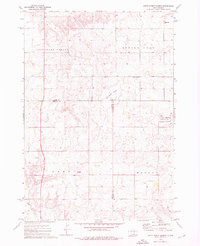 1973 Mittelstedt Slough1976 Print · USGSThe wetlands of central South Dakota are meticulously detailed in the early 1970s, showing the intersection of Hand, Buffalo, and Jerauld counties. Researchers can trace rural landmarks like the Ebenezer Ch, the small settlement of Eden, and the National Waterfowl Production Area.
 - 1974 Map of Bedashosha Lake, 1977 Print
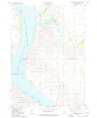 1974 Bedashosha Lake1977 Print · USGSThe Missouri River breaks of Buffalo and Brule Counties are captured here in the mid-seventies, showing a landscape shaped by tribal lands and recreation. Trace local history through landmarks like St Johns Ch and the public lands of Brule Bottom State Public Hunting Area.
 - 1982 Map of Lyonville, 1983 Print
 1982 Lyonville1983 Print · USGSThe rural crossroads of South Dakota come to life in this early 1980s survey of the plains where four counties converge. Genealogists and local historians can locate community pillars like Lyon Sch, the Crow Lake Ch, and the Salem Cem.
 - 1983 Map of Pukwana NE
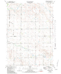 1983 Pukwana NE1983 Print · USGSBuffalo and Brule counties in the early 1980s showcase a vast stretch of prairie defined by the Crow Creek Indian Reservation. Local history enthusiasts can trace the meandering paths of Crow Creek and Smith Creek through the open landscape.
Showing maps 1-25 of 95
Frequently asked questions
- What are the different types of historical maps available for Buffalo County?
- What is the oldest map of Buffalo County?
- Where can I purchase historical maps of Buffalo County for my home or office?
- Where can I download high-res historical maps of Buffalo County?
- Are there historical topographic maps available for Buffalo County?
- Is there historical aerial imagery available for Buffalo County?
- Where are historical maps of Buffalo County sourced from?